Why Evolution is True is a blog written by Jerry Coyne, centered on evolution and biology but also dealing with diverse topics like politics, culture, and cats.
Here’s the second part of a batch of photos sent by Texas reader Rik Gern (part 1 is here). The introduction was this:
n mid-March I visited a friend on a ranch in Luling, Texas, a small town about 50 miles south of Austin and 60 miles east of San Antonio. Originally a railroad town, and once known as “the toughest town in Texas”, Luling is now a minor oil town. [JAC: It’s also the home of the City Market, one of the finest BBQ joints in Texas.]
The landscape is typical of much of central Texas; it can look monotonous on the surface, but it’s full of interesting life when you look up close. The woods, which the locals refer to as scrub brush, consists largely of Spanish Oak, Mesquite, and Elm:
You can enlarge the photos by clicking on them; Rik’s text is indented.
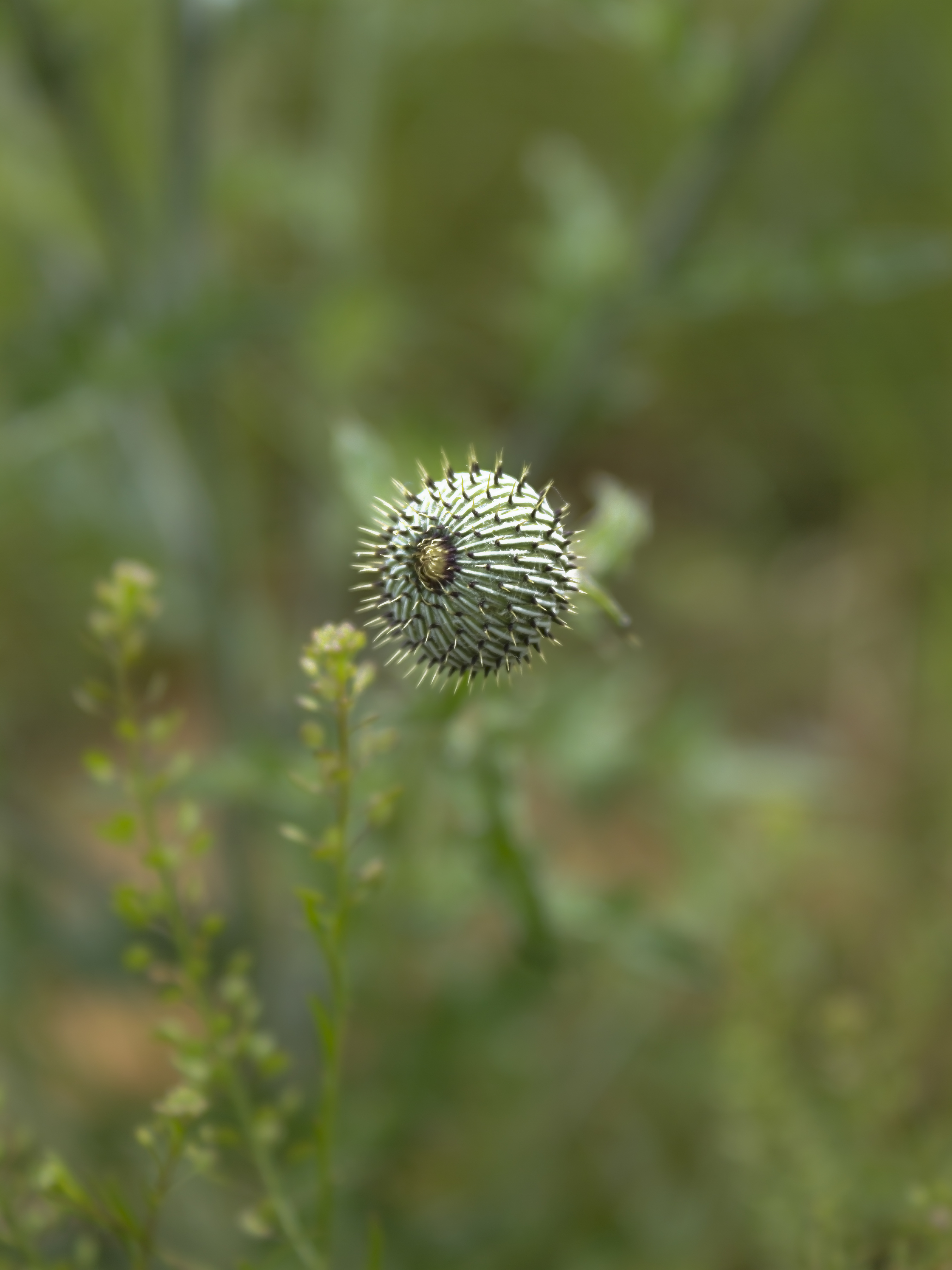
This looks like some kind of floating spiked orb, but it is an overhead view of a Texas thistle (Cirsium texanum).
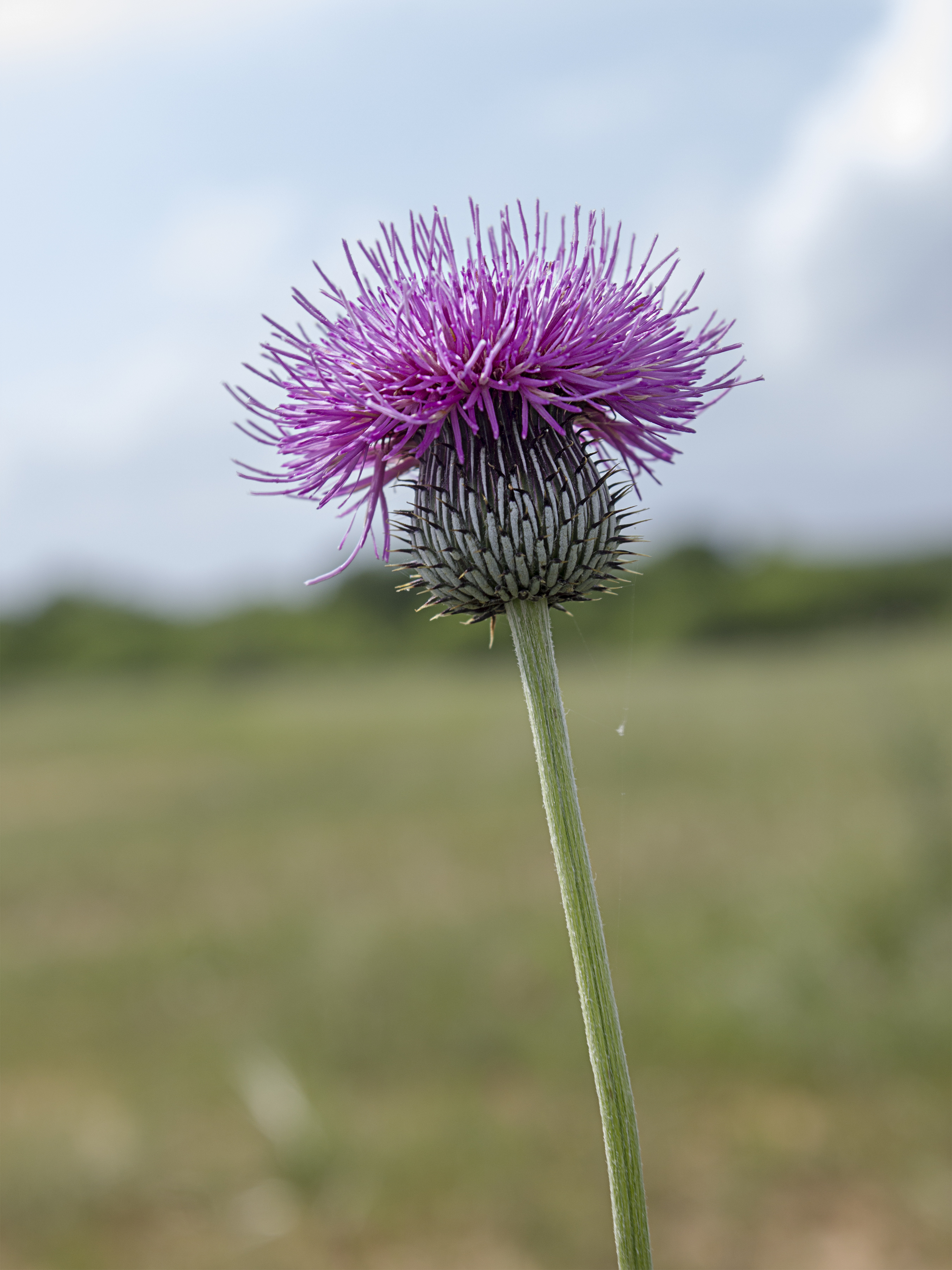
Here is a view of the flower in bloom. If this was all there was to it and it wasn’t covered in spikes, you’d want them as ground cover all over the place!
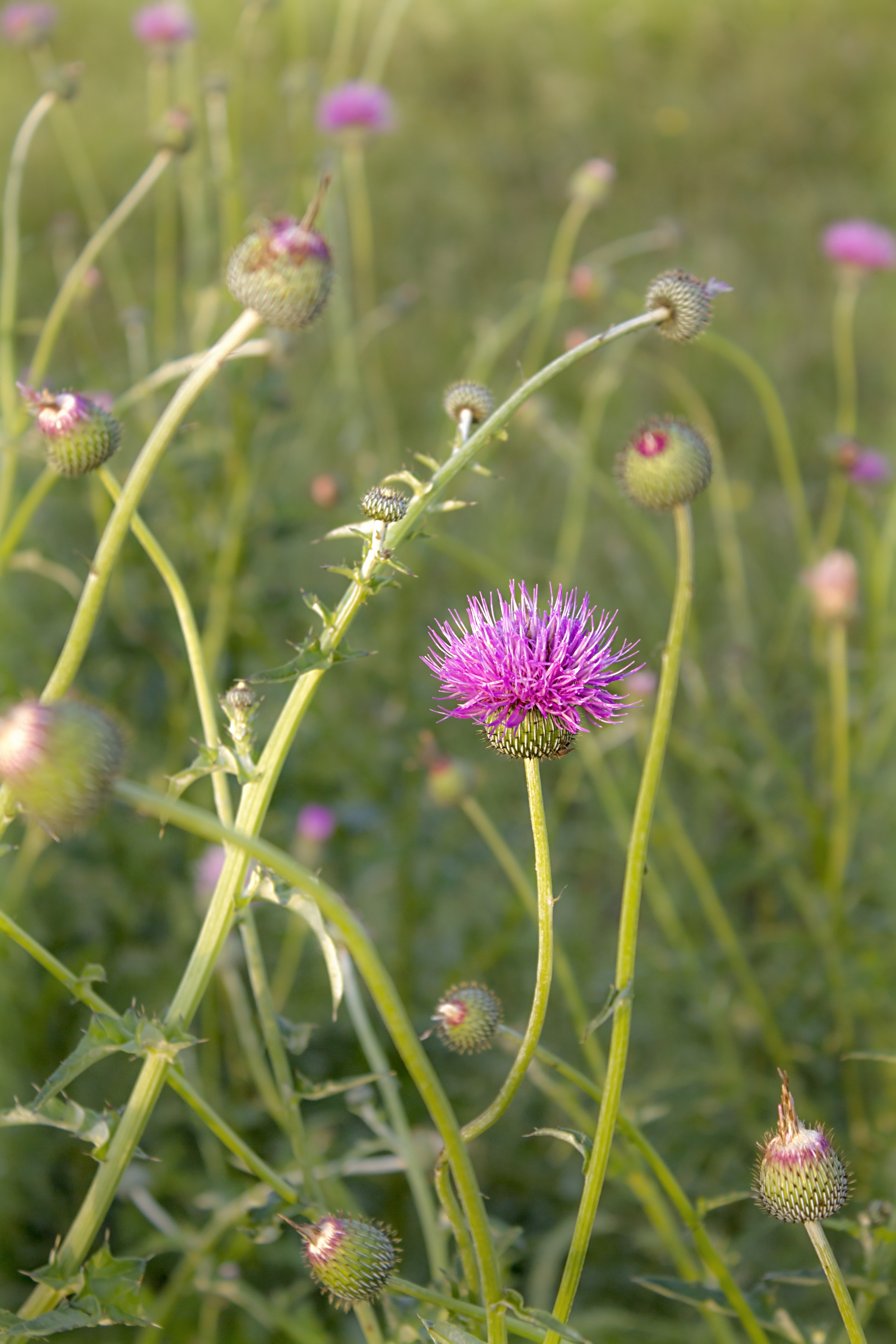
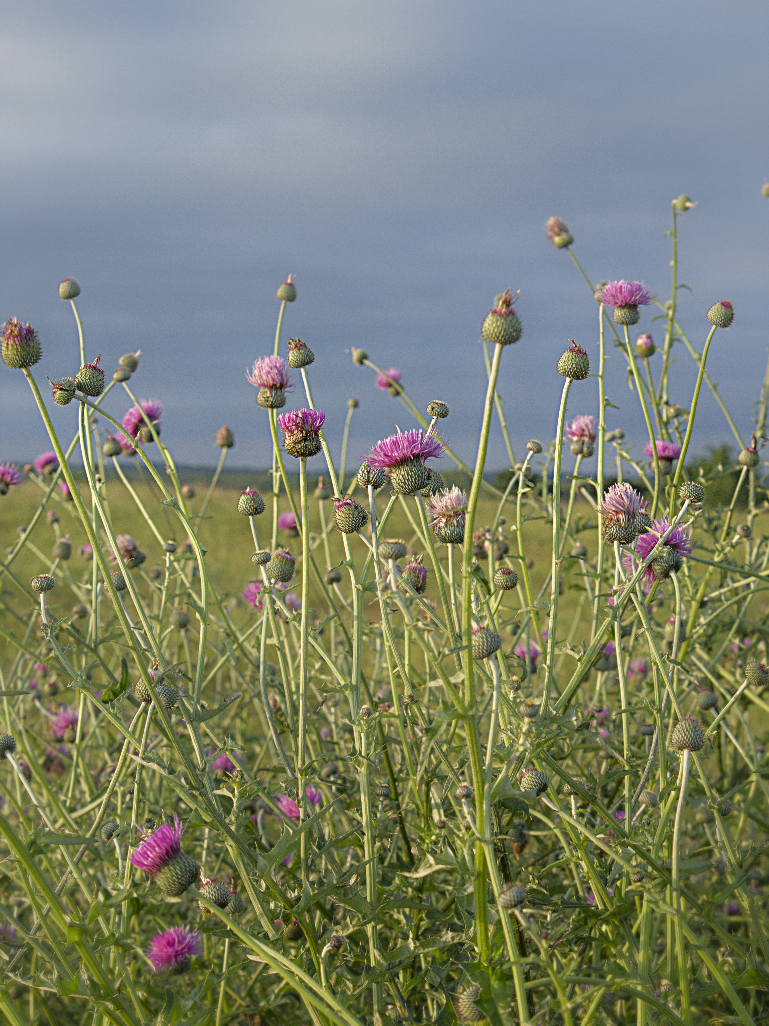
Here are several of the plants in different stages of blooming. Still beautiful, but a little more menacing.
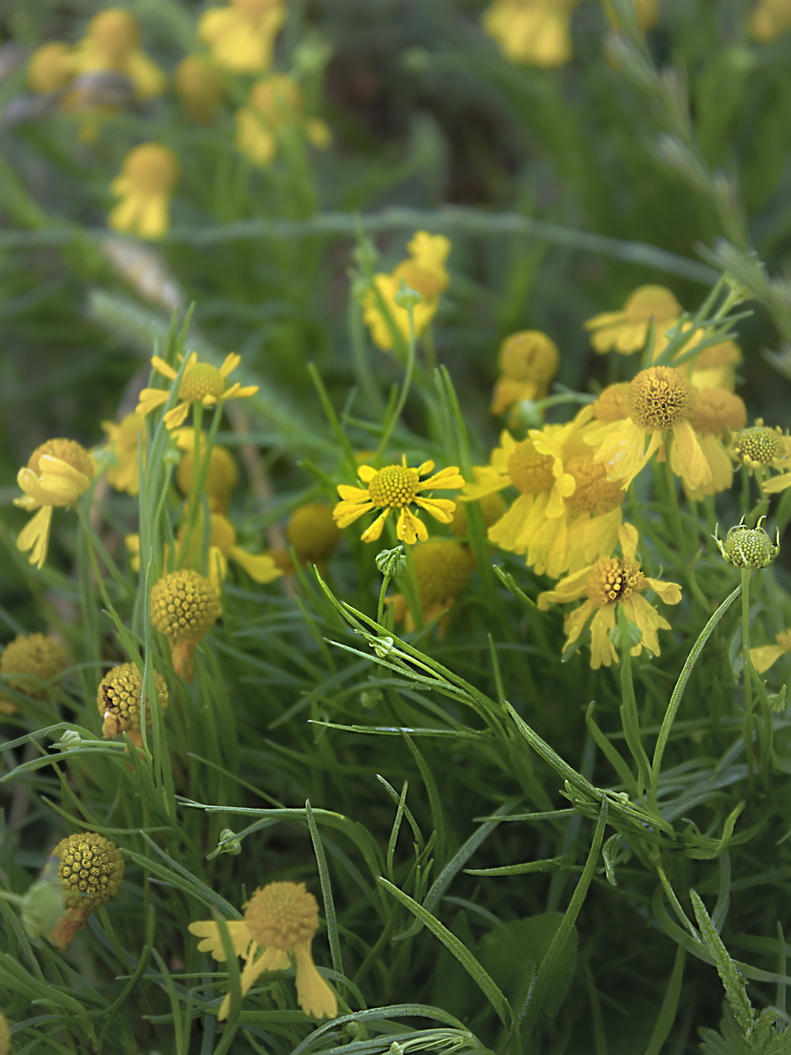
Bitterweed (Helenium amarum) may have been the most common flower in this field. It’s a member of the daisy family and also goes by the names of yellow sneezeweed and bitter sneezeweed. I guess I got lucky because they didn’t make me sneeze!
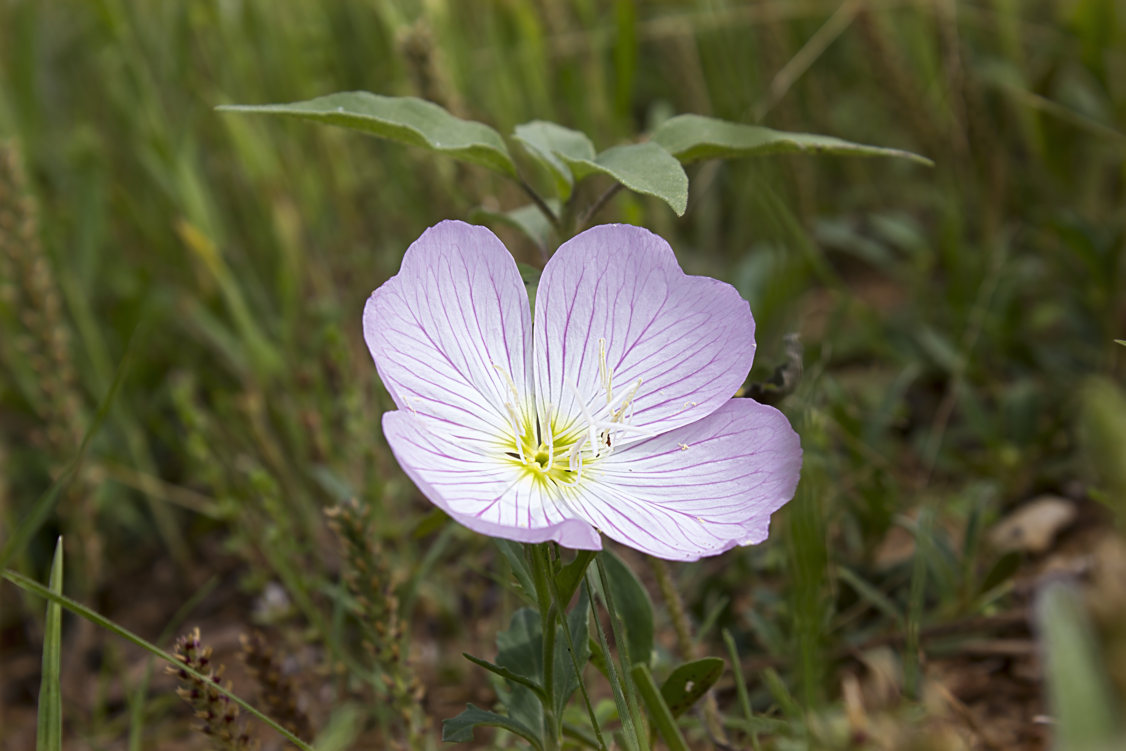
This pink evening primrose (Oenothera speciosa) makes for an interesting optical illusion; the light is coming from the upper right and of course the petals form a concave shape, but if you imagine the light source coming from the lower left, all of a sudden it appears to be billowing outward in a convex fashion. These are often referred to as buttercups, but are not part of that family.
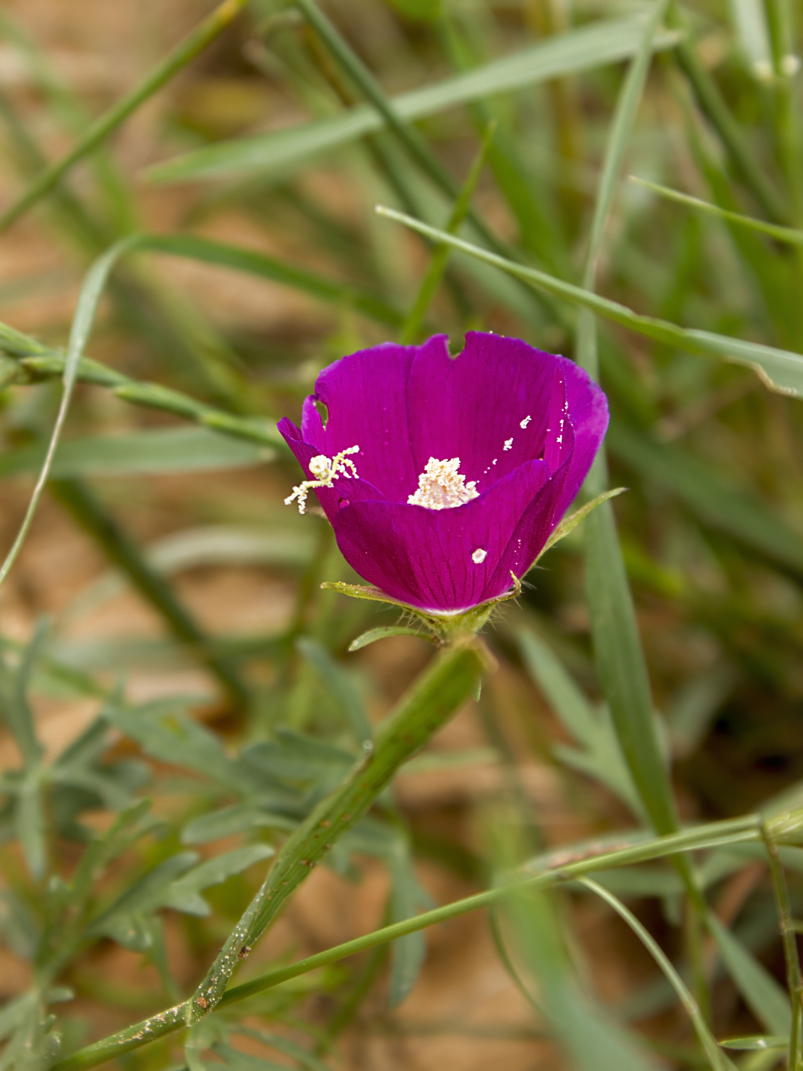
As I was photographing this Winecup (Callirhoe involucrata) I noticed some movement and was surprised to get photobombed by a little spider. I didn’t realize spiders could be pollinators.
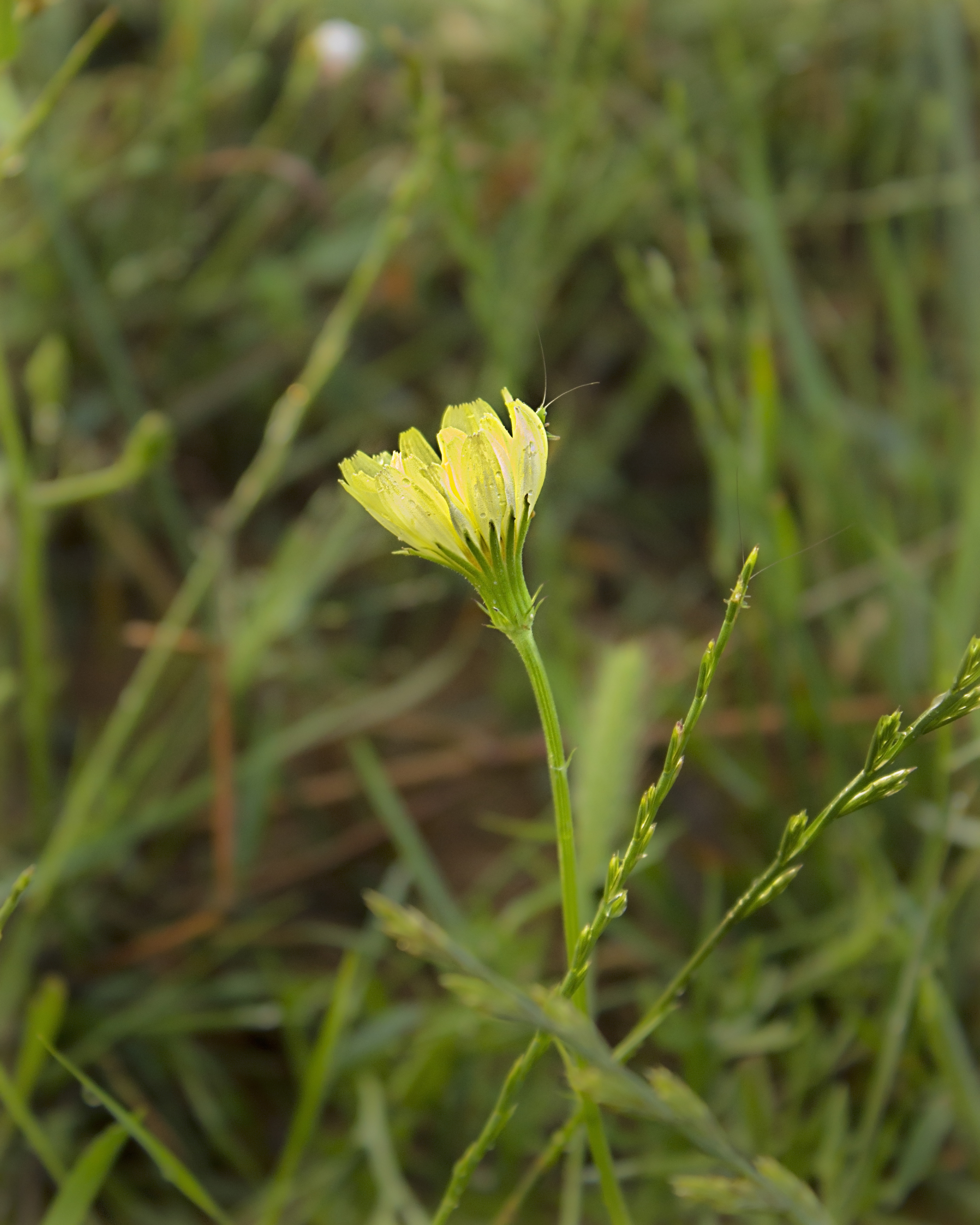
You’d think this flower would be easy to identify, but iNaturalist’s Seek app couldn’t identify it, and a web search for “yellow Texas wildflowers” didn’t help either. It’s mighty pretty though, and this picture is also photobombed, this time by two tiny critters with long antennae.
This is called a pinwheel or Indian blanket (Gaillardia pulchella) and has been photobombed by the same type of critter that found its way into the previous picture.
The sun sets on Luling; a beautiful end to a beautiful day!
To give you an idea of the richness of the landscape, all of these pictures, minus the sunset were taken within an approximately fifteen foot radius of one another. One other life form that played a major role (the villain, as it were) in these pictures was the pesky chigger (genus Eutrombicula). City boy that I am, I waded deep into the fields and got down on my hands and knees to take pictures, entranced by the beauty of the plants and neglectful of the precautions I should have taken against these little pests. Not only did I fail to tuck my pants into my boots, but I neglected to shower at the end of the day, so when I returned to my home in Austin I had bright red itchy dots all around the area covered by my sox and grundies. That was about ten weeks ago and I still have marks on my ankles. I won’t make that mistake again, but it was still worth it to see so many pretty sights!
I have many promises from readers to send photos in, but I haven’t called in the promissory notes. Do send me any good wildlife photos you have.
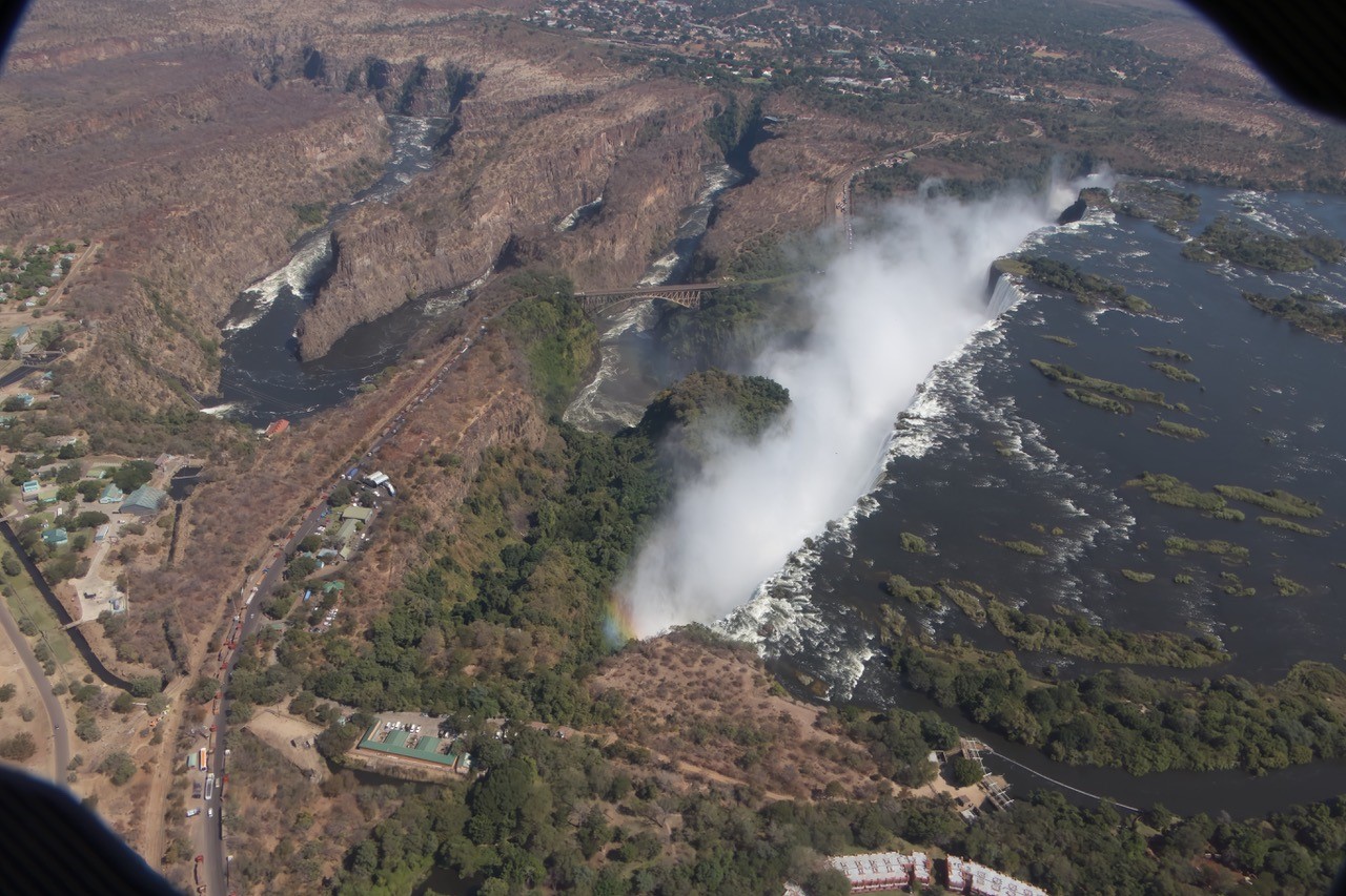
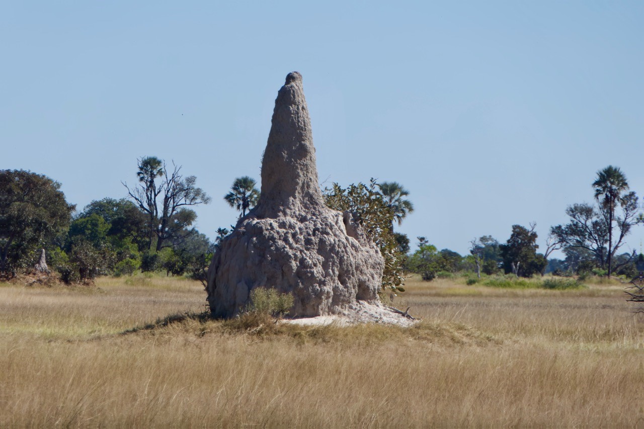
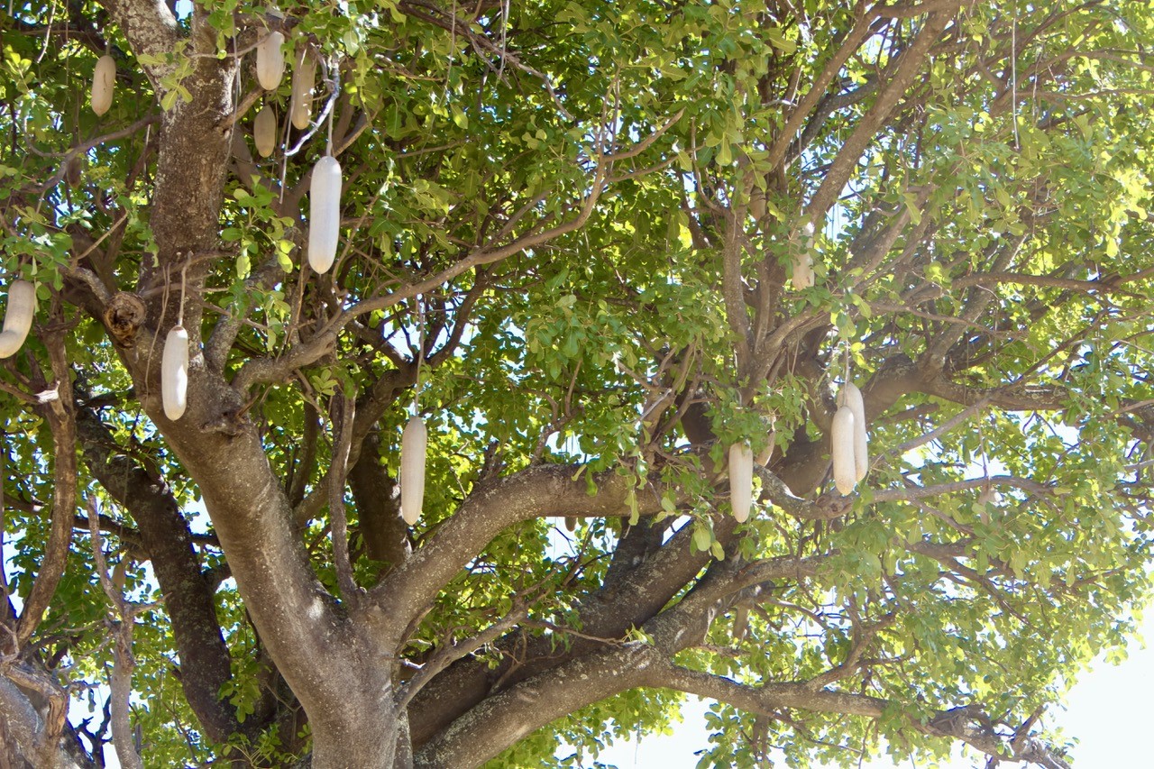
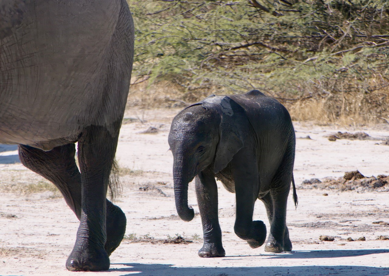
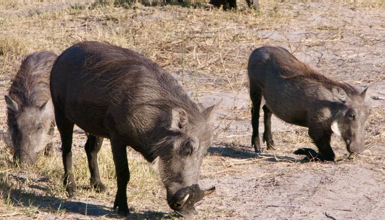
Today we have part 4 of Tony Eales’s recent safari to Botswana (part 1 is here, part 2 is here, and part 3 is here). To me this is the culmination: Victoria Falls!
Tony’s narrative is indented, and you can enlarge the photos by clicking on them.
Safari Part IV: Chobe and Victoria Falls
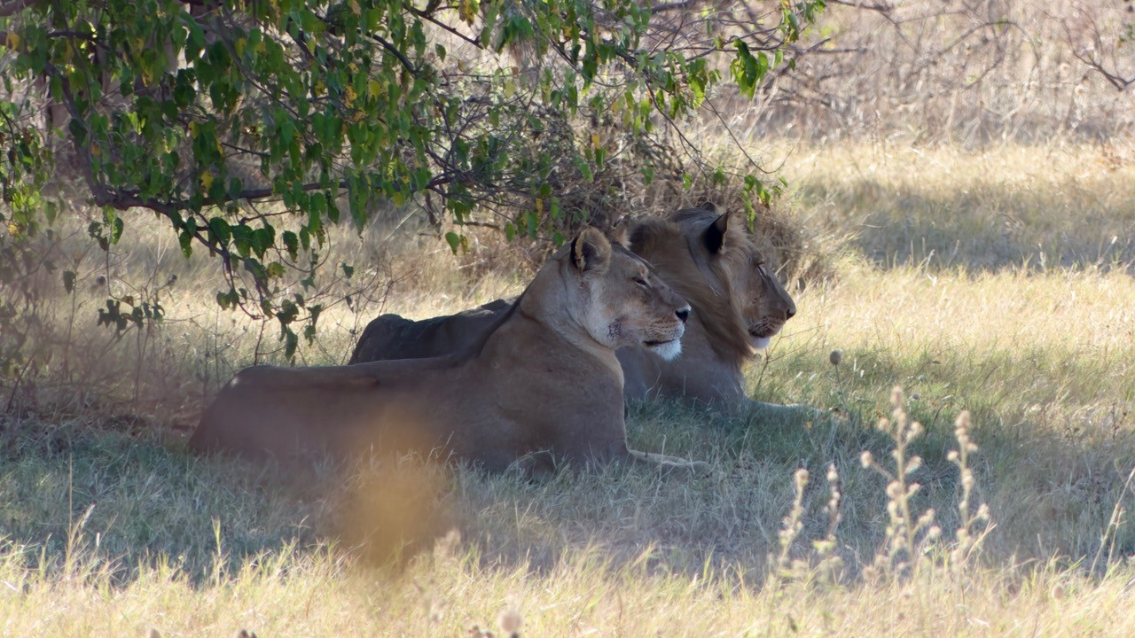
Chobe is an amazing national park famous for its large population of elephants and having lions that specialise in hunting elephants:
Our best viewings of wildlife were along the Chobe River, the south side of which is in Botswana and the opposite shore, Namibia. Young giraffes (Giraffa camelopardalis ssp. giraffa) sparring on the banks of the Chobe River.
And young impala (Aepyceros melampus) also sparring:
From the high banks we could watch giant herds of buffalo:
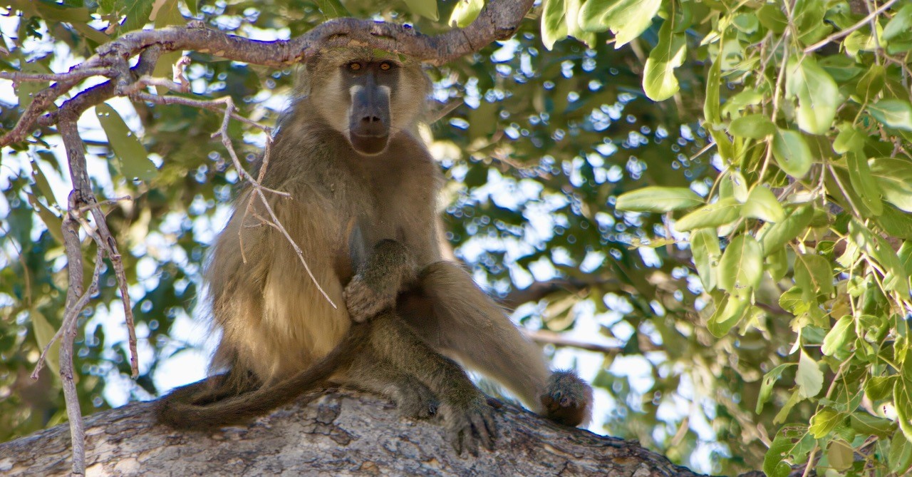
The riverbank also had a large troop of chacma baboons (Papio ursinus ssp. griseipes) allowing close up views of family like and squabbles.
And by the riverside the sunsets were amazing as the large mammals started to get active again:
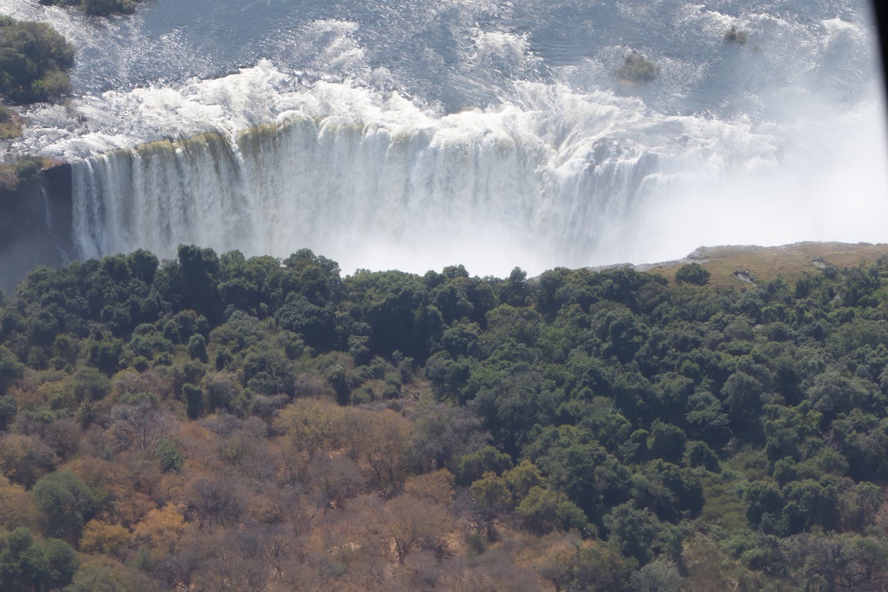
On the Zimbabwe border we bid farewell to our guides and safari truck and after processing we got into a minibus and went to the tourist township of Victoria Falls. Several of the group decided to hire a taxi together and visit the falls that afternoon. The entrance had long lines and where the taxi dropped us hawkers came and asked us if we wanted to hire a raincoat for 3USD. Most were thinking “How wet can it really be?” but I thought that it was probably a good idea and in the end we all hired raincoats. The entrance looked cheesy with faux rocks and vines rendered in concrete giving it a bit of a discount Flintstones look, and entry for foreigners was an eyewatering 50USD each. We got in and went through the kiosk and gift store, following the rising sound of the falls and the ever-present sound of helicopters.
All I can say is that $50 seems cheap now, the first glimpses of the falls were jaw-dropping. we looked out on massive thundering falls with unmeasurable amounts of water plummeting into invisible depths, obscured as the bottom was by the clouds of spray. Above it all a great rainbow.
Picking up our jaws from the floor we soon realised that this represented perhaps a tenth of the falls and only the first of some 20 odd viewing spots along about a kilometre and a half of cliff-face that looked across directly at the face of the falls.
We were all giggling and babbling, almost running from one viewing spot to the next, through a rainforest created entirely by the spray of the falls:
Each viewing spot got progressively more of the spray until the last spot was basically like a tropical downpour:
And that was the trip. We saw so much wildlife, experienced a world very different from the one I grew up with or that I see represented anywhere on tv or in the media and marvelled at landscapes at once familiar but also alien.
I’ve travelled a lot of the world and you could say that about anywhere, the world is a wonderful and awe-inspiring place but even so, there’s something extra special about sub-Saharan Africa that’s not like anything I’ve seen before. What a place!
Today’s photos of Costa Rica come from reader Leo Glenn. His narrative is indented, and you can enlarge the photos by clicking on them:
Here are some photos from my recent trip to Costa Rica. We spent most of our time on the Pacific side in the northwest region, in Guanacaste Province. The Pacific side has more distinct dry and rainy seasons, in contrast with the Caribbean side, which receives considerably more rainfall year round. Although slightly smaller in land area than the U.S. state of West Virginia, Costa Rica boasts 32 national parks, over 50 wildlife refuges, and over a dozen forest and biological reserves. This creates tension, of course, between preservation efforts and ecotourism, which is the country’s largest source of income.
The view from a higher elevation, about 20 minutes from where we stayed.
The local beach, Playa Avellanas, was a short walk from our lodging via a boardwalk that traversed a mangrove swamp, comprised mostly of White Mangrove (Laguncularia racemosa). After an earthquake in 2012, the land along the coast rose one meter, which closed off the mouth of the river, causing the water in the mangrove swamp to stagnate and kill all of the trees (thus the many dead trees in the foreground). A restoration effort was undertaken to restore the area and replant the mangroves. It appears to have been largely successful, though it will be years before the new trees mature and the ecosystem returns to something close to its pre-earthquake state.
The shallow and drier areas of the swamp were populated by several crab species, including the Racer Mangrove Crab (Goniopsis pulchra).
The forested areas on the path to the beach were dotted with numerous small burrows, inhabited by Red Land Crabs (Gecarcinus quadratus), which would freeze when approached, before slowly slinking backwards into their holes.
A juvenile Atlantic Ghost Crab (Ocypode quadrata). They were lightning fast, and very hard to photograph.
Some Brown Pelicans (Pelecanus occidentalis), flying over the beach. There were quite a few more in the line. Apparently, a group of pelicans can be called a pod, a pouch, a scoop, a squadron, or, if fishing as a group, a fleet.
Although colorful butterflies were abundant, I lacked the skill, patience, and hardware to photograph them, unless, as in this instance, I got lucky when one happened to land in the swimming pool. We rescued it immediately, of course, and after a few minutes spent drying its wings, it took flight. Theona Checkerspot (Chlosyne theona).
I did manage one halfway decent photo of an Apricot Sulphur (Phoebis argante).
A Crested Caracara (Caracara plancus), described on Wikipedia as “a bold, opportunistic raptor, often seen walking around on the ground looking for food,” which is exactly what this one was doing.
A nest of Northern Warrior Wasps (Synoeca septentrionalis), in a tree outside our lodging. According to Wikipedia, “It is a swarm-founding wasp that is also eusocial, exhibiting complicated nest structure and defense mechanisms.” The nest was about 30 ft up in the tree, and without a telephoto lens (or a very long stepladder), this was the best photo I could get. Its high location in the tree was a comfort to us, being so close to our rental house. Though not a particularly aggressive species, they are reported to have a very painful sting.
Today’s photos come from evolutionist Jody Hey from Temple University. His narrative and captions are indented, and you can click on the photos to enlarge them.
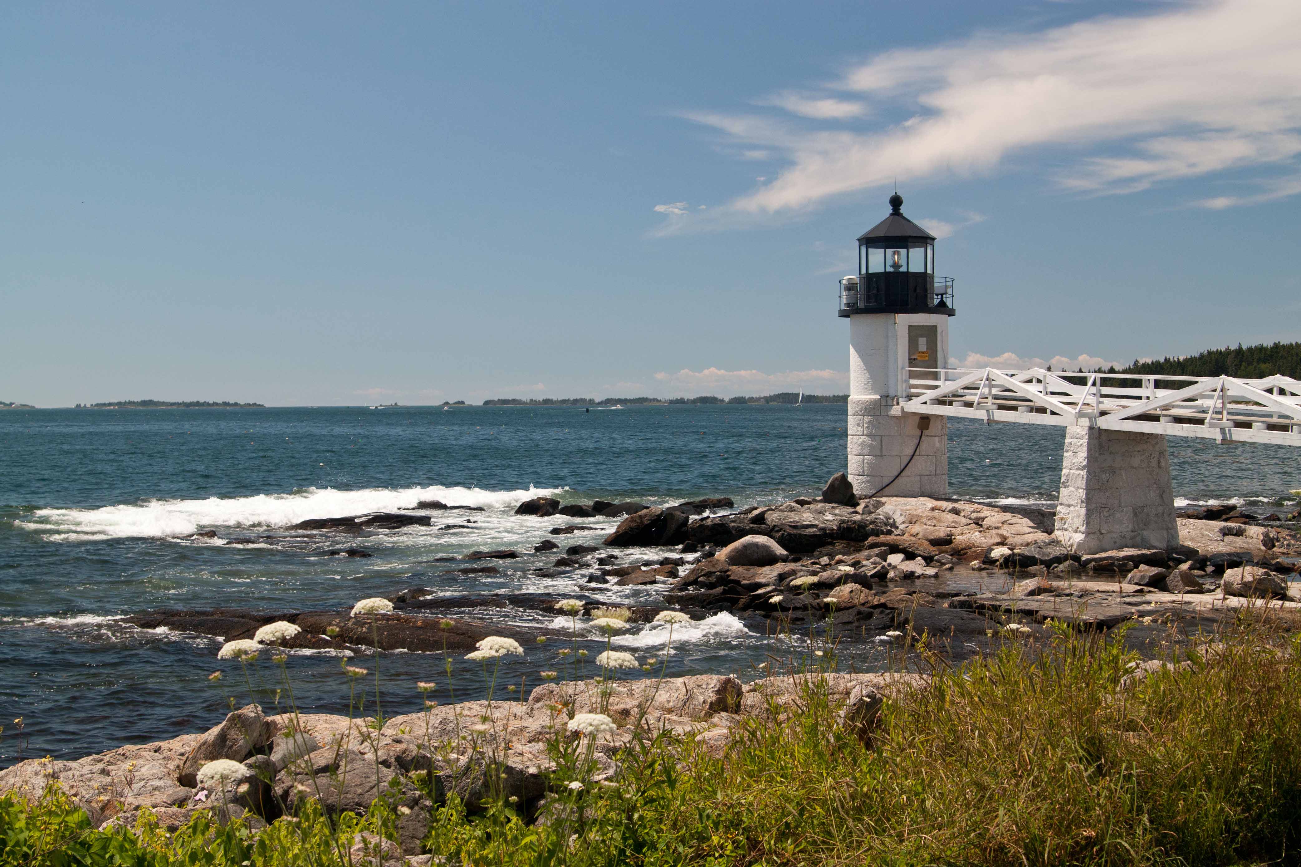
The coast of Maine offers a lot of beautiful scenery and some great wildlife watching. My visits there are usually in mid-summer, which if you are inland is not the best time of year for watching birds. However, the seaside has lots of visible action year round. On or near the coast, many of the birds are large, and the sightlines have few obstructions, so getting passable photographs can be relatively easy. Below are some pictures taken at Marshall Point, the location of a much photographed lighthouse near Port Clyde, and the island of Monhegan, home to a small community of lobstering folk and artists, and just a 12 mile ferry ride from Port Clyde.
One day I had just finished my picnic lunch and was walking on the beach facing the harbor of Port Clyde, and saw this Great Black-backed gull (Larus marinus) enjoying its own lunch, an Atlantic rock crab (Cancer irroratus).
The tidal range is quite large in coastal Maine, especially further north and east, so the things to see vary widely throughout the day. Here is a Least sandpiper (Calidris minutilla) exploring the barnacles at low tide.
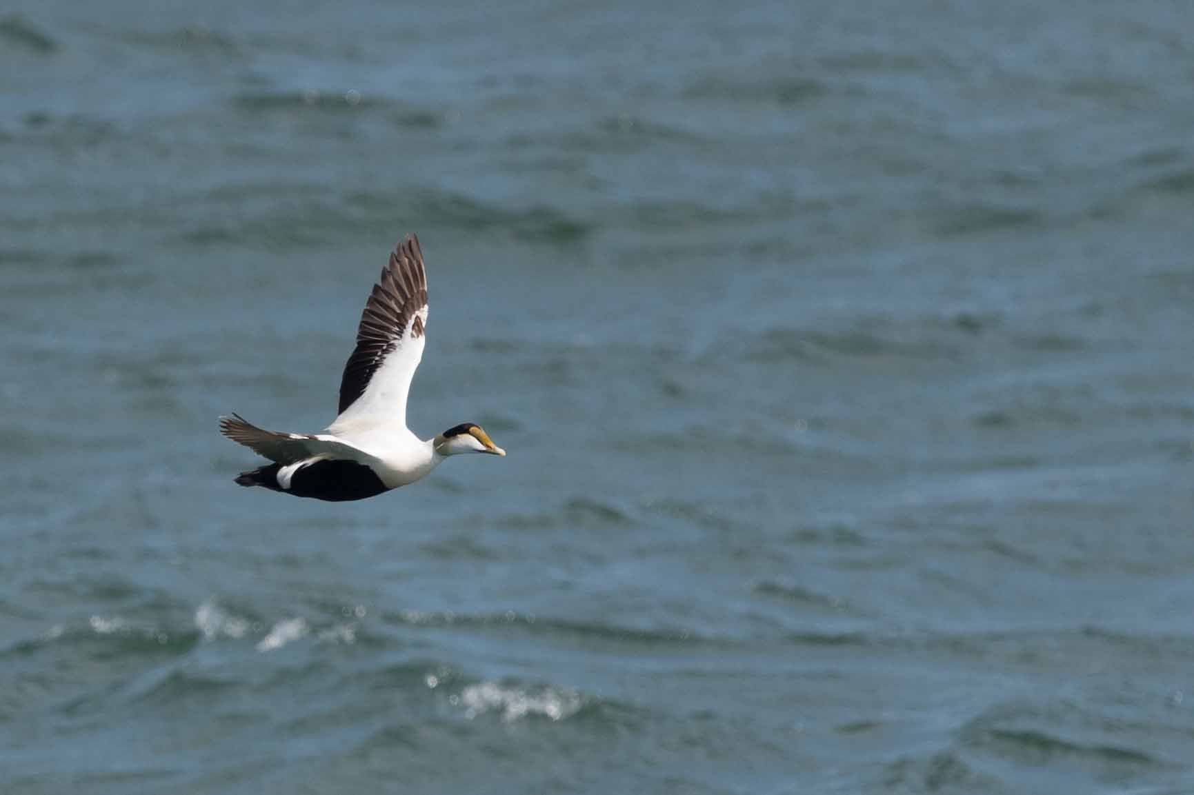
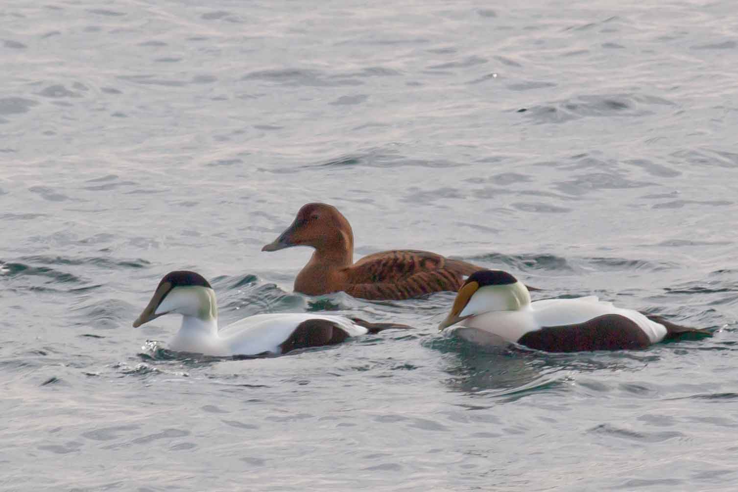
Marshall point is separated from ocean waters only by a few islands, unlike much of the jagged cost of Maine most of which is some distance from the open ocean. This means that Common Eiders (Somateria mollissima) can be seen there year round. In the summer their markings are fairly dull, but in the winter and spring, they are spectacular.
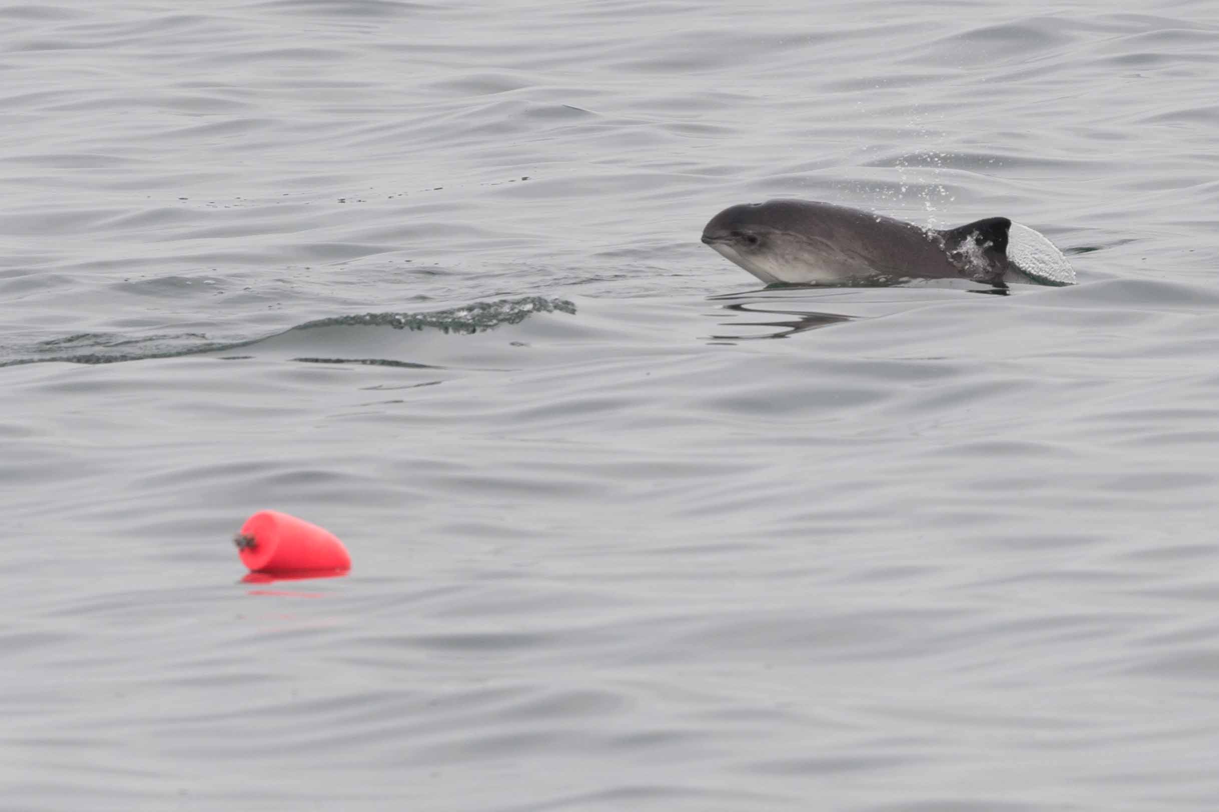
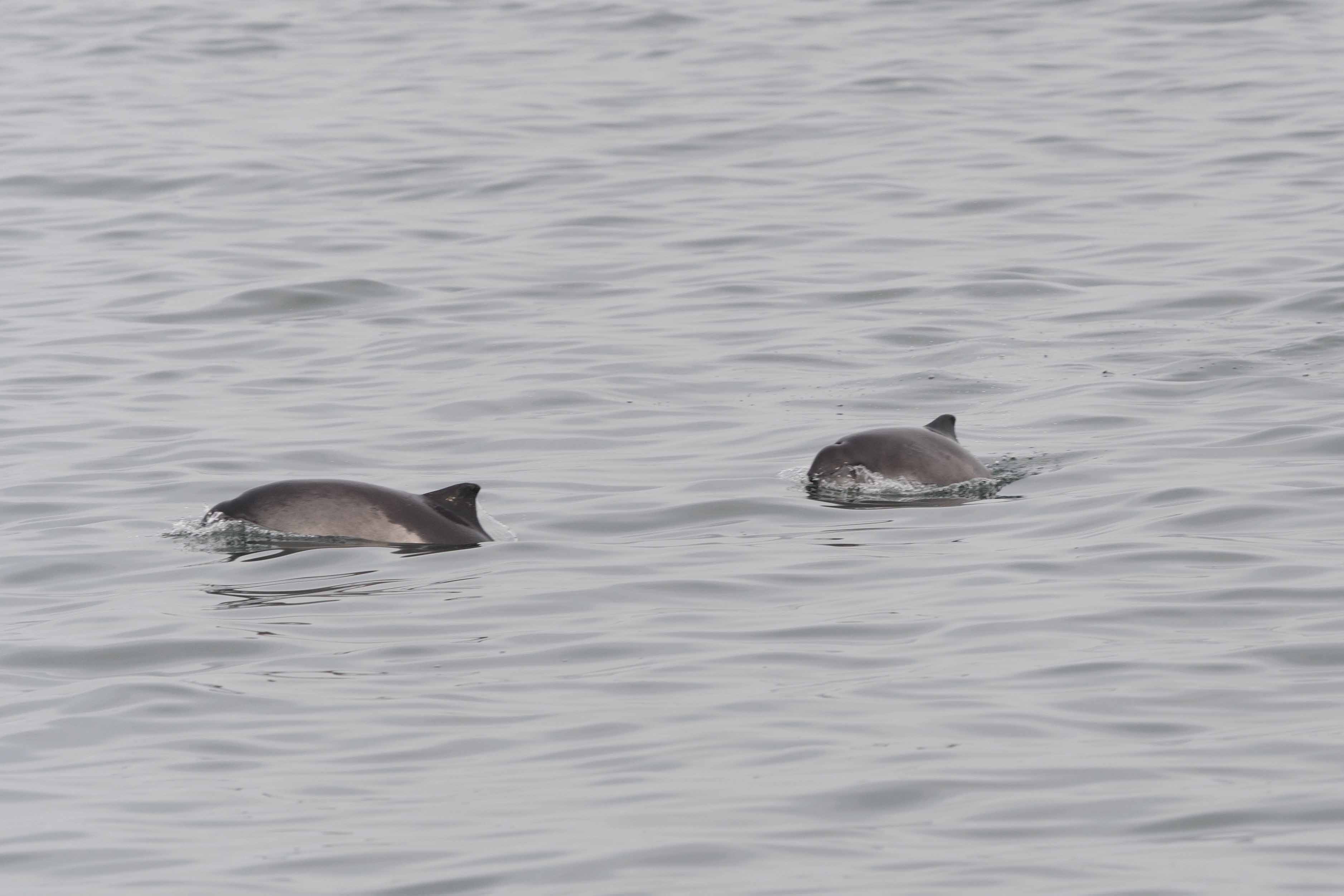
The ferry ride from Port Clyde to Monhegan offers some great opportunities to see marine mammals, including a couple varieties of seals and Harbor Porpoises (Phocoena phocoena):
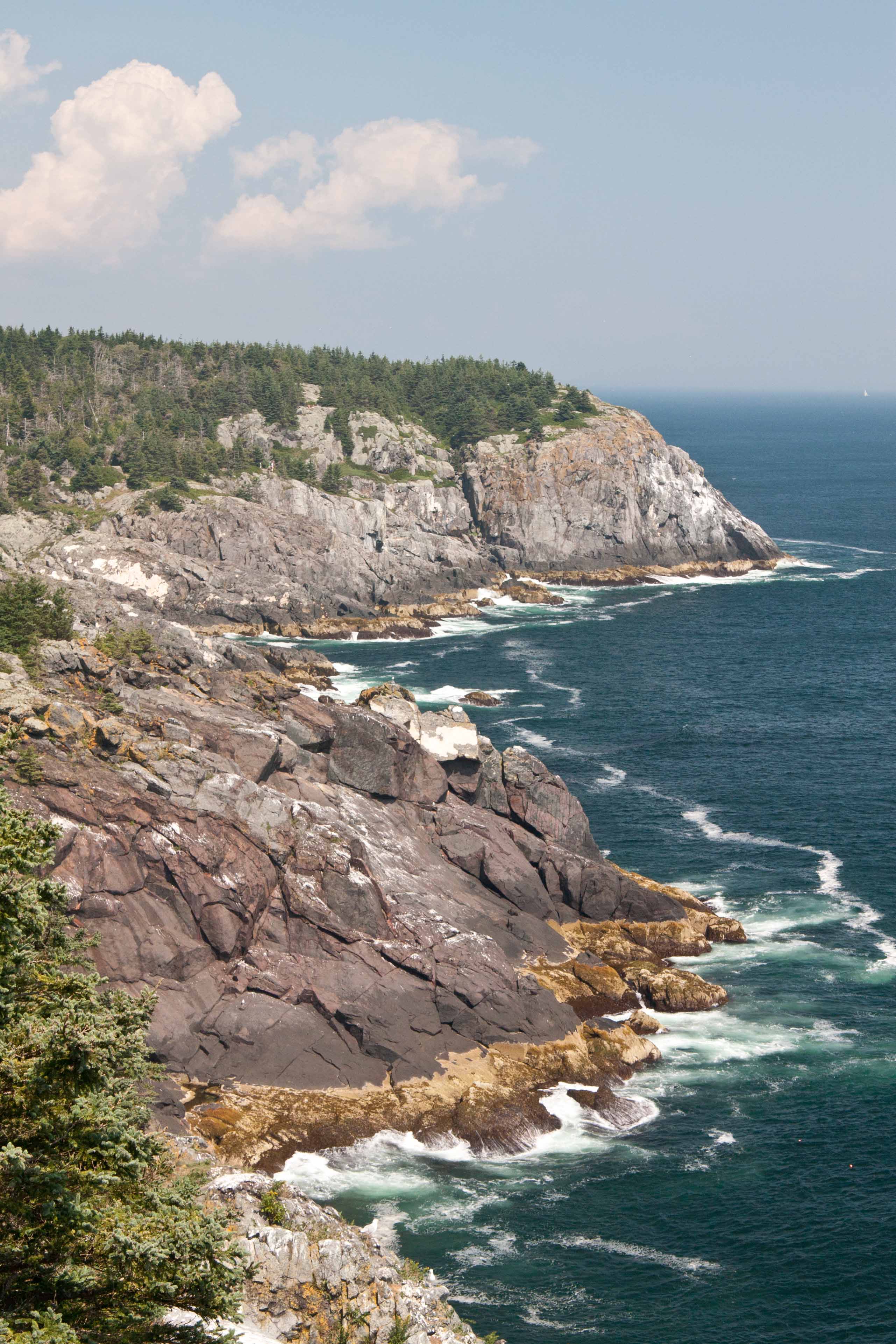
Monhegan island itself is less than 5 square miles in area, however the majority of it is owned and maintained as wild land by a private non-profit land trust. Visitors are free to explore the beautiful woods and rocky cliffs that dominate the eastern side of the island, as well as eat and shop in the little village. The cliffs also offer great viewing of a variety of coastal and ocean-going birdlife.
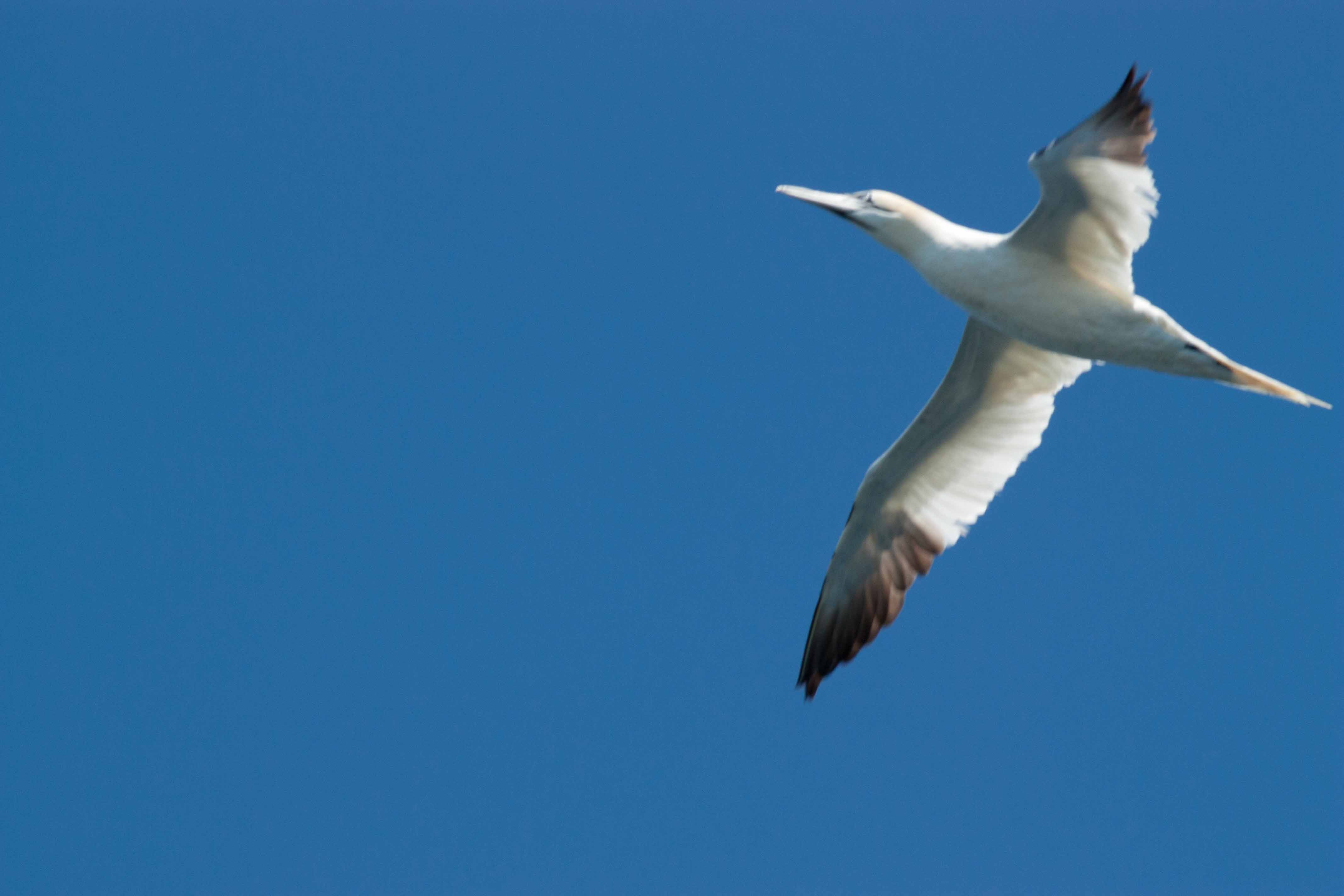
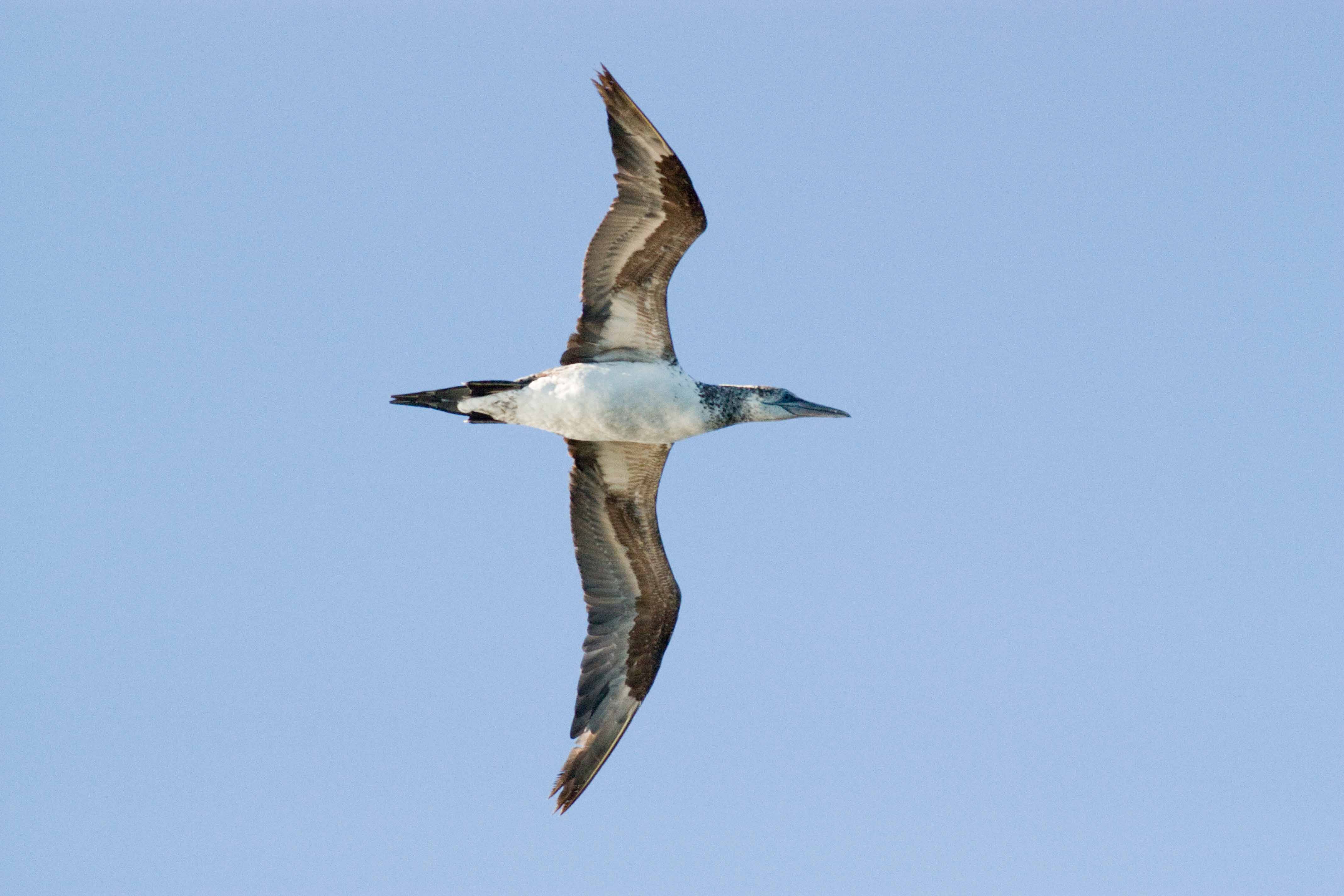
Northern Gannets can often be seen from the cliffs (as well as from the ferry). Here is a somewhat blurry adult, and a more in-focus juvenile:
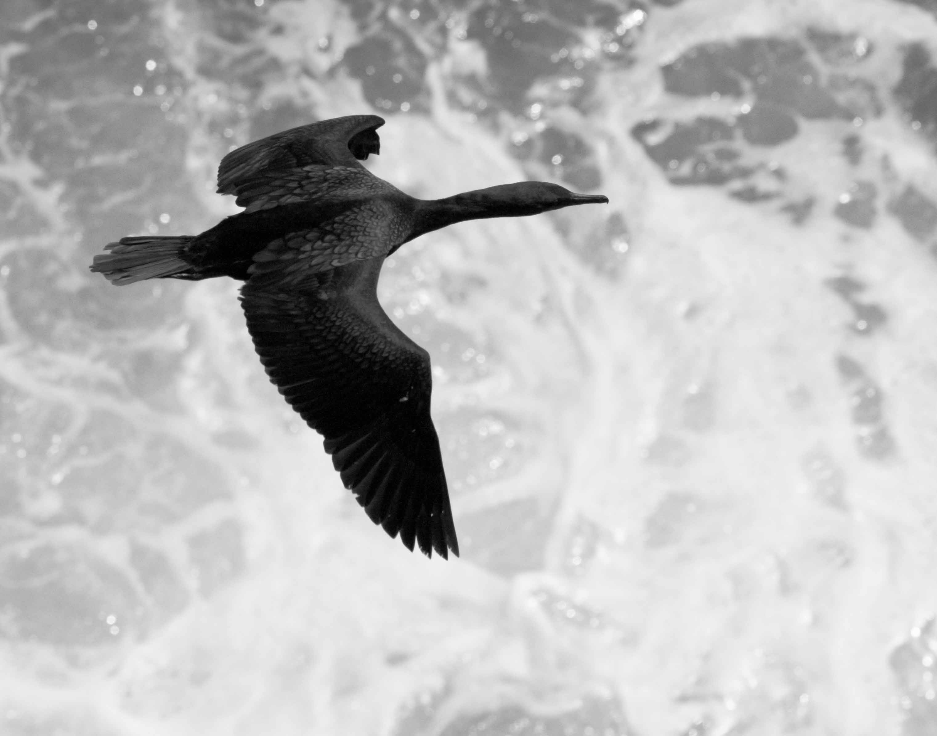
This Double-crested Cormorant (Nannopterum auritus) obligingly flew directly below me at the same time as the waves were crashing:
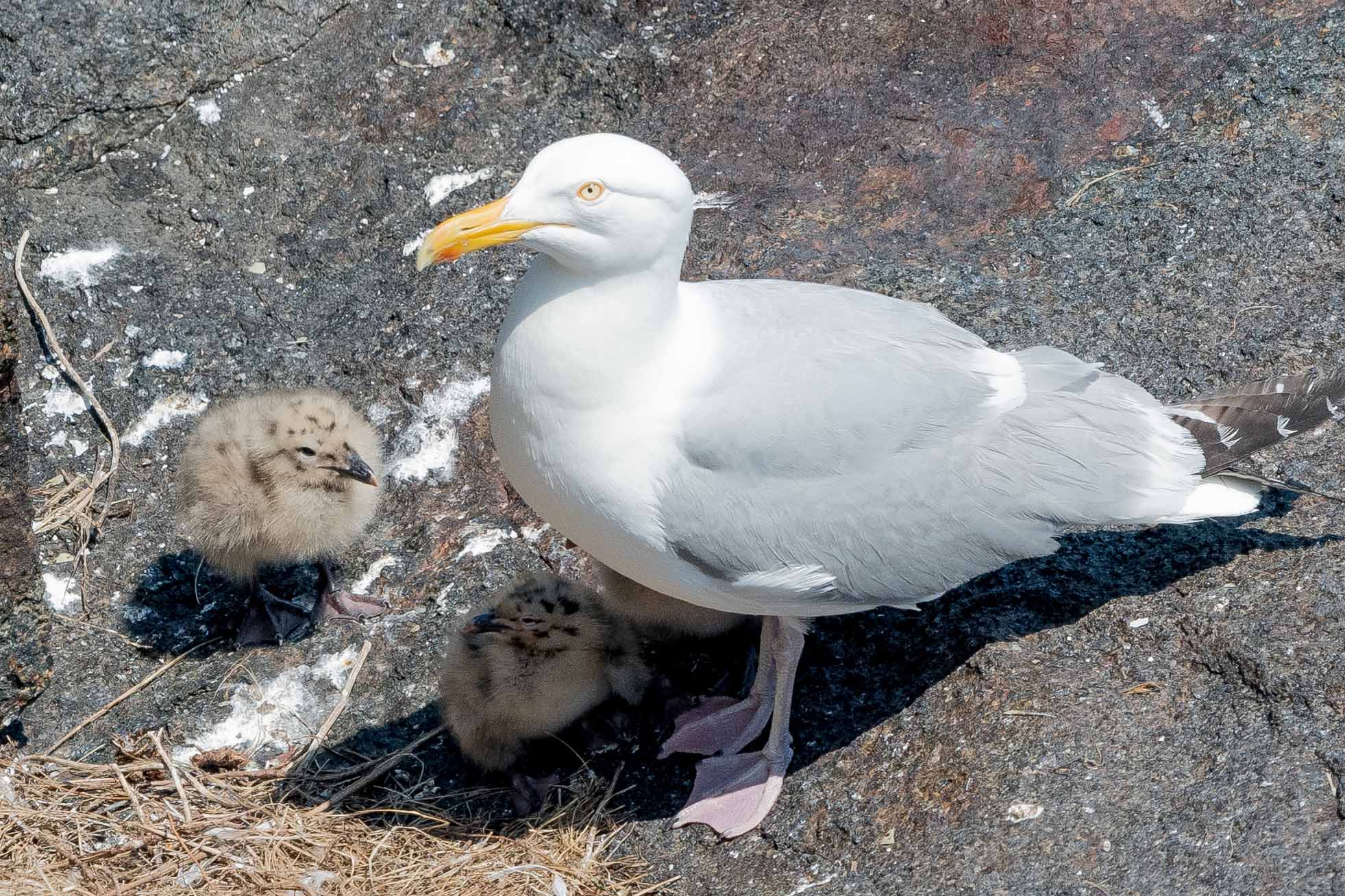
The cliffs are also a popular nesting site for Herring Gulls (Larus argentatus):
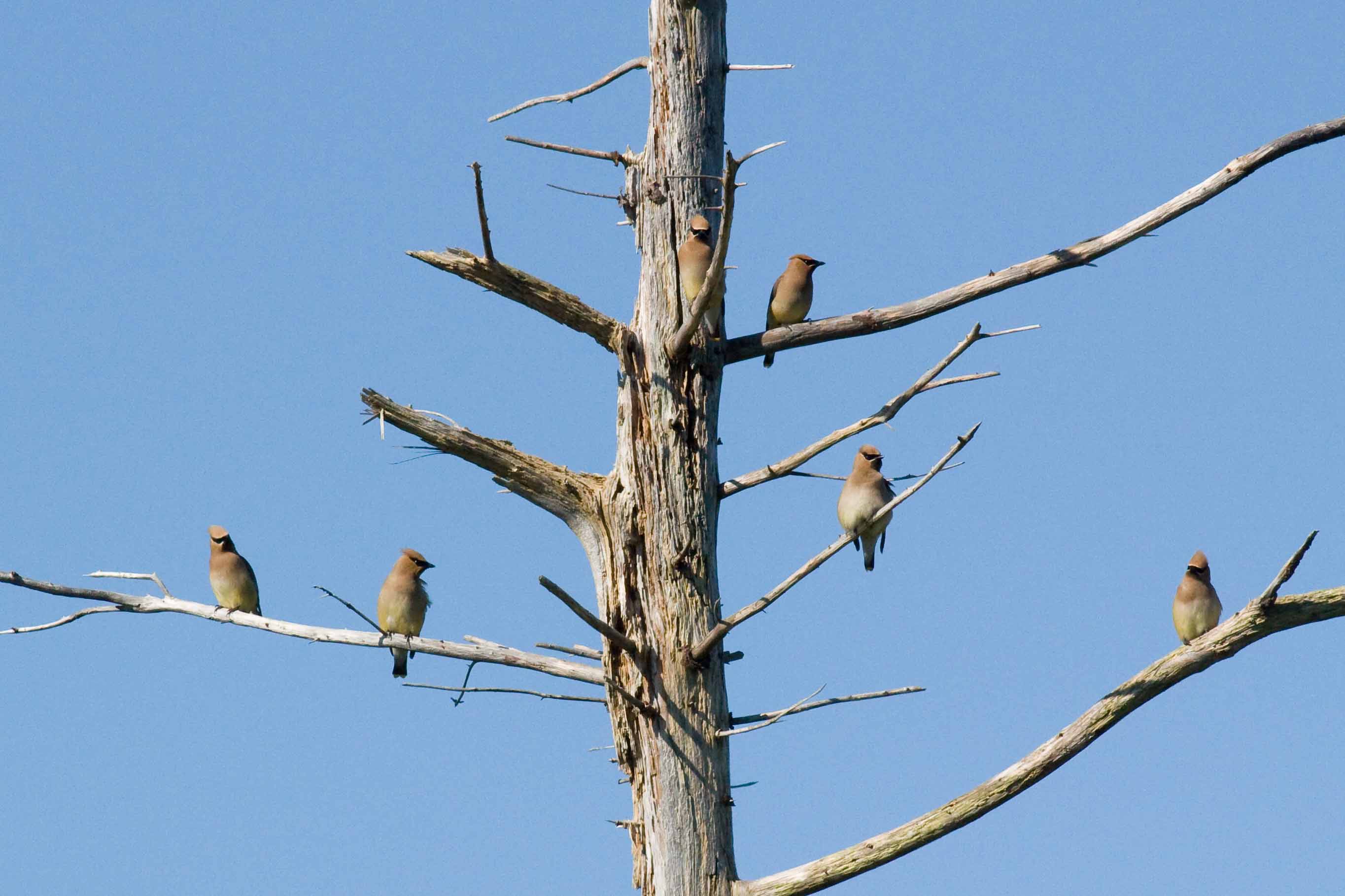
These Cedar waxwings (Bombycilla cedrorum) were also at the Monhegan clifftops one day, though the coastal location was fortuitous as they are a widespread and common species:
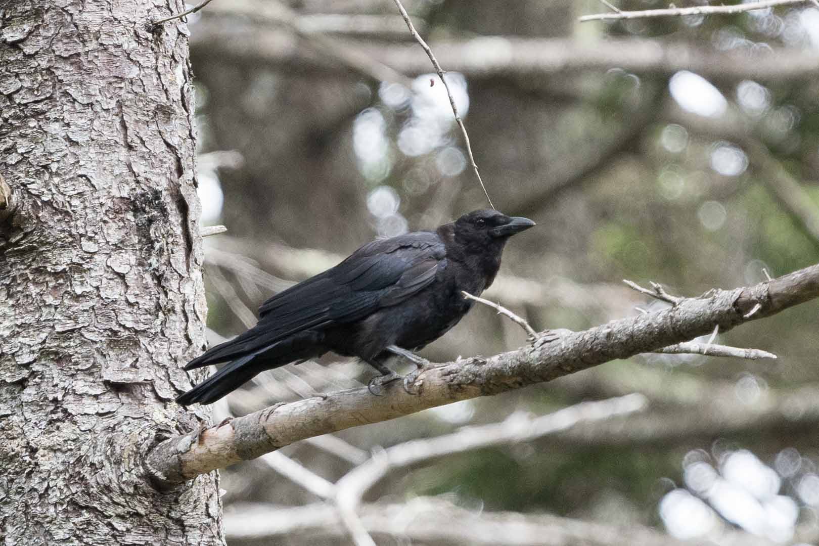
And closely things out for Monhegan, I go this lucky shot of a Common Raven (Corvus corax) one day, deep in the spruce woods:
Lastly, a lagniappe (as Jerry would say). Not far from Monhegan and Marshall Point is Eastern Egg Rock, home to the world’s first restored colony of Atlantic Puffins (Fratercula arctica). The story of that restoration is fascinating, and now it is apparently safe for the birds to be seen by tourists during the breeding season (from a boat, that is). I took the boat tour one day a couple years ago, just before the end of the season when there were only a few puffins to be seen, but at least I got a picture:
Today sees the return of Robert Lang, physicist, origami master and, today, photographer. Robert’s narration is indented, and you can click on the photos to enlarge them.
More local animals
The Los Angeles basin is a vast urban/suburban metropolis, but its natural boundaries of ocean and mountains are abrupt with sharp transitions created by water and steepness. The northern boundary is formed by the San Gabriel and San Bernardino Mountains (collectively, the Transverse Ranges) and they rise steeply from many back yards along the range. My studio is about 20 feet from the edge of the Angeles National Forest; this gives rise to many wildlife encounters, both at the studio and on the trails that climb up from the back property line. Most of these pictures are fairly recent.
One from last fall that I’ve been saving for RWP is this California Tarantula (Aphonopelma sp.). Probably a male, because he was out and about; in the fall, the males go on walkabout looking for females (who mostly stay hidden in their burrows):
Then we turn to a couple of reptiles. The Western Fence Lizard (Sceloporus occidentalis) is one of the most common lizards around; just walking down the front steps, I’m likely to see one (although it’s rare that they stay still enough to be photographed). They are highly variable in color, and the same lizard can appear either light or dark. In the morning, they are dark to absorb the sun’s rays; then in the afternoon, after they’ve warmed up, they lighten their skin and their lovely iridescence becomes visible:
I was pleased on a recent hike to see a Blainville’s Horned Lizard (Phrynosoma blainvillii) at an elevation of about 4000 feet. They used to be more common in the San Gabriels, but earlier in the previous century their numbers were reduced by collectors gathering them for the curio trade, and they’ve never fully come back. I really should have taken a wide-angle photo of this one; it would have been a great candidate for the “Spot the …” series, as it was so perfectly camouflaged against the sand and gravel I nearly stepped on it:
Another reptile that I’m glad I didn’t step on was this Southern Pacific Rattlesnake (Crotalus oreganus helleri), who was stretched out across the trail. He was pretty chill, though; didn’t budge as we approached, and so we gingerly stepped past. A nice set of rattles on that one!
We have three kinds of squirrels around; ground squirrels, gray squirrels, and the (introduced) Fox Squirrel (Sciurus niger). The local rattlers are happy to dine on any of them.
We also have both crows and ravens; crows are more common down in the neighborhoods, while ravens like this Common Raven (Corvus corax) dominate up in the chapparal. This one is perched on the top of one of last year’s blooms from the Whipple Yucca (Hesperoyucca whipplei):
Larger creatures sometimes come visit the meadow behind the studio. A not infrequent visitor is the coyote (Canis latrans). Although this one was (barely) within the National Forest, they come far down into the adjacent neighborhoods, where they find plentiful food in the form of dropped fruit, loose garbage, and the occasional domestic animal whose owners ill-advisedly allow them to roam free:
Another frequent large visitor is the California Mule Deer (Odocoileus hemionus californicus). This time of year, the bucks are in velvet, like this one. We had a very wet spring, so there is a lot of browse in the mountain canyons and not much to lure them into the meadow, but in the fall, when the acorn crop starts to fall, they’ll be visiting twice a day:
In much of California, the urban/wilderness interface usually exists in one of two states: (1) recovering from the last wildfire; (2) stocking up for the next wildfire. A year ago we had a relatively small wildfire just across the canyon; fortunately, it was a cool day with not much wind, and the fire crews held it to just a few acres:
I spent the afternoon watching the firefighters dragging hoses for hundreds of yards up the ridges while helicopters and fixed-wing aircraft dropped water and fire retardant. I am in awe of the firefighters, who were clambering up cliffs that I wouldn’t even try to scramble under the best of circumstances, while they were wearing and/or carrying 50 pounds of kit and dragging hoses. Within a few hours, they had things under control. The drifting smoke and red fire retardant gave things an almost surreal appearance as they were mopping up:
That was a year ago. One thing about the chaparral is it recovers quickly from fire (indeed, many plants rely on it), and after this spring’s wet rains, the formerly bare ground is covered in new growth, and the burned bushes have resprouted. They’re getting ready for the next fire, which is bound to happen sometime; it’s the nature of this bit of Nature.
Today we have a new contributor, William Terre Blanche from Pretoria, South Africa. William’s narrative of a hiking trip is indented, and you can enlarge his photos by clicking on them.
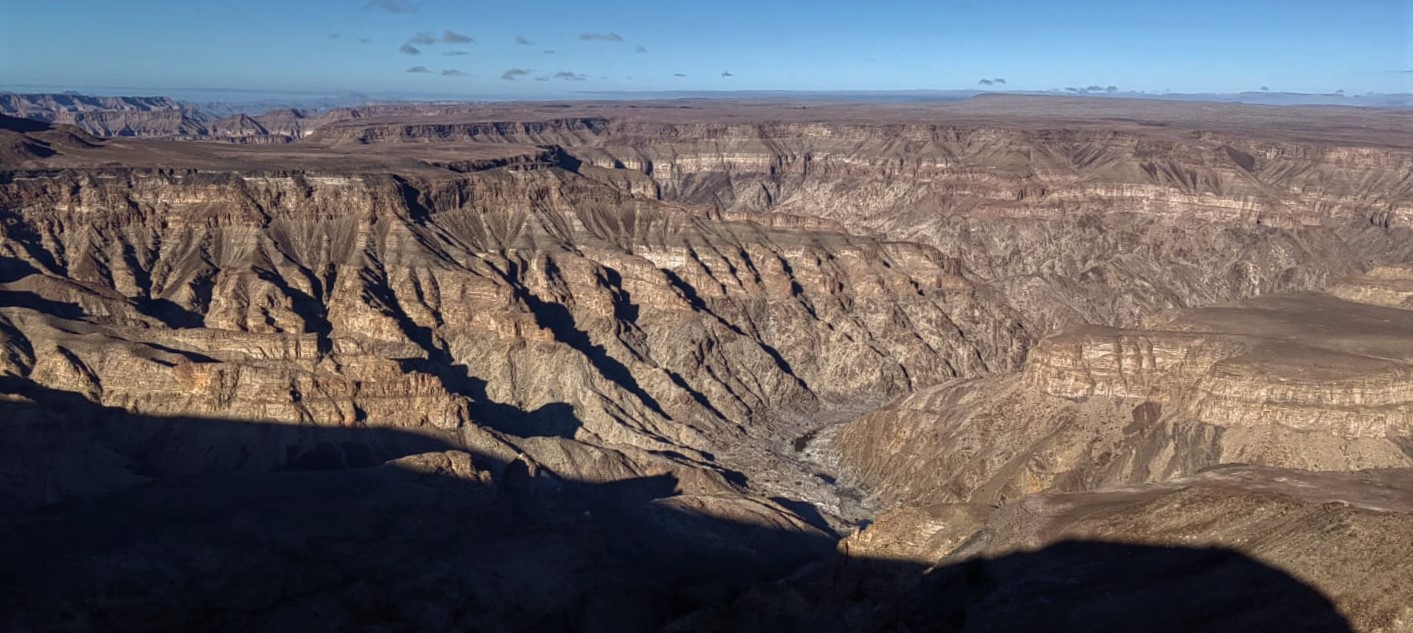
The Fish River Canyon in southern Namibia is, according to most sources, the second largest canyon in the world, after the Grand Canyon, and I recently undertook the 75km hike through a part of the canyon. Because of the extreme temperatures in this part of Namibia the hike is only possible during our winter months, from May to September. [JAC: it’s also at 160 km long, the longest canyon in Africa.]
The hike is unique in that there are no demarcated overnight spots, and no facilities whatsoever, so you simply hike as far as you can every day, and then set up camp under the stars. It can be done in 4, 5 or 6 days, depending on your level of fitness.
The view over the canyon from the starting point of the hike. This was quite a challenging day since we had to first descend the approximately 500m to the bottom of the canyon before starting the actual hike:
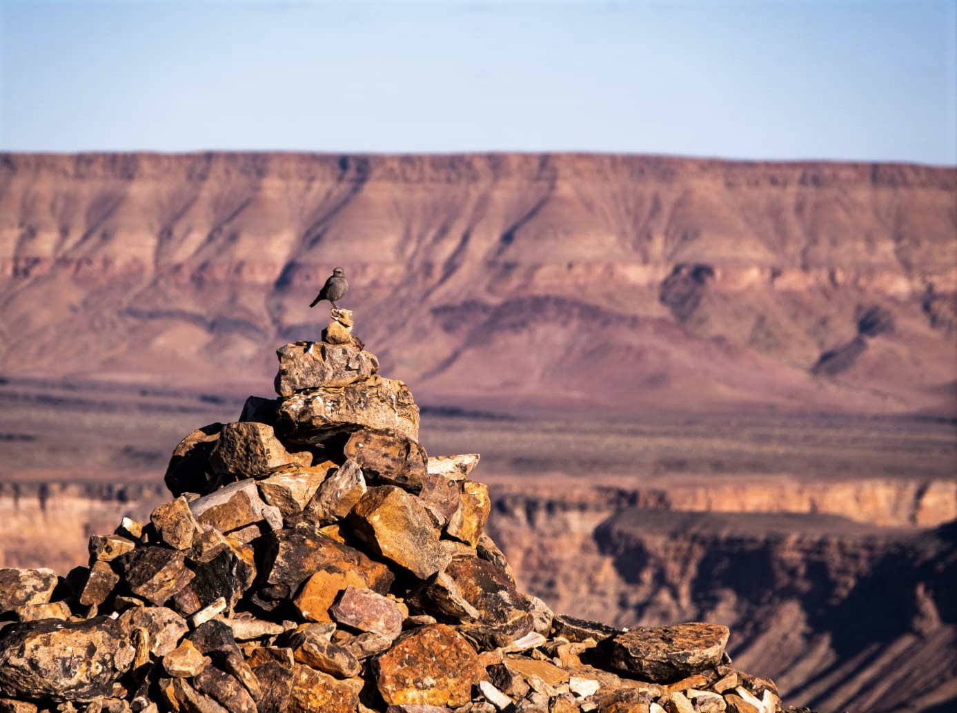
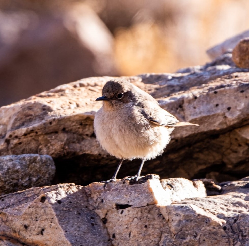
Another view from the top. The bird is a female Mountain Wheatear (Myrmecocichla monticola):
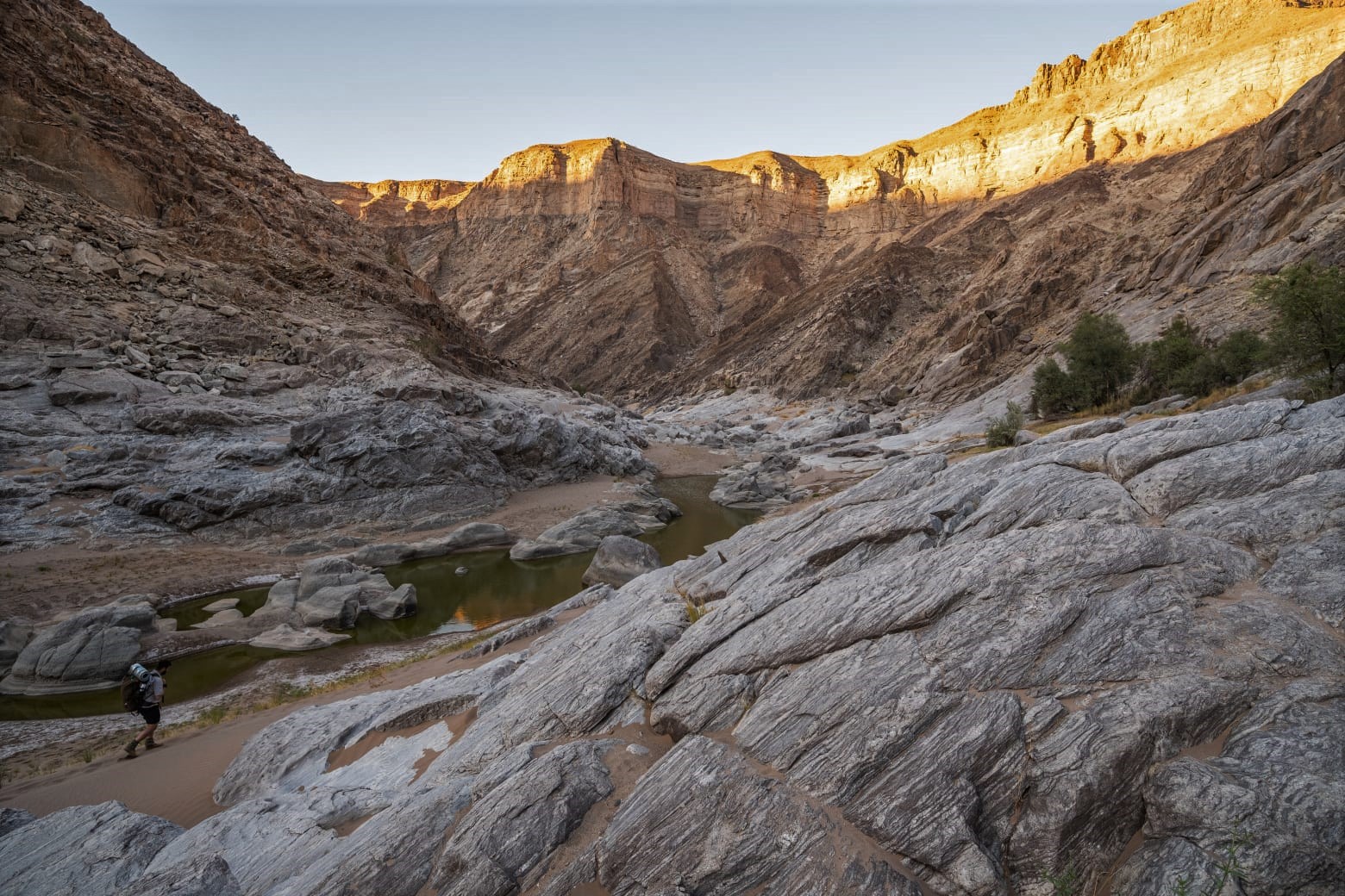
]Hiking through the canyon. The river rarely flows in winter, and the few remaining pools are quite green, so the water has to be purified before it can be used.
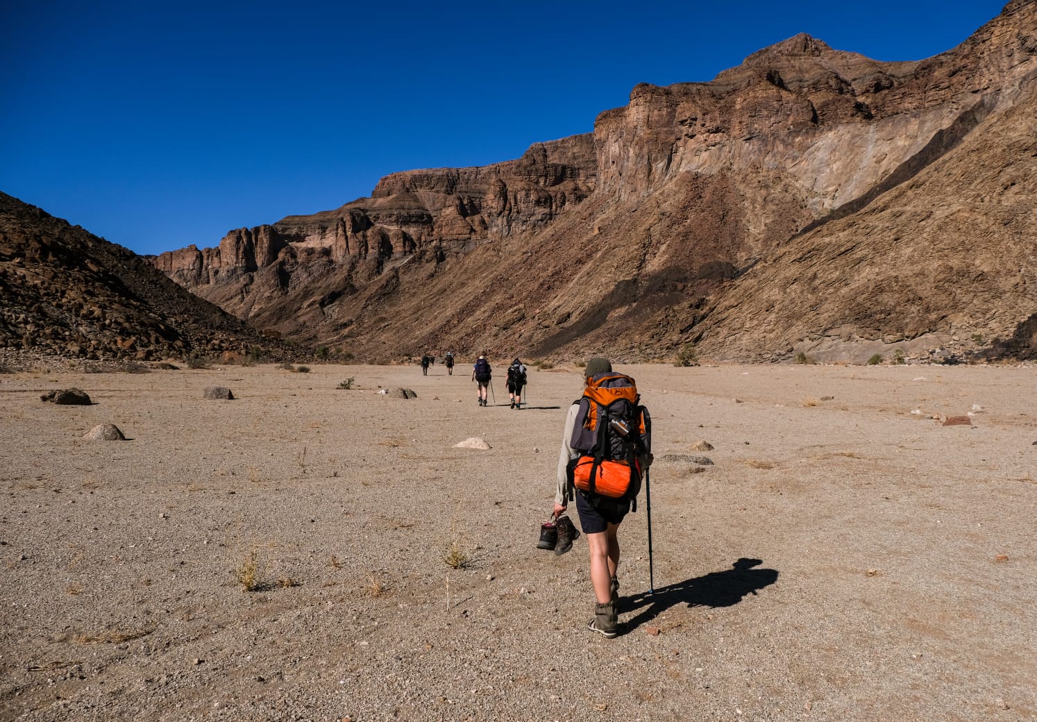
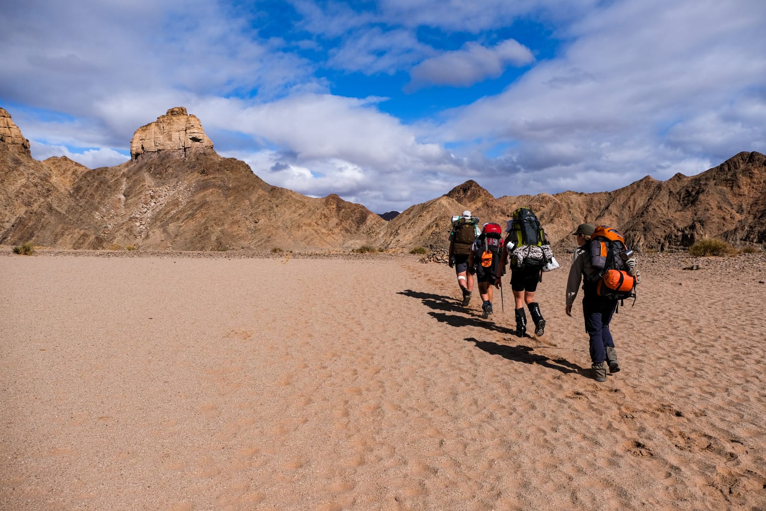
Part of our group. The scenery is absolutely fantastic but can also be quite intimidating when making your way on foot.
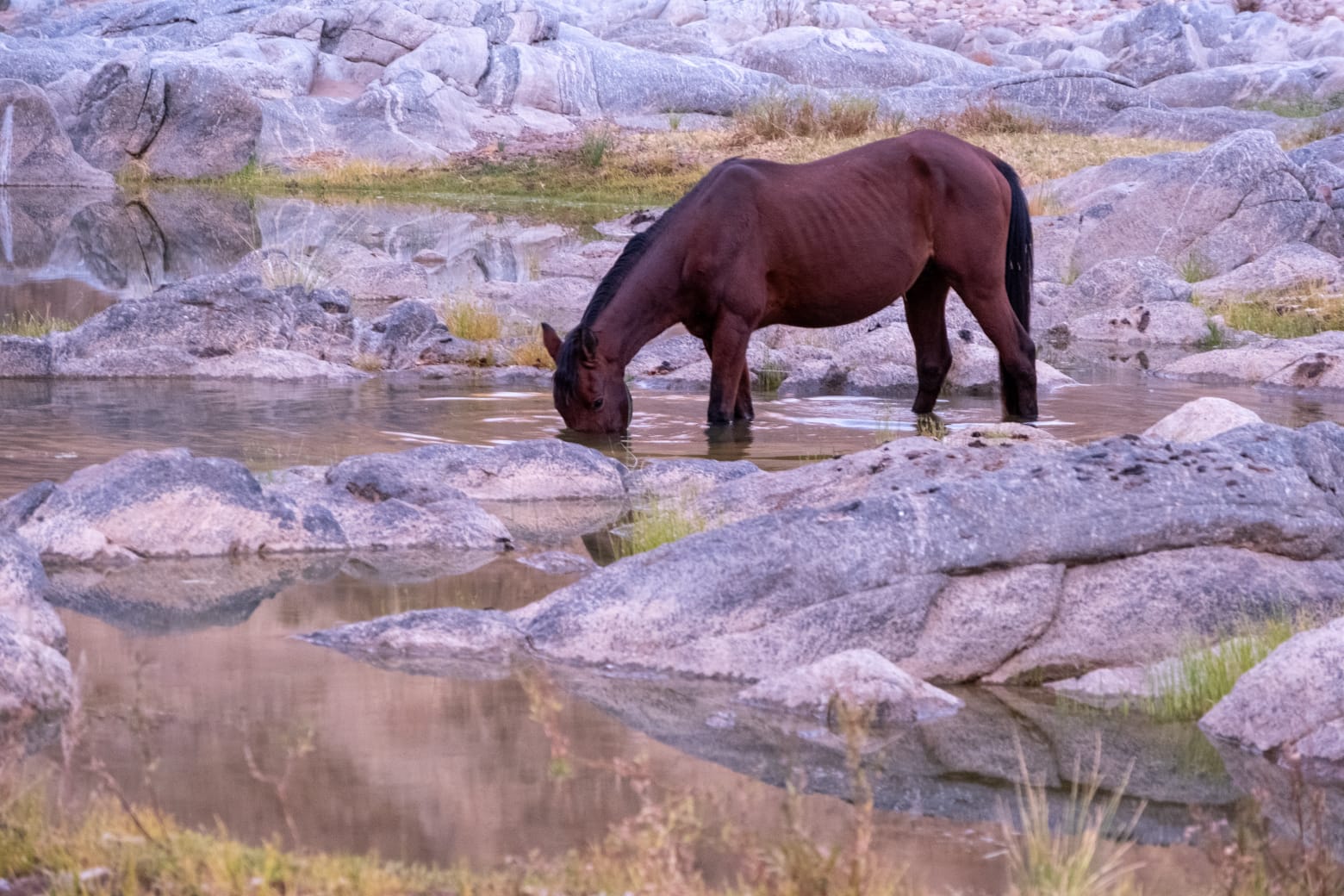
We were lucky to see a number of the famous wild horses of the canyon. There are several theories as to the origins of these horse, but they are most likely the descendants of horses deserted by German Schutztruppe during World War 1. Irrespective of how they got there, it is amazing to see how these once domesticated animals have adapted to the harsh conditions, and survive without any human intervention:
After the first 50km or so the canyon starts to open up, and a lot of walking is through very soft sand, which proved to be even more tiring than clambering over rocks!
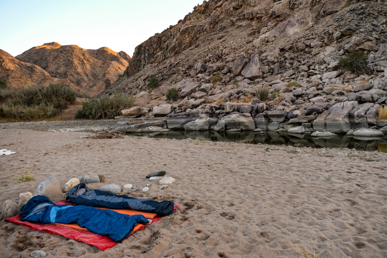
As mentioned there are no facilities, so camping is wherever you find a suitable spot, and you literally sleep under the stars:
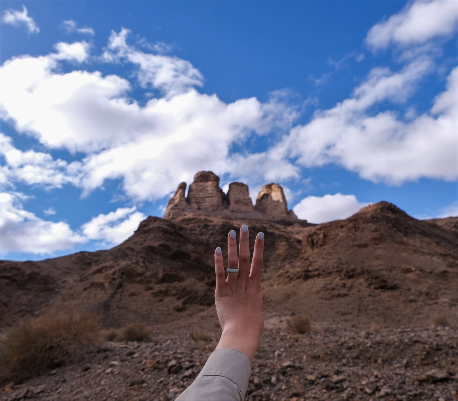
Towards the end of the hike we walked past the appropriately named “Four Finger Rock”:
A Familiar Chat (Oenanthe familiaris). At almost every stop along the hike one or more of these friendly little birds would appear to keep us company (and beg for scraps).
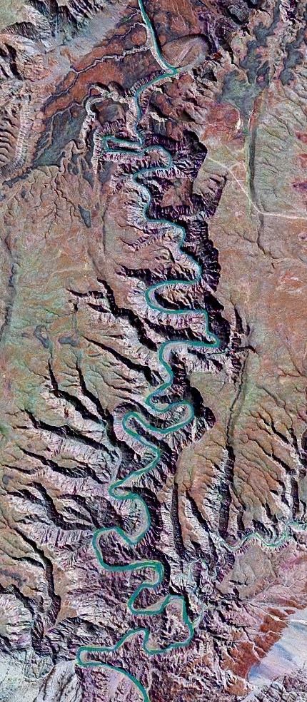
JAC: I’ve added a map showing where the canyon is (my arrow) and a satellite image (turquoise line shows the canyon):
Today’s plant photos are from Rik Gern of Austin, Texas: the first of a set of two. Rik’s captions are indented, and you can click on the photos to enlarge them.
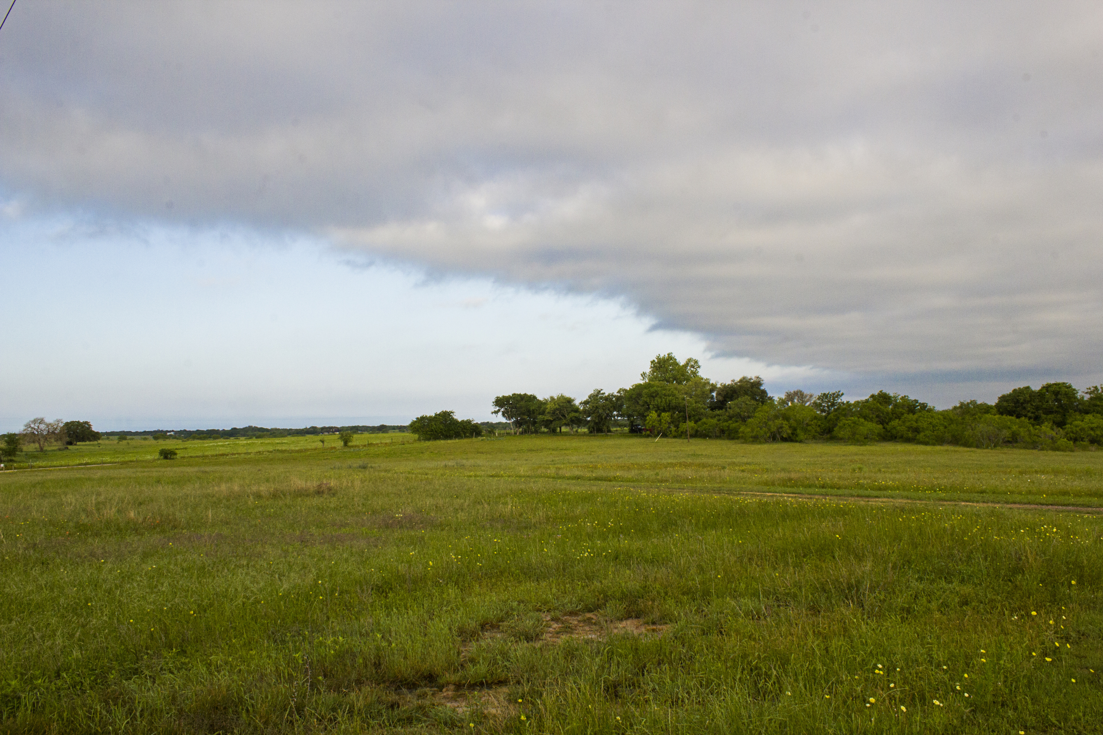
In mid-March I visited a friend on a ranch in Luling, Texas, a small town about 50 miles south of Austin and 60 miles east of San Antonio. Originally a railroad town, and once known as “the toughest town in Texas”, Luling is now a minor oil town. [JAC: It’s also the home of the City Market, one of the finest BBQ joints in Texas.]
The landscape is typical of much of central Texas; it can look monotonous on the surface, but it’s full of interesting life when you look up close. The woods, which the locals refer to as scrub brush, consists largely of Spanish Oak, Mesquite, and Elm:
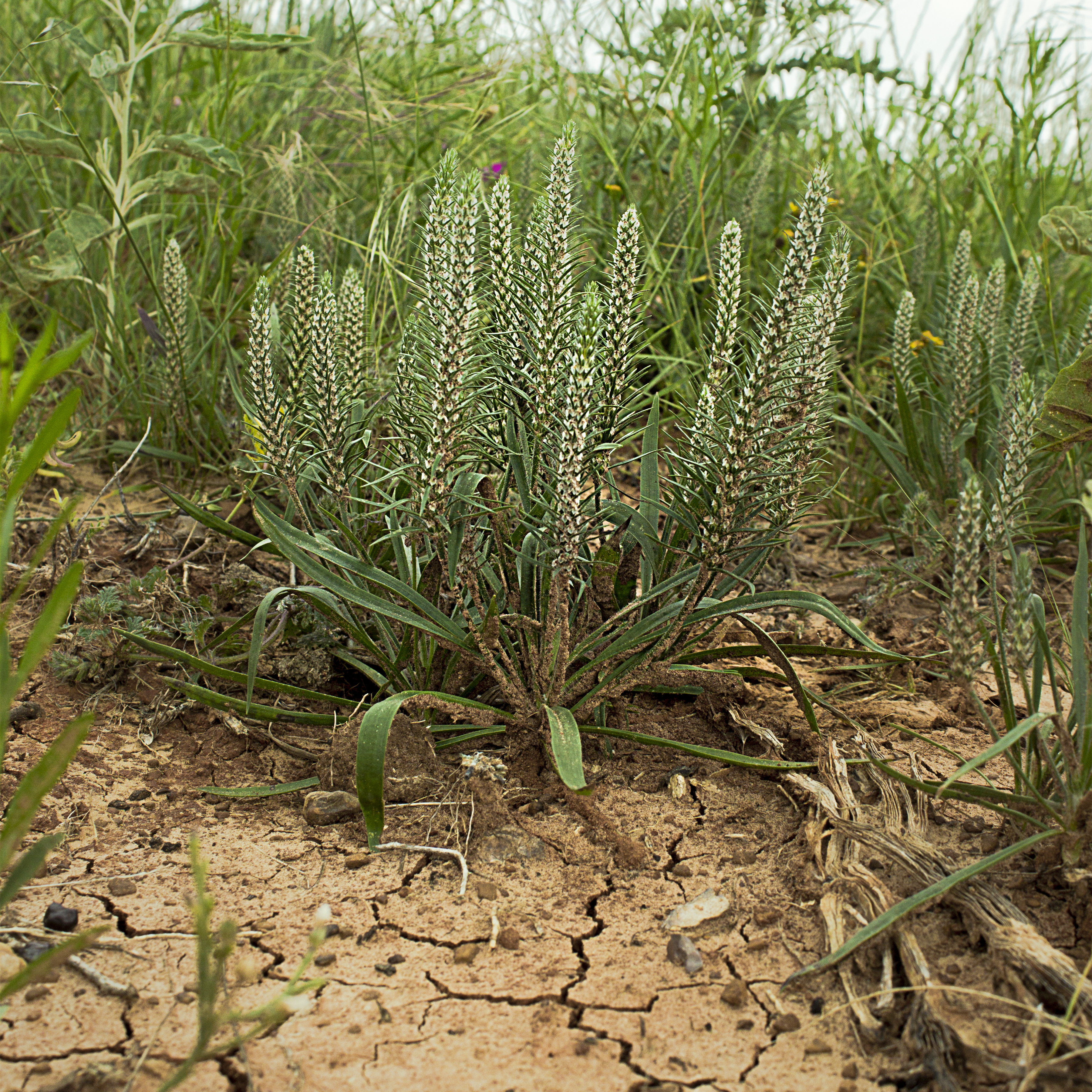
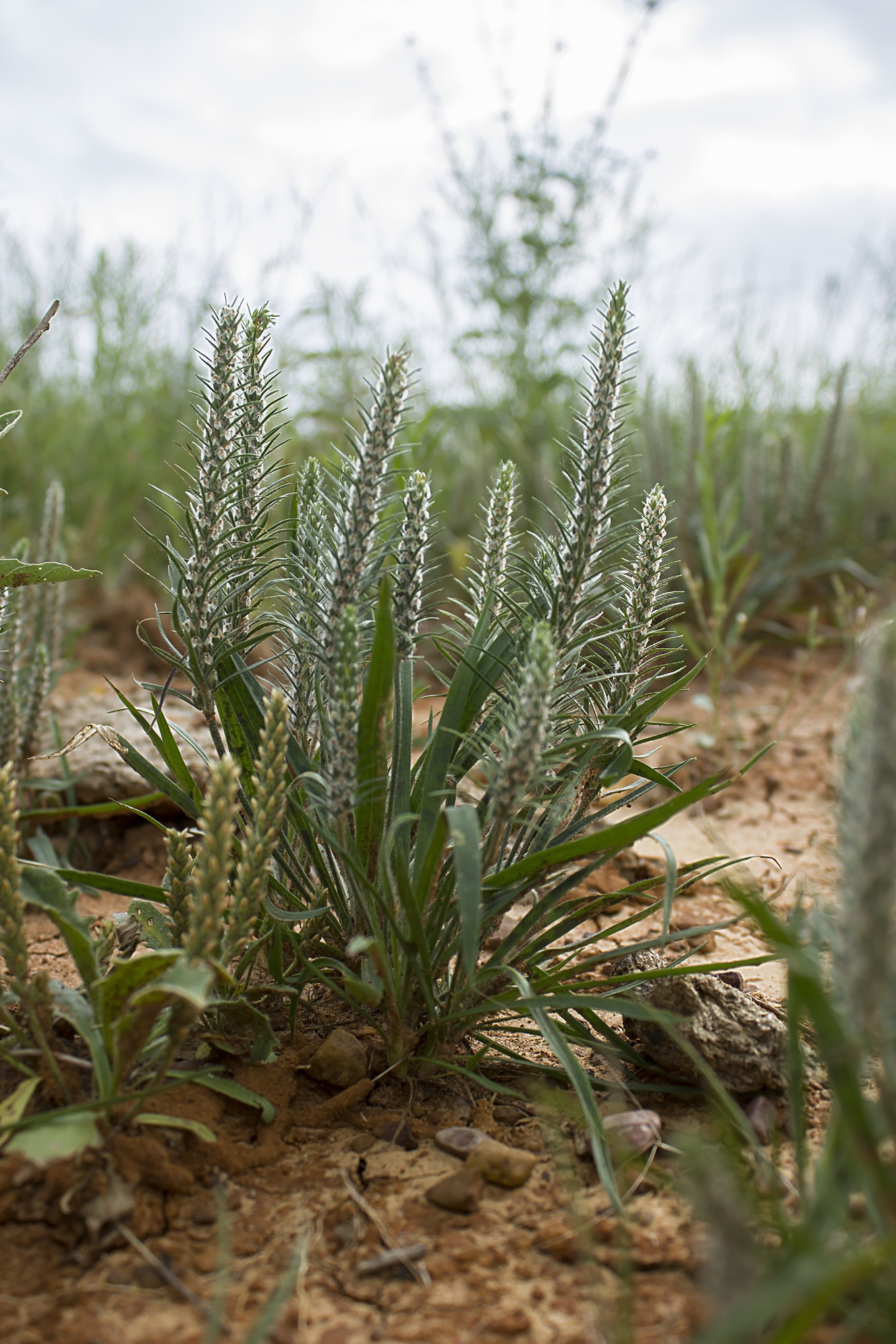
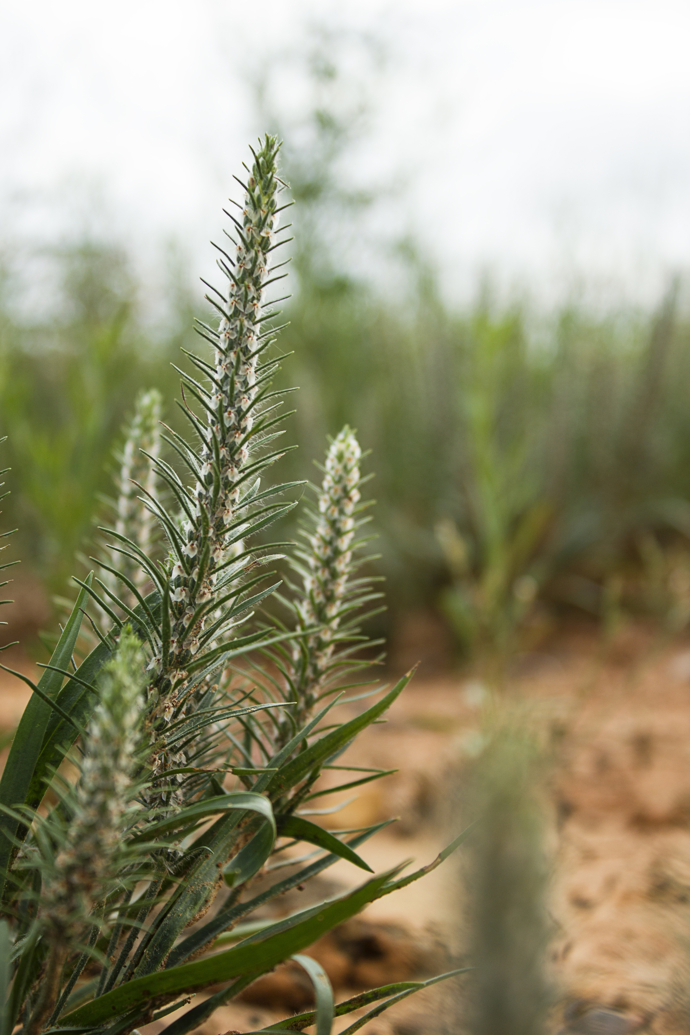
This hardy plant, breaking thru the crusty soil, is bracted plantain (Plantago aristata).
If you enlarge the photo above, you can see that it is covered with tiny flowers. I’d like to visit a little later in the season to see them in bloom!
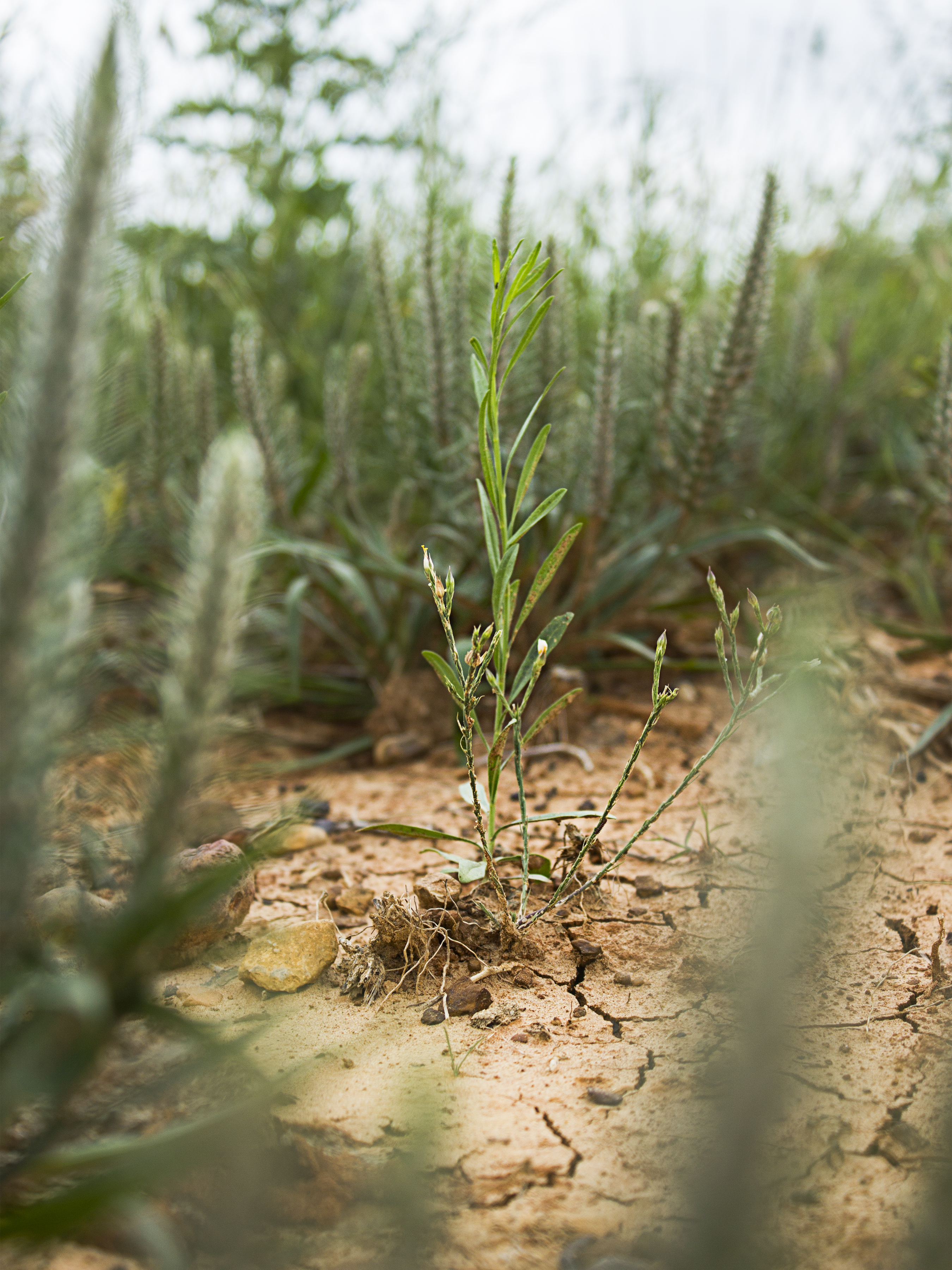
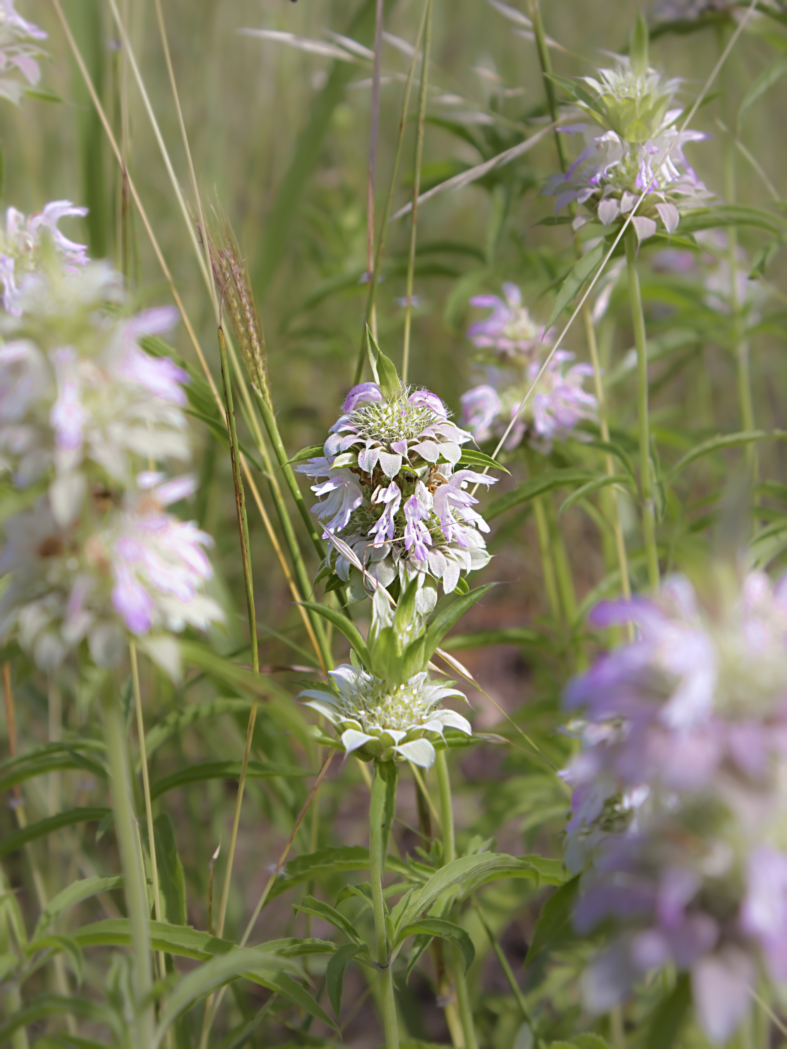
I’m not sure what this little sprout is; it’s growing among the braced plantains and may be one of them, or perhaps it’s a member of the next group of plants, the spotted beebalm (Monarda punctata).
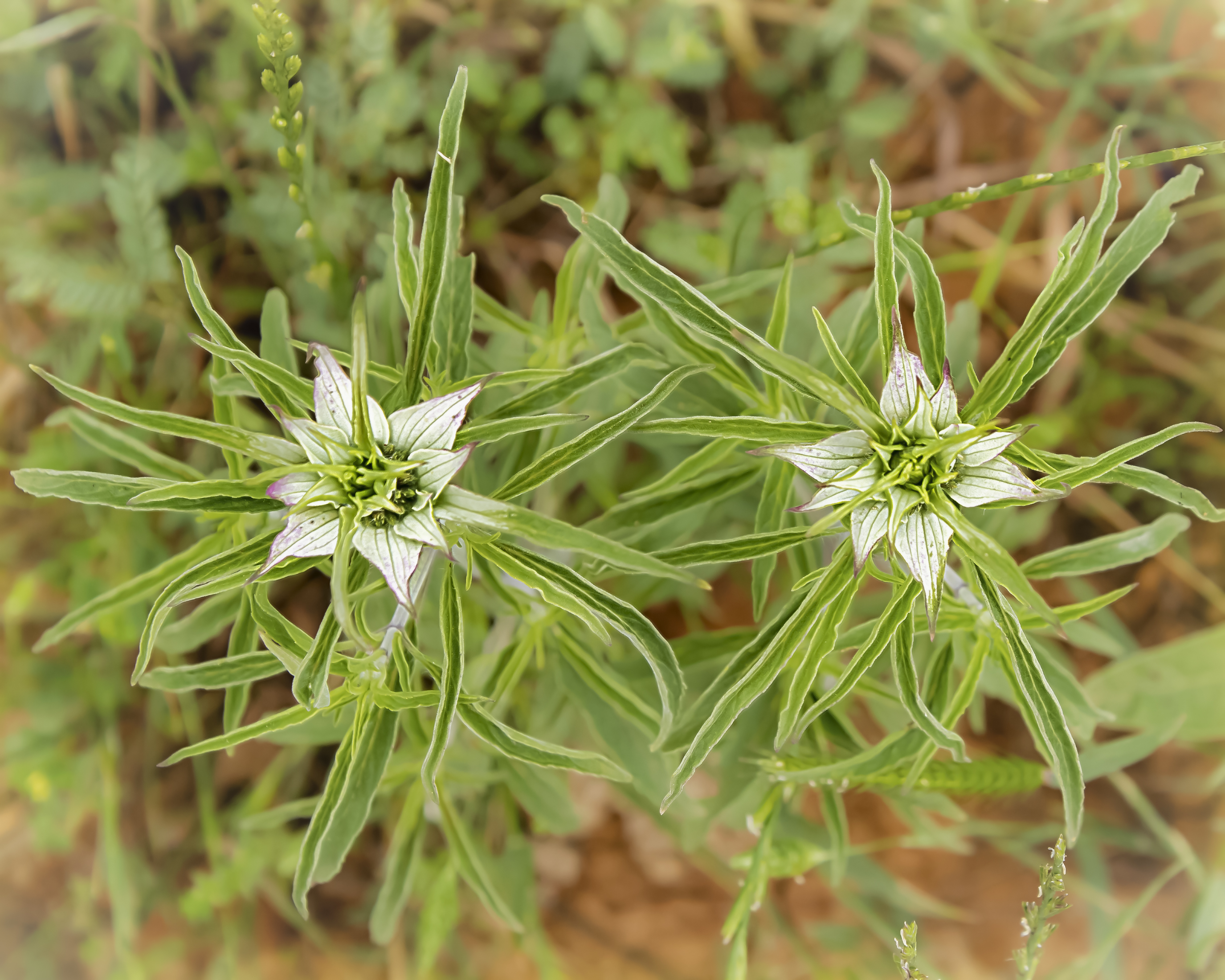
This image of two spotted beebalm plants is taken from above.
The following two pictures were the only ones not taken in Luling; these were taken in a hay field in nearby Kingsbury in late May. I’m not sure if they’re a different species or just more mature plants of the same species.
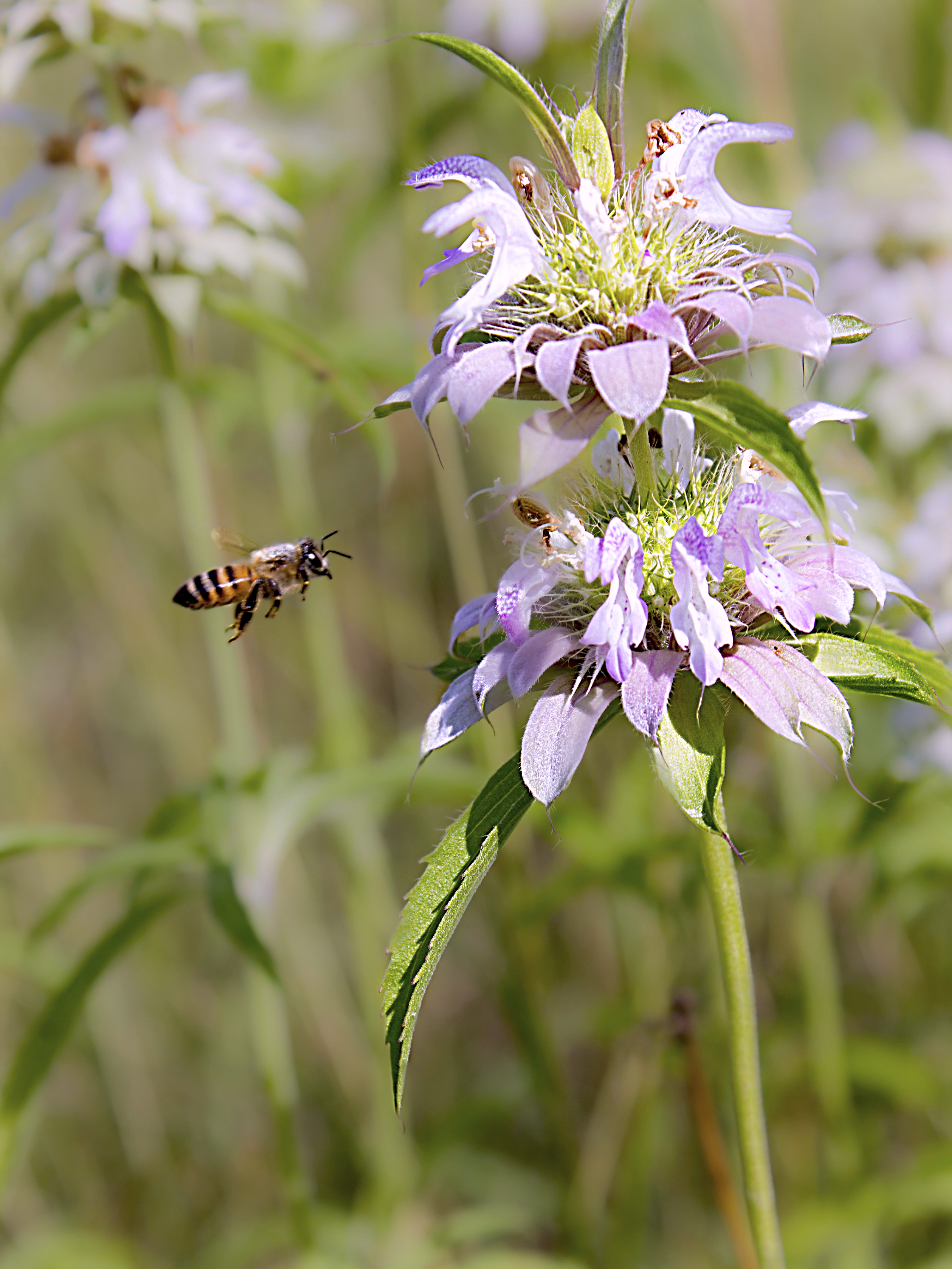
A beebalm wouldn’t be a beebalm without a bee!
Here’s another unidentified plant. I think it might be a spotted beebalm whose flower head has fallen off. Whatever it is, I like the shapes!
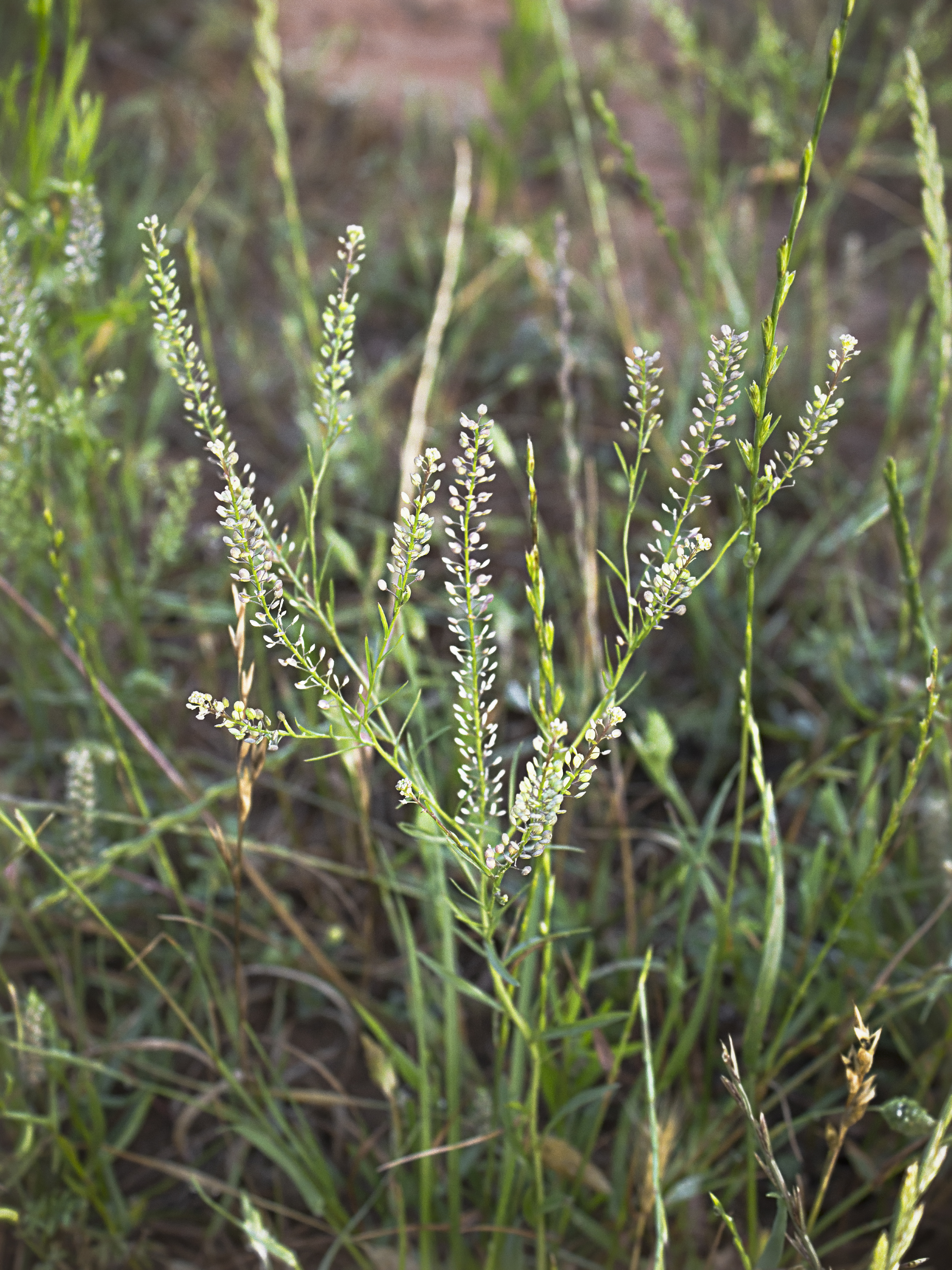
Common peppergrass (Lepidium densiflorium) is indeed common in these parts and adds a lacy goodness to the fields.
These are some of the scruffier plants I saw. With the next batch you will see some of the more colorful denizens of Texas’ countryside.
There isn’t much wildlife in these photos by Athayde Tonhasca Júnior, but a lot of history and travel, so they qualify as “wildlife”. His notes are indented, and you can enlarge his photos by clicking on them.
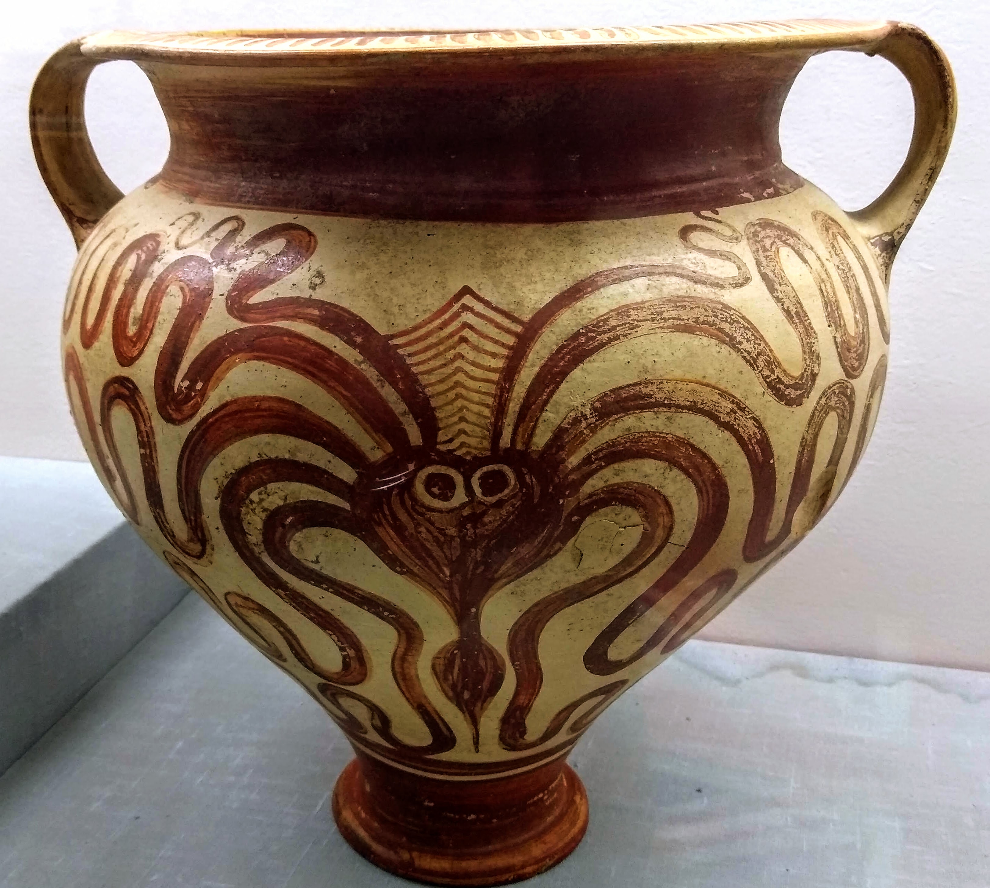
Phoenicians, Greeks, and Minoans (Cretans) were very fond of octopuses. This 1500-1450 BC vase is one of many pieces of octopus-themed pottery in the Cyprus Museum (Nicosia) and museums from all over the Aegean region. Scholars have offered countless explanations for this Octopoda-fixation.
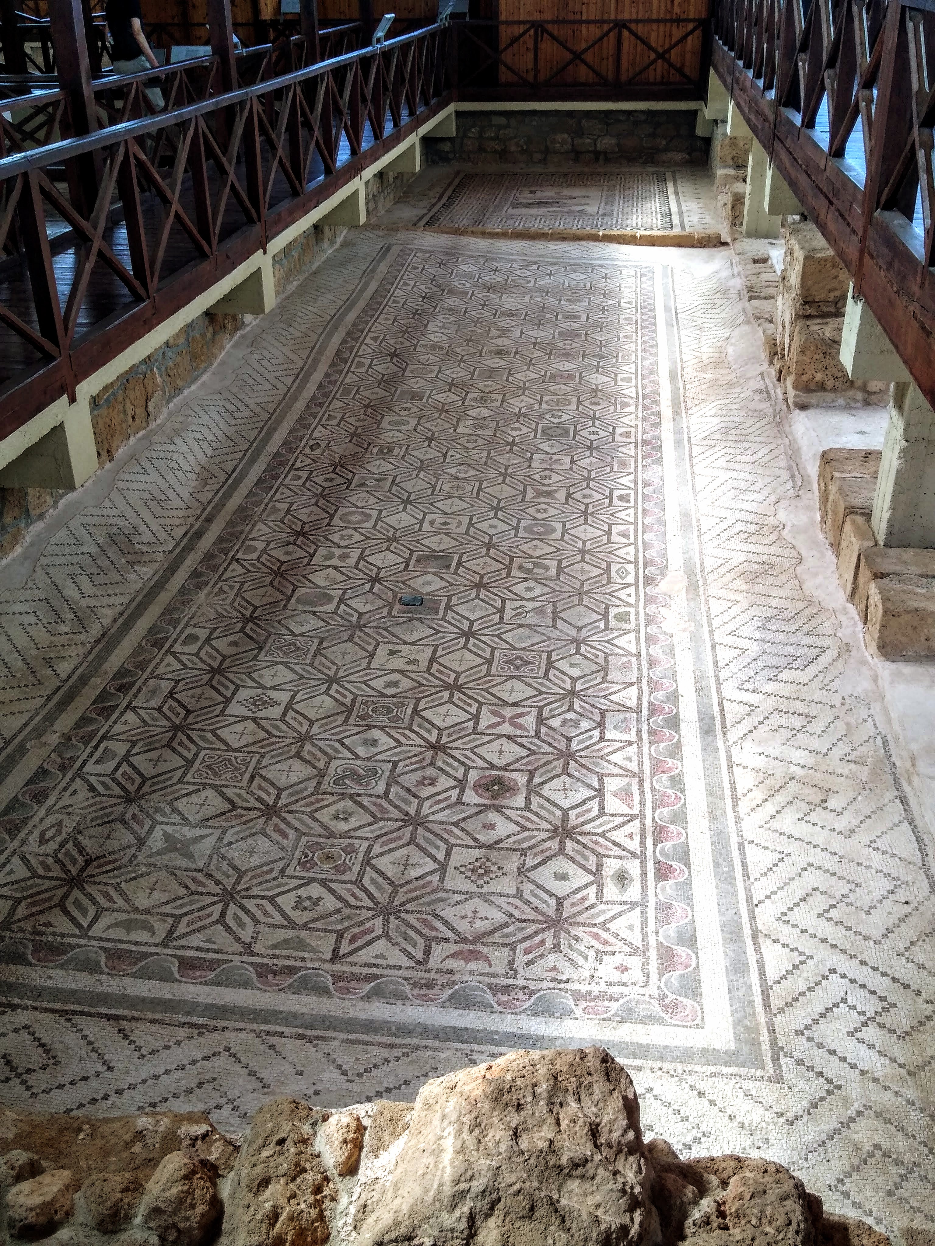
Today’s rich and famous stuff their homes with art objects, but the Romans had mosaics as symbols of status. They were created by artisans specialised in assembling tesserae (a tessera is a small tile made of ceramic, stone or glass). The Mosaics of Paphos from 3rd-4th century AD were discovered in 1962 when a farmer accidentally unearthed one of them while ploughing his field. They are part of Paphos archaeological complex, an UNESCO World Heritage site.
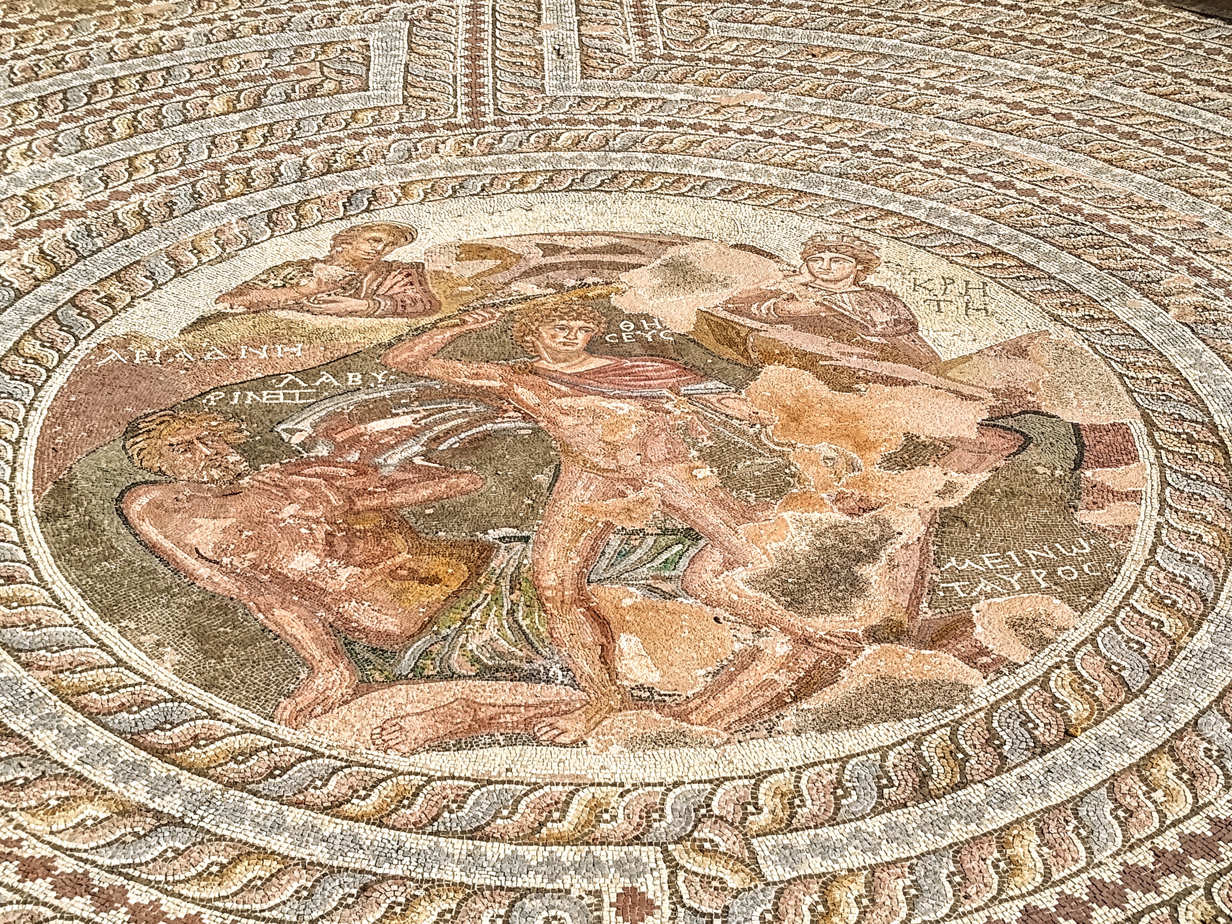
This mosaic depicts the duel between Theseus and the Minotaur in the Labyrinth of Crete. Theseus is holding a club and grabbing a horn of the Minotaur, who has fallen to his knees. The scene is framed by successive decorative zones that symbolize the Labyrinth.
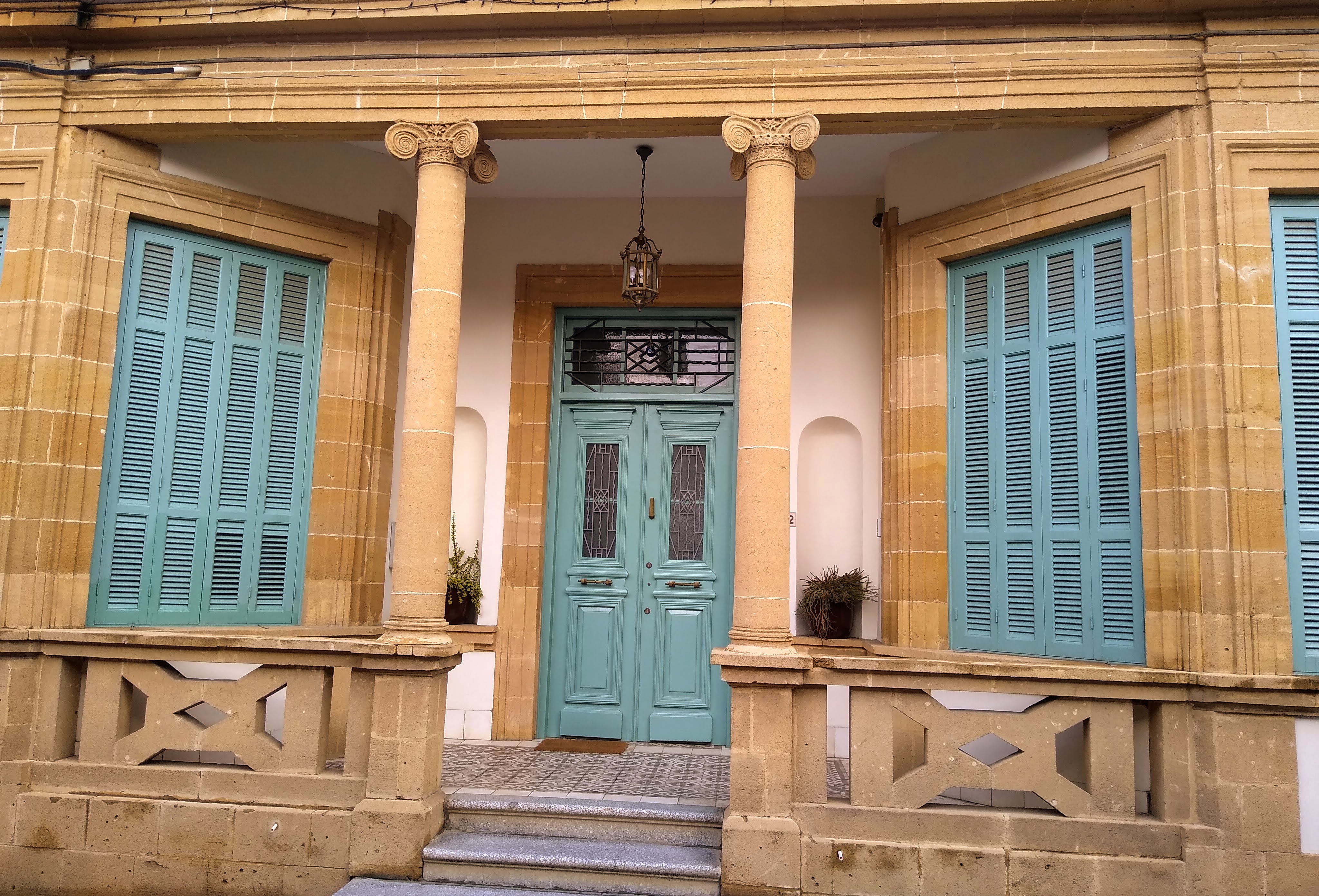
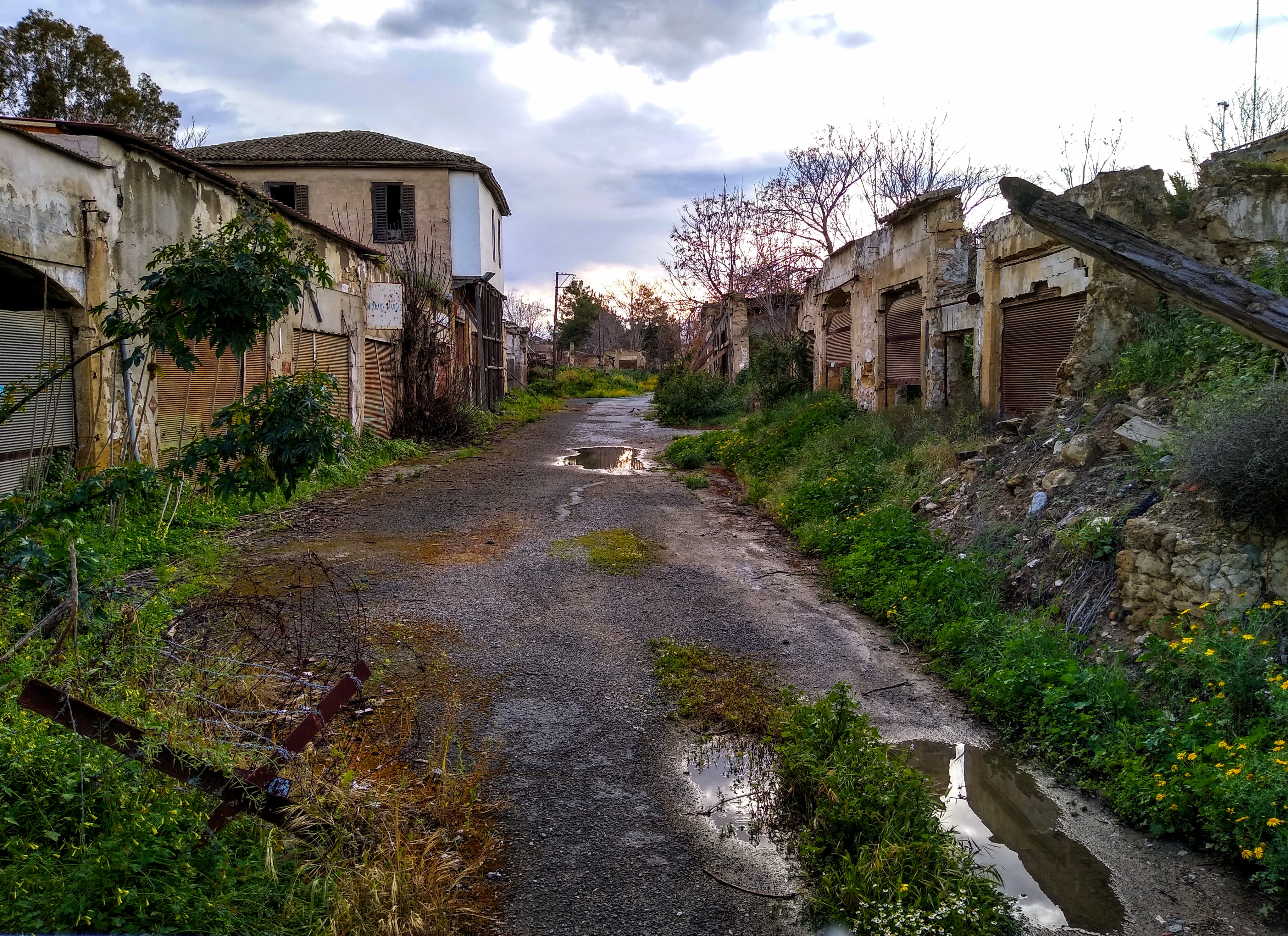
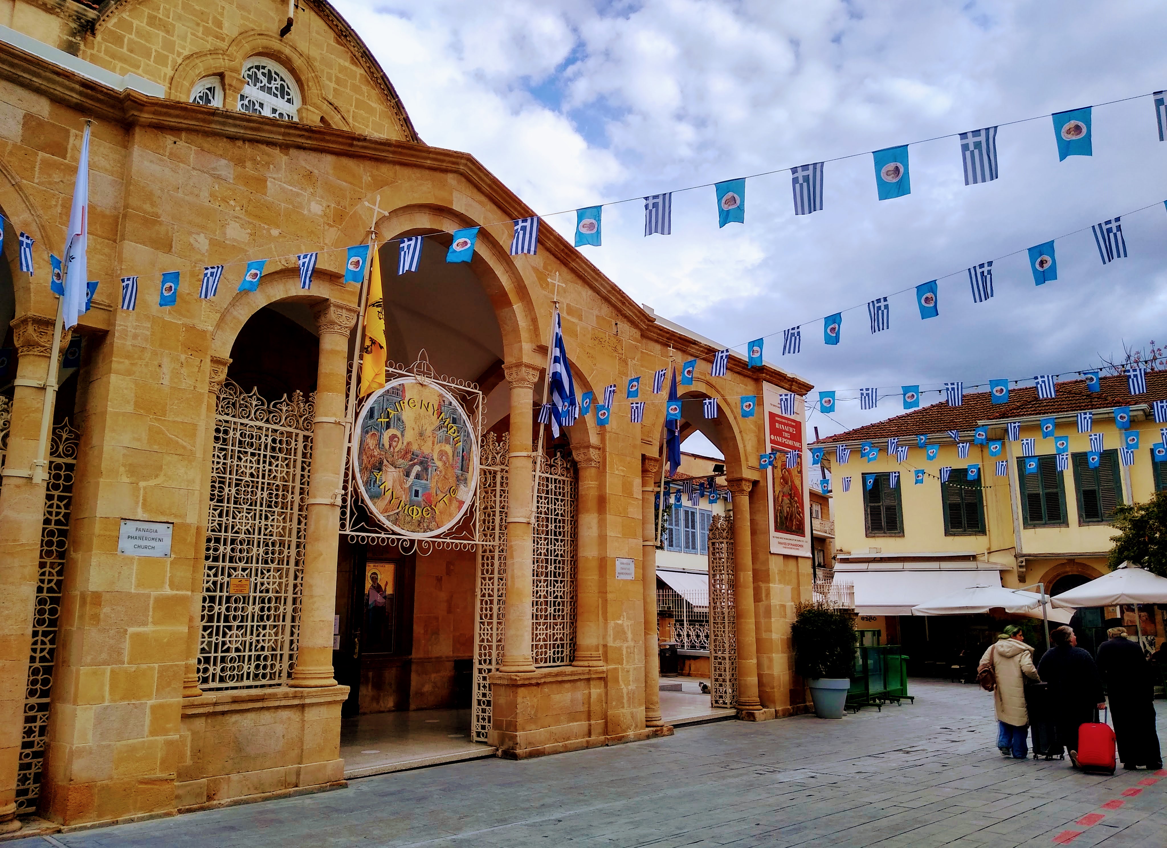
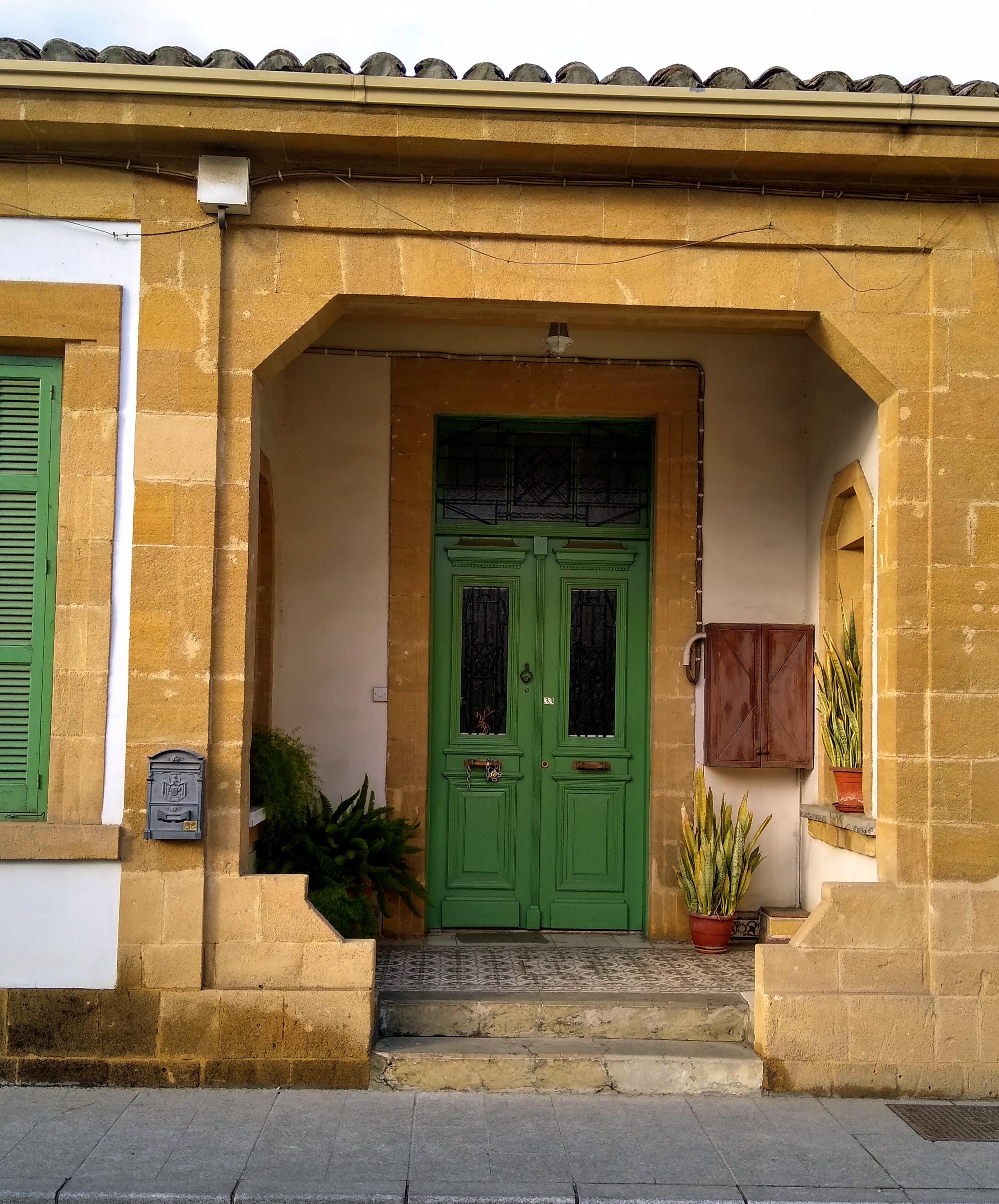
Nicosia, the Cypriot capital, is not particularly photogenic. But many houses have lovely, old-fashioned porticos.
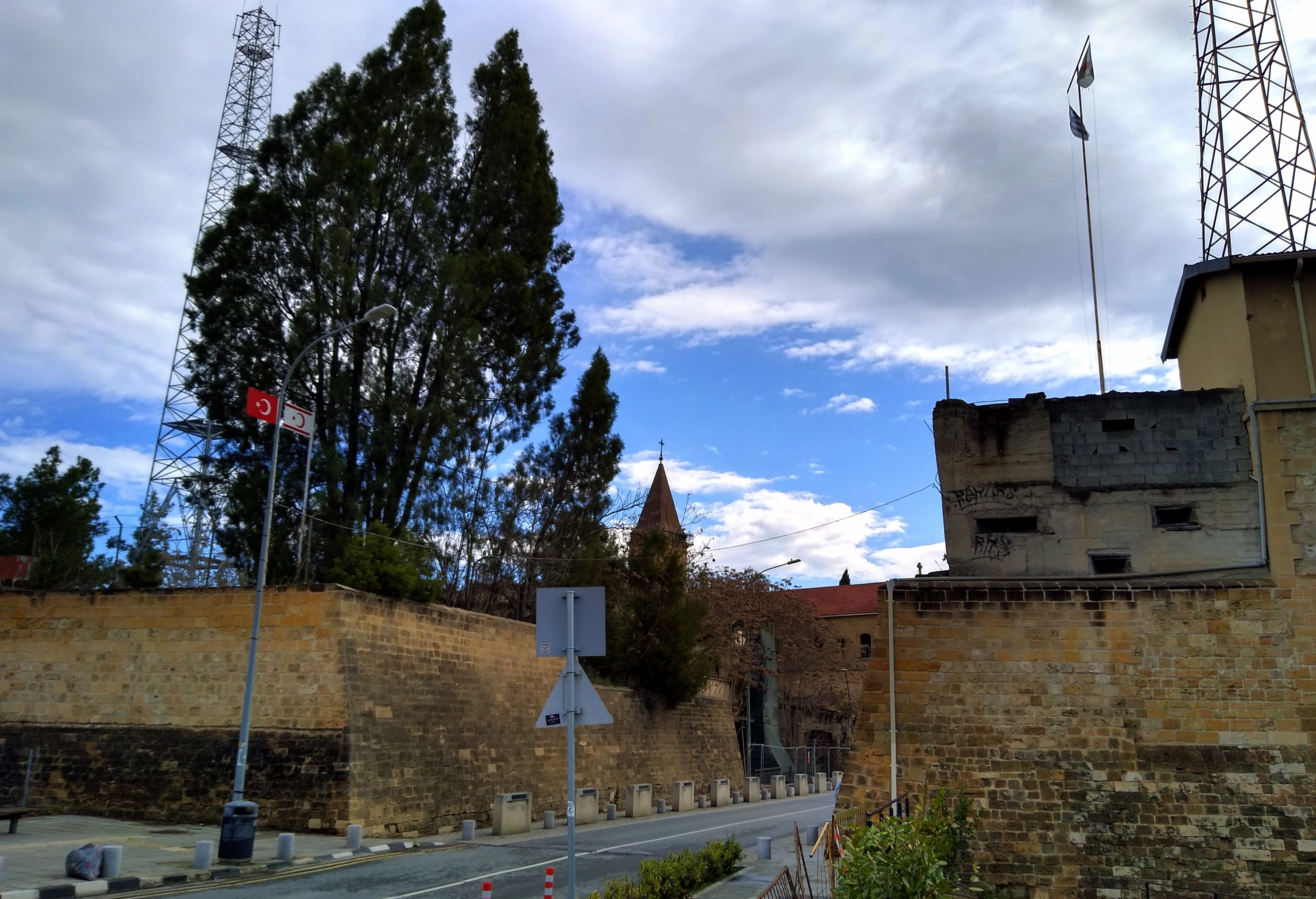
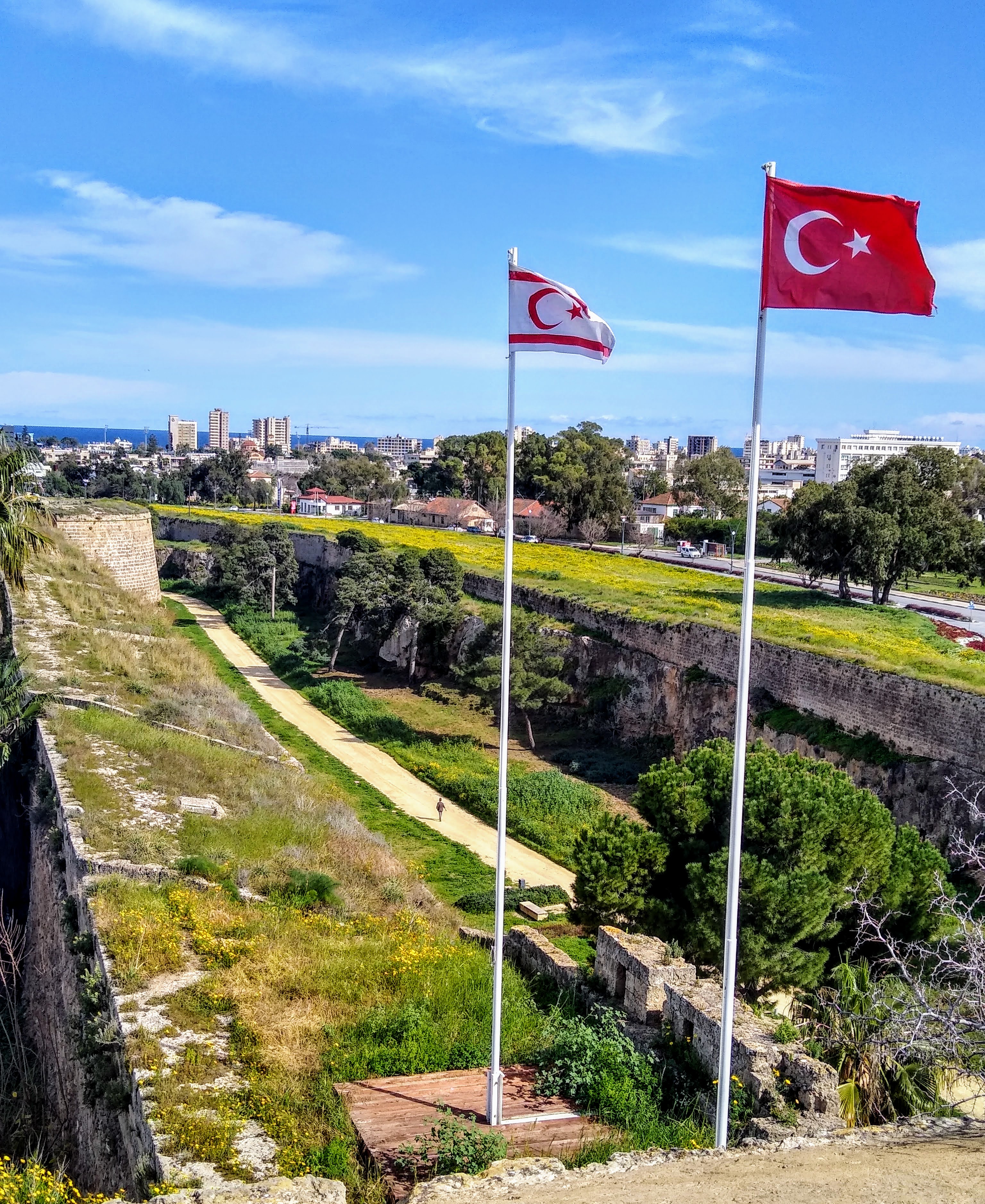
This street divides Lefkoşa (North Nicosia, on the left) and Lefkosia (South Nicosia), both surrounded by Venetian walls. Nicosia was the capital of the unified island until 1974, when Turkey invaded Cyprus. Now Lefkoşa is the capital of the Turkish Republic of Northern Cyprus (TRNC), a ‘country’ recognised by nobody except Turkey, and Lefkosia is the capital of the Cyprus republic. The pillboxes on the right side are pocked by bullet marks, reminders of the vicious fighting in 1974.
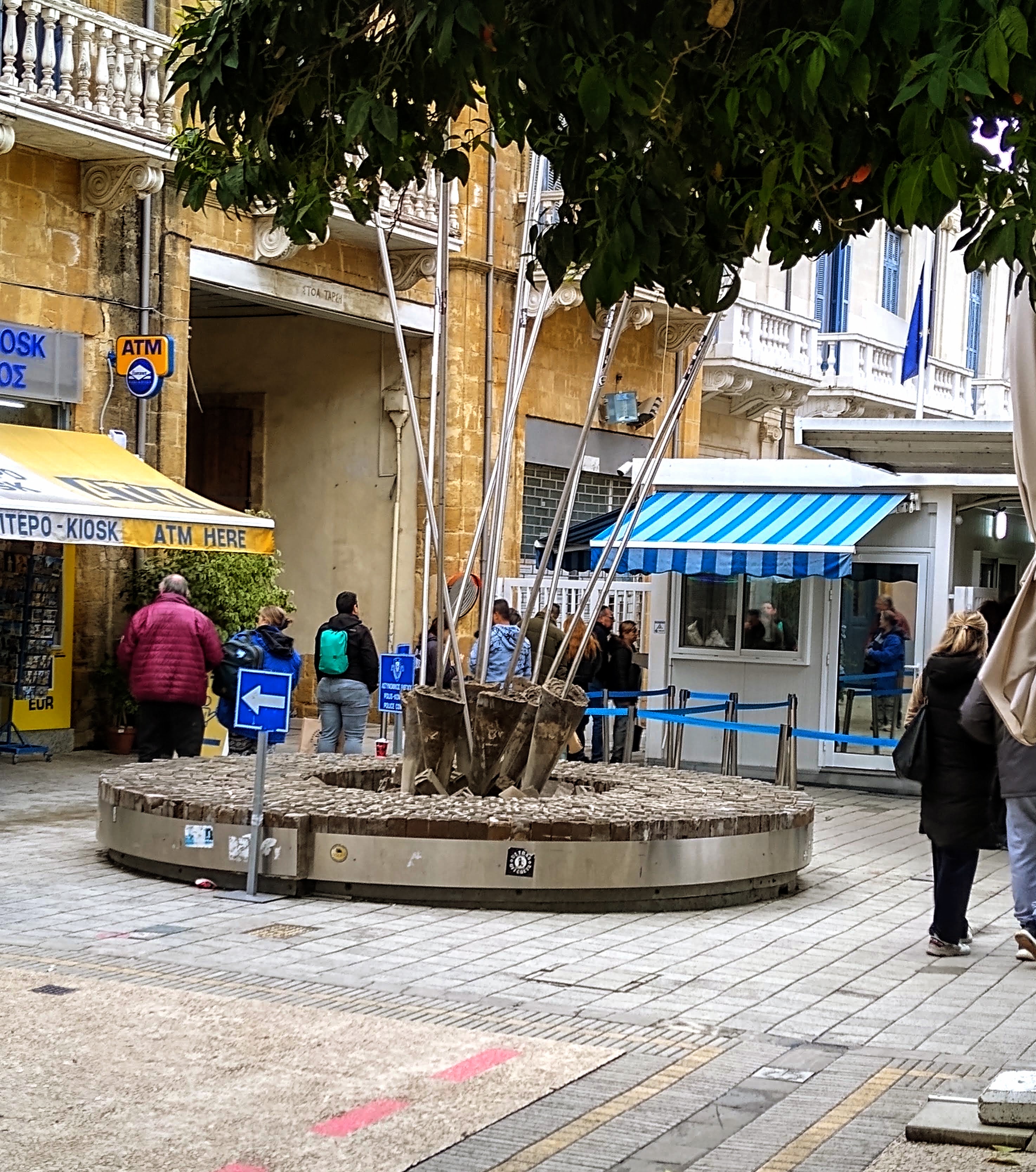
The United Nations Buffer Zone, known as The Green Line. This 180 km-long no man’s land divides Cyprus from the Turkish occupied area. The Green Line is patrolled by a UN force and an army of mangy cats.
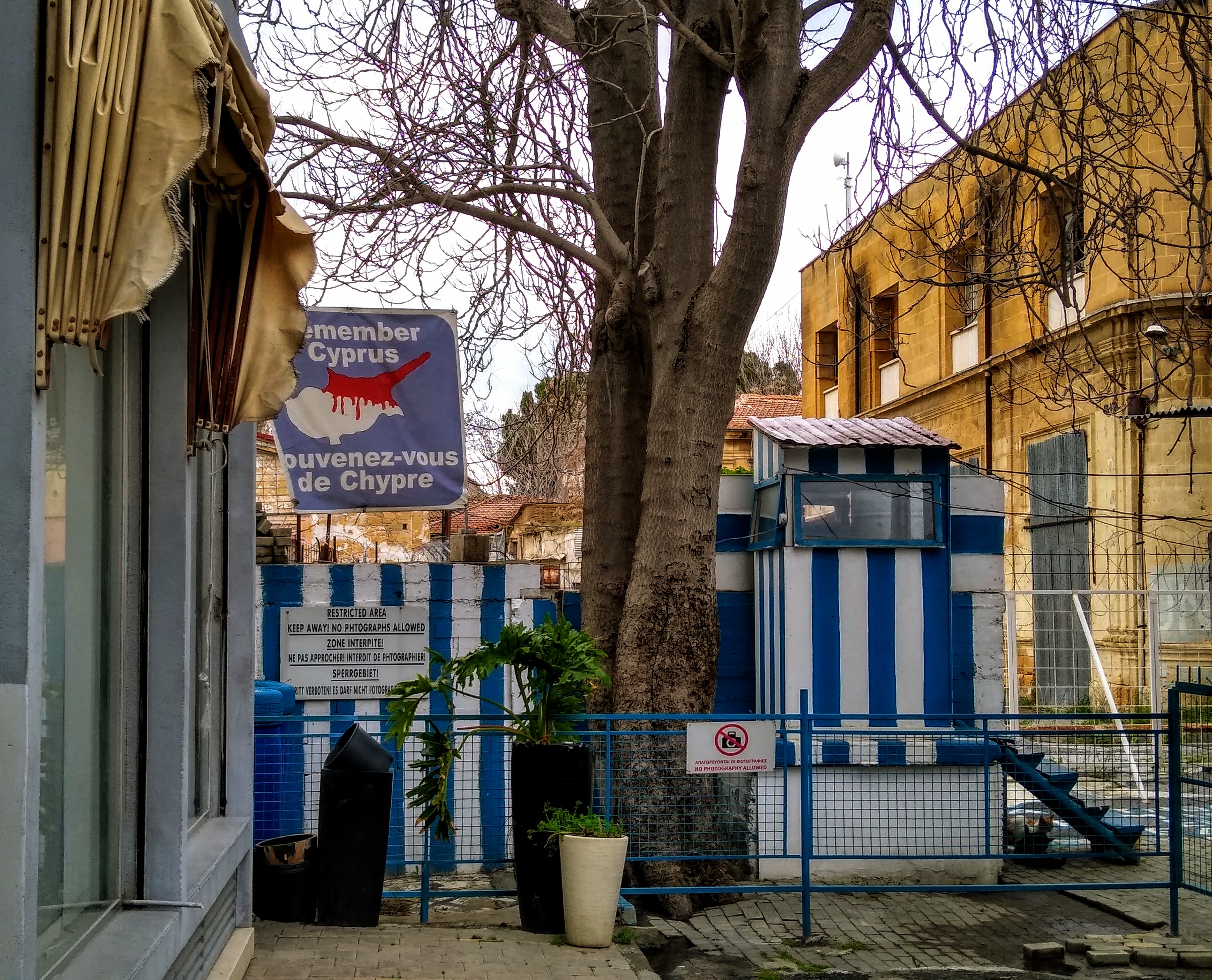
Cyprus version of Berlin’s Checkpoint Charlie: you show your passport to a bored Cypriot guard, walk 50 m past dilapidated & empty buildings, show your passport to a bored Turkish guard, and officially leave Europe. The Turkish side is jam-packed with shoppers with an eye for bargain luxury-branded merchandise, possibly genuine handbags, shoes, clothes and assorted tat. There’s no need to change currency: traders are more than happy to take Euros instead of the ailing Turkish Lira.
The Green Line is not a Berlin Wall reincarnation, but it saw its share of activists arrested or shot. Today the Line’s greater danger is being shouted at by a UN soldier for the illegal act of photographing their shabby military installations. Notice the white-and-blue Greek colours, which are meant to rub the Turks the wrong way.
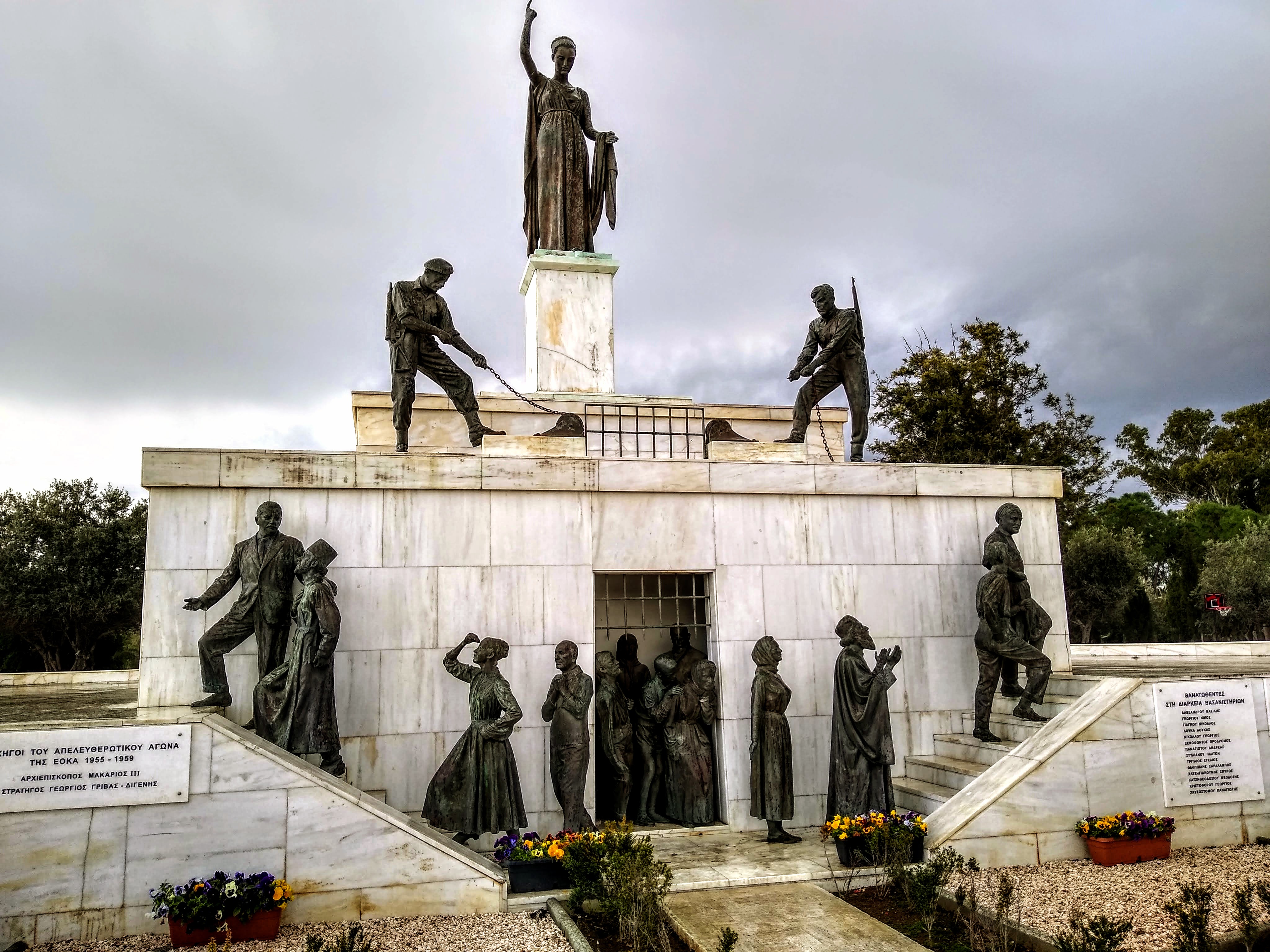
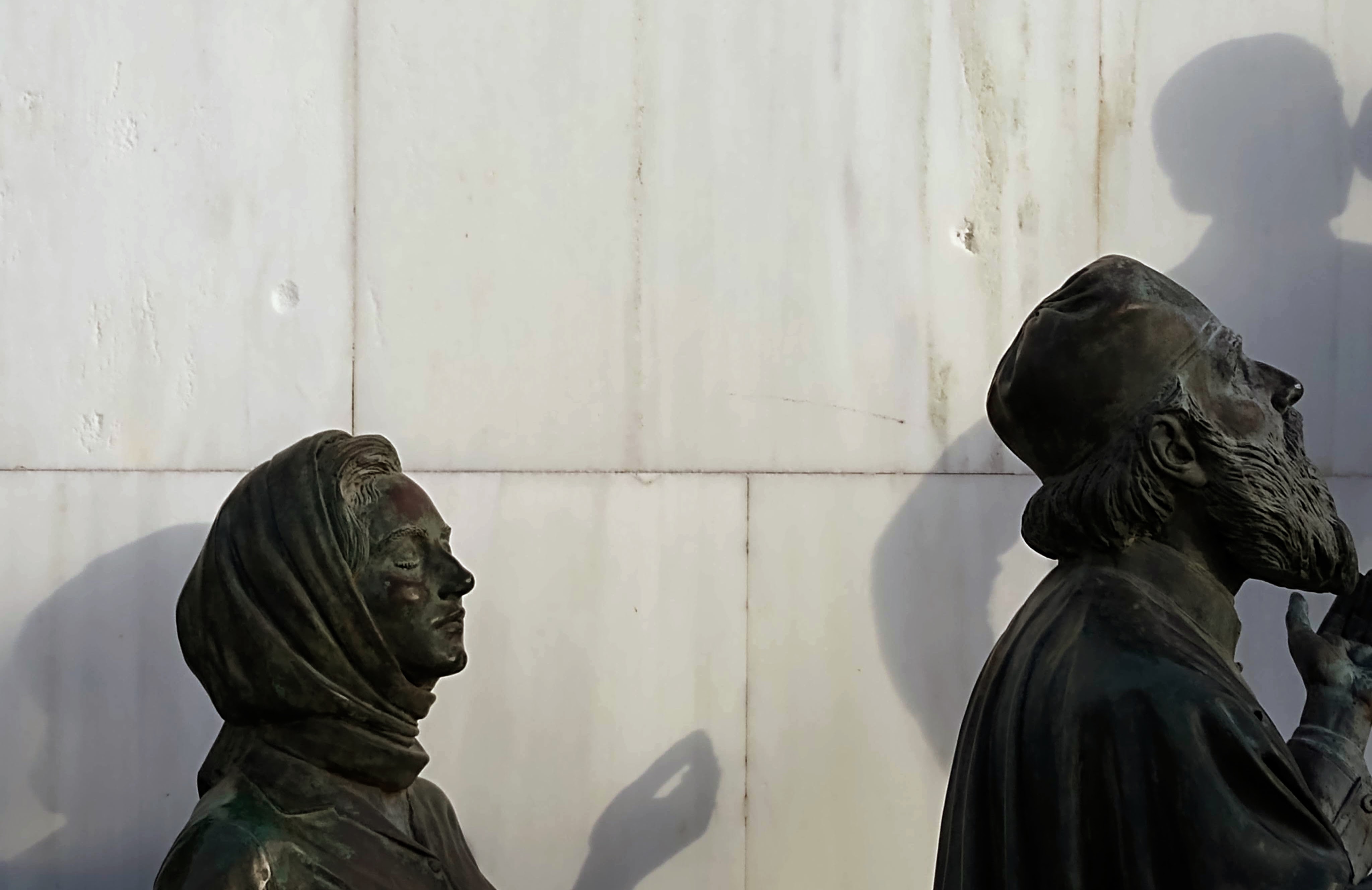
The Liberty Monument to celebrate independence from Britain in 1960. Liberty stands above two members of EOKA (National Organisation of Cypriot Fighters) opening the prison gates to free rebels, civilians and the clergy. Unfortunately there was no room in the monument for remembering the hundreds of Turkish-Cypriots murdered by EOKA, whose war cry was ‘first the British and then the Turks’. About 90 EOKA members were killed during the insurgency (a few were tortured in prison by the British forces), while nearly 500 British & Turkish-Cypriots, including policemen, medics and civilians, were murdered. One man’s freedom fighter is another man’s terrorist.
The Liberty monument was erected in 1973, one year before the Turkish invasion. The bullet impressions above the heads of these statues are mementos of those turbulent times. It all started when the right-wing military usurped power in Greece, and the humourless, moustachioed colonels winked the go-ahead to the Greek-Cypriots dreaming of enosis (union with the Greek motherland). Union happened in Crete, but Turkish-Cypriots were not keen on pan-Hellenism. Turkey moved in to defend its brethren, thousands were killed, and many thousands living on the wrong side of the island were displaced.
You see more Greek flags than Cypriot flags in the streets of Nicosia. The enosis aspiration may not have died, which will keep the Turks wary of Cyprus’ reunification.
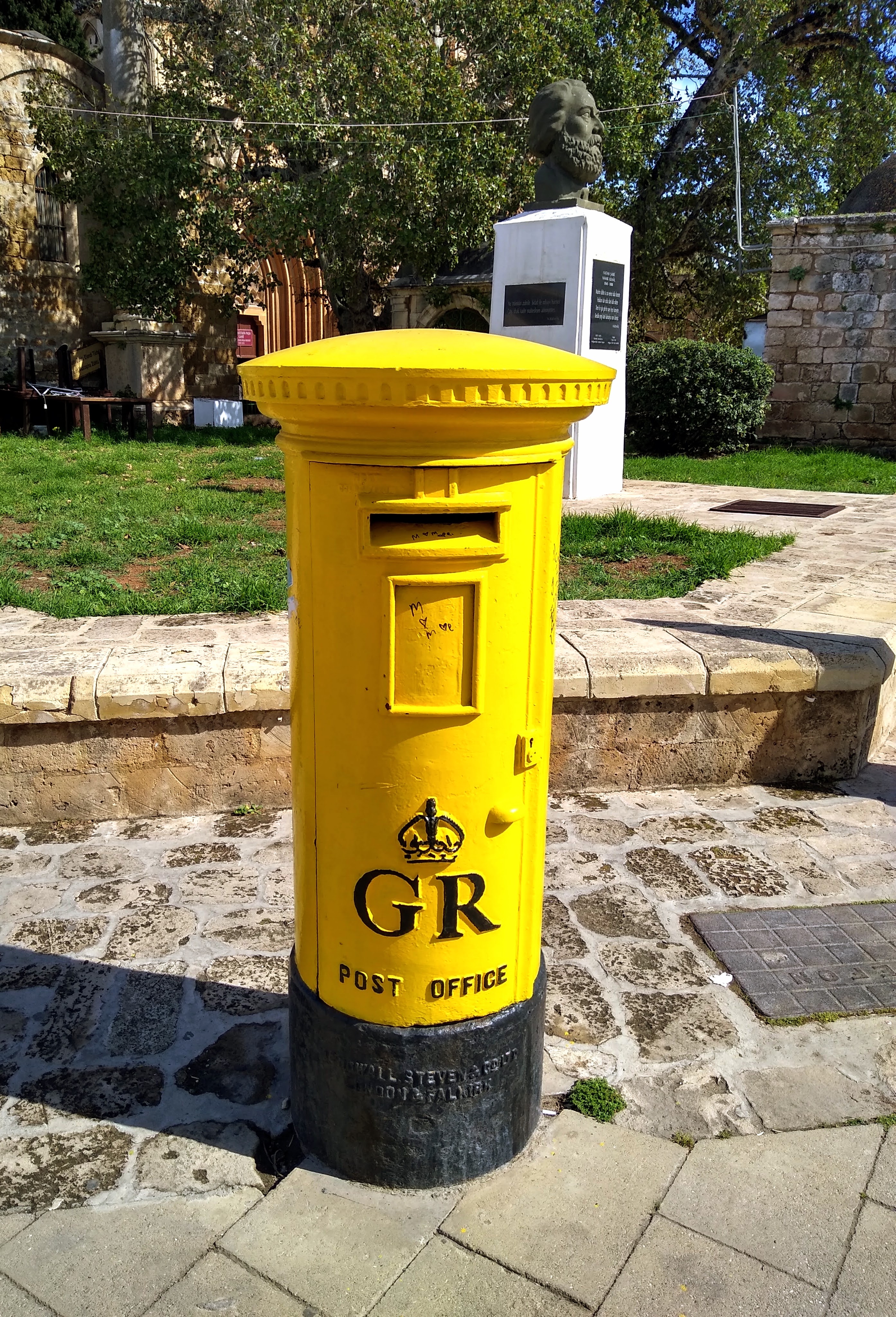
What did the British ever do for Cyprus? A decent postal service, for one thing. To disguise their colonial past, the traditional red pillar-boxes were painted yellow. But the Royal Cypher (George Rex) was kindly preserved.
Sign in a Nicosia restaurant: One of the penalties of refusing to participate in politics is that you end up being governed by your inferiors—Plato.
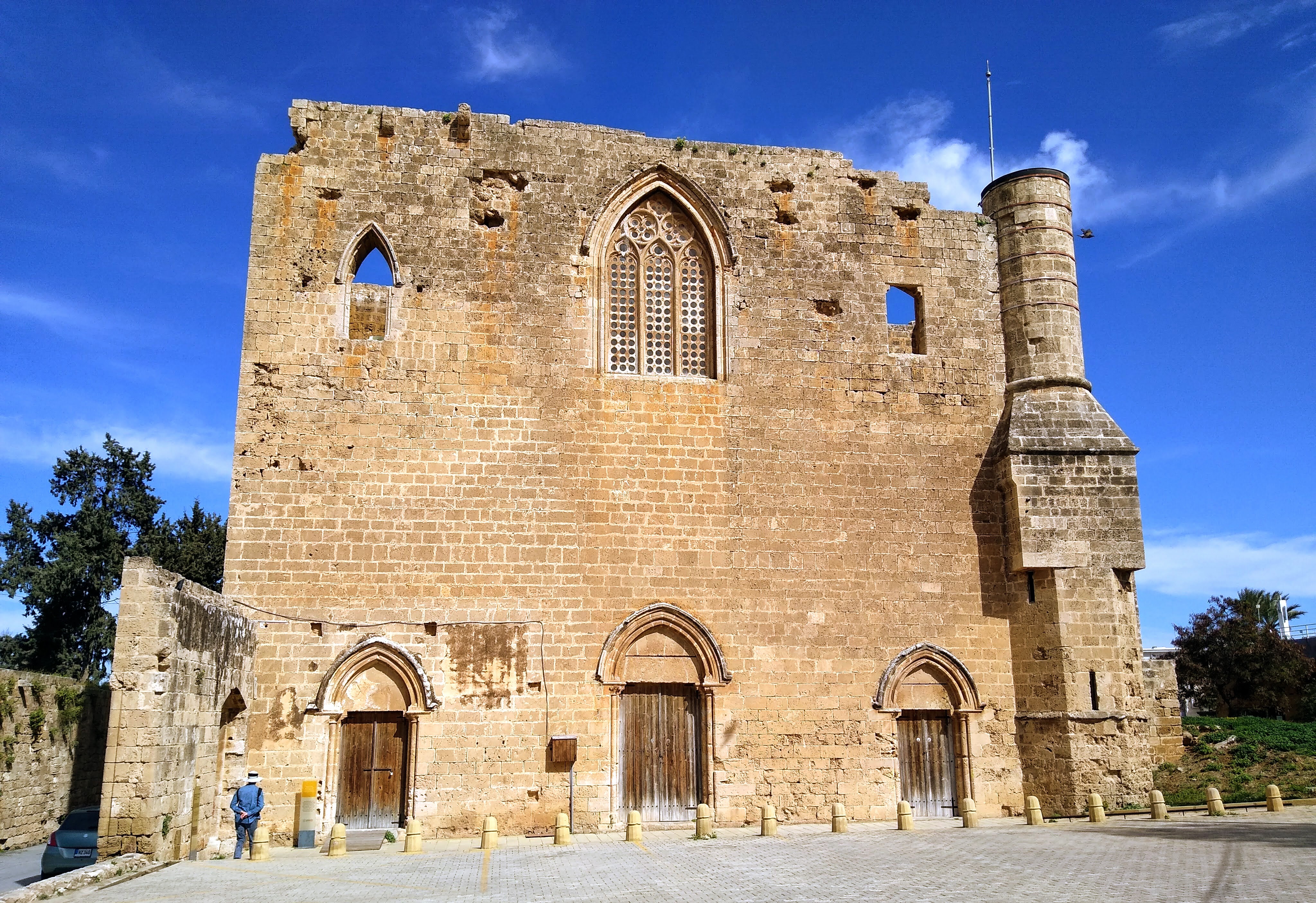
A Gothic church from 1360 in Gazimağusa (Famagusta) on the Turkish-occupied northern coast. Converted to a mosque in 1572, the Brits finally put the building to good use by changing it to a wheat warehouse. Famagusta was established during the Byzantine era by refugees from the island of Salamis (in today’s Greece) fleeing Arab raiders. The city prospered under the Lusignans (French crusaders who ruled Jerusalem, Cyprus and Armenia at various times between 12th and 15th c.), and reached its zenith with the influx of Christian merchants and craftsmen after the fall of Acre to the Saracens in 1291. The Catholic Church ban on economic ties with the infidel was an even better windfall: Famagusta, strategically positioned to face the Middle East, became a major commercial hub for the whole eastern Mediterranean. And you thought modern international relations were complex.
The Turkish and Turkish-Cypriot flags over the Venetian walls surrounding Famagusta. The town was blocked by the Ottomans in 1570, but the vastly outnumbered Venetian defenders held out for ten months. Their commander, Marcantonio Bragadin, agreed to surrender after being promised that civilians could leave the city and his soldiers could sail for Crete. But when the Ottoman commander Mustafa Paşa learned his opponents were so few, he lost his rag. He ordered the killing of several Venetian officers and the remaining Christians. Bragadin had his ears and nose cut off, and after several weeks of’ imprisonment, he was flayed alive. His skin was stuffed with straw and sent to the sultan in Constantinople. The treatment of Bragadin supposedly motivated the Venetians to victory at the Battle of Lepanto, which stopped Ottoman expansion in the Mediterranean. Eventually a Venetian pinched Bragadin’s skin and smuggled it to Venice, where it rests in the Basilica di San Giovanni e Paolo. The tall buildings in the distance are in the ghost town of Varosha. Once the heart of Famagusta’s tourism, the town was evacuated and fenced off after the 1974 Turkish invasion.
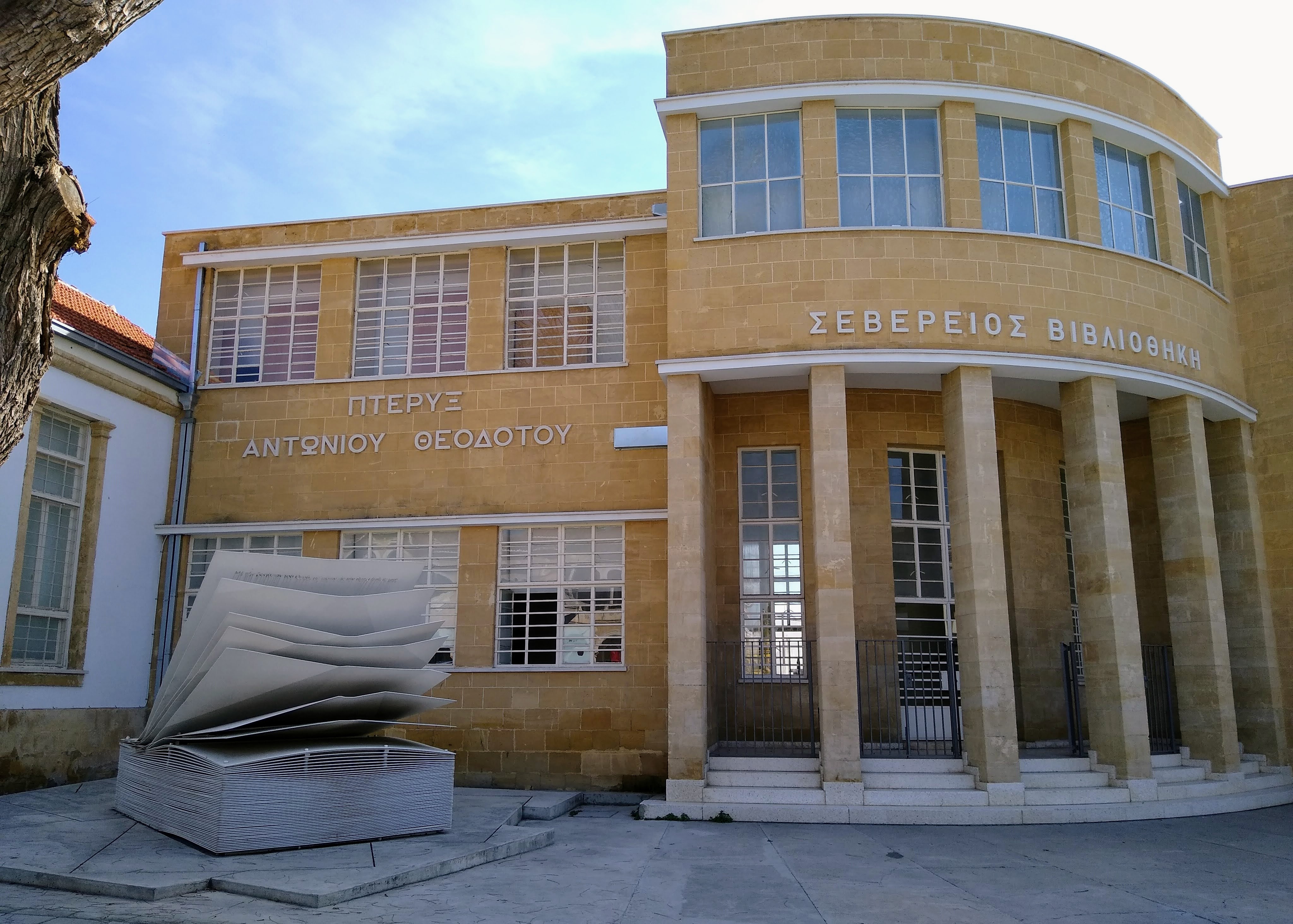
Severios Library’s inspiring front (Nicosia).
No boring “High Street” or “Station Road” in Cyprus or Greece.
Another charming portico in Nicosia.
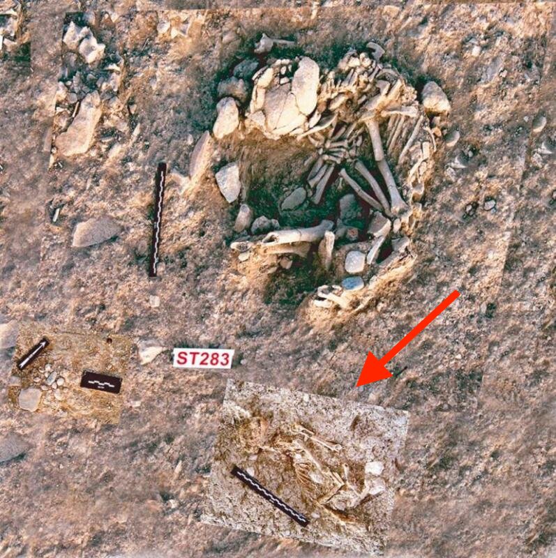
From Jerry: Since it’s Caturday, I want to add that Cypress may be the site where we have the first evidence of domesticated cats (9,500 years ago). Here’s the Wikipedia entry:
Historians previously accounted Egypt as the earliest site of cat domestication due to the clear depictions of house cats in ancient Egyptian paintings about 3,600 years old. However, in 2004, a Neolithic grave was excavated in Shillourokambos, Cyprus that contained skeletons, laid close to one another, of both a human and a cat. The grave is estimated to be 9,500 years old, pushing back the earliest known feline-human association significantly. The cat specimen is large and closely resembles the African wildcat (Felis silvestris lybica), rather than present-day domestic cats.
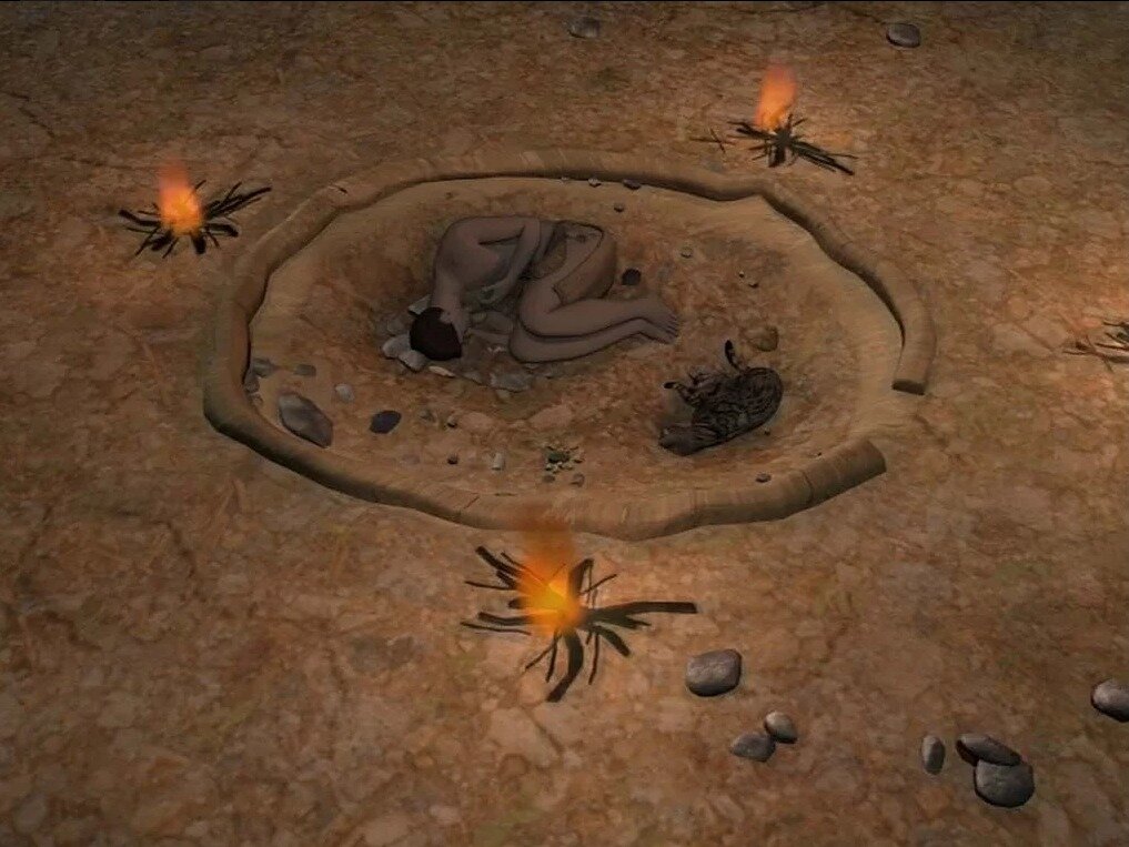
Here’s a photo of the site and a reconstruction from National Geographic (captions are theirs). I put the arrow to show the cat skeleton. Text from Nat. Geo.:
The complete body of the animal was buried in a small pit at about twenty centimeters from the human grave. The tomb, particularly rich in offerings in comparison to other graves known from this period in Cyprus, suggests that the individual had a special social status. Τhis grave certainly bears witness to relationships between humans and cats in the 8th millennium B.C., not restricted to the material benefit of humans but also involved in spiritual links.
The cat is buried together with its “master”, 3D reconstruction of the Early Aceramic Neolithic grave of Shillourokambos.
Tomorrow might be the last day for Readers’ Wildlife unless I get more submissions. Just sayin’.
Gregory Zolnerowich, an entomologist at Kansas State University, sent some pictures of a kayaking trip and associated sights. His narrative is indented and you can click on the photos to enlarge them.
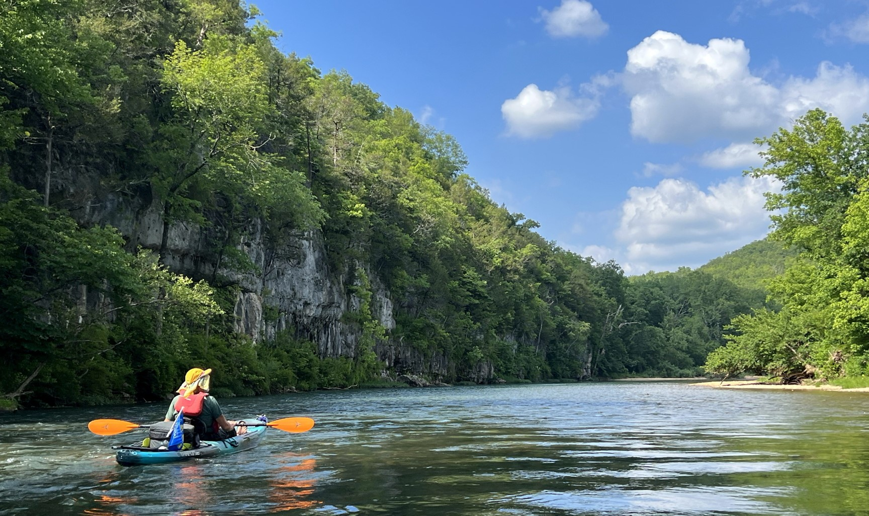
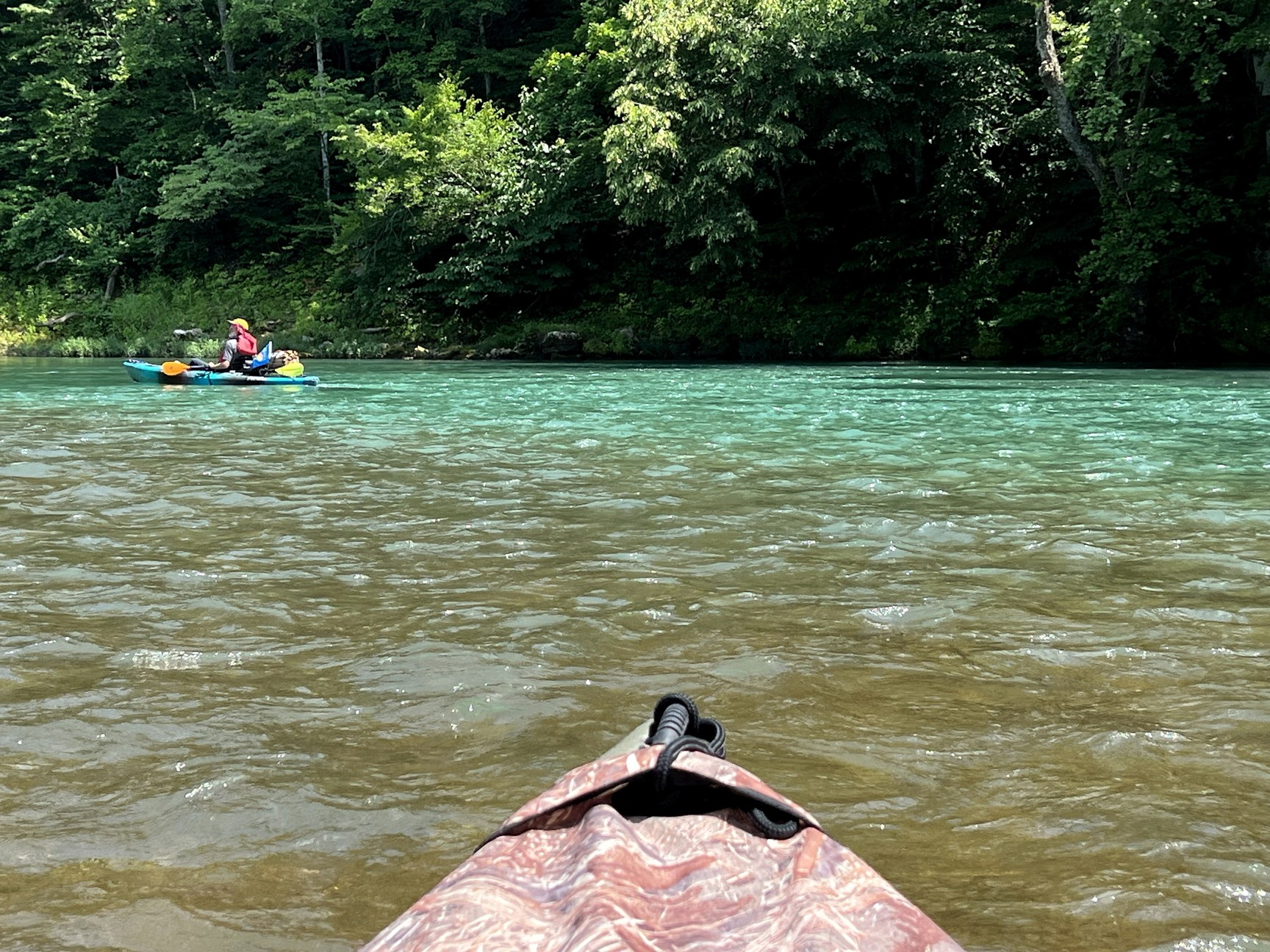
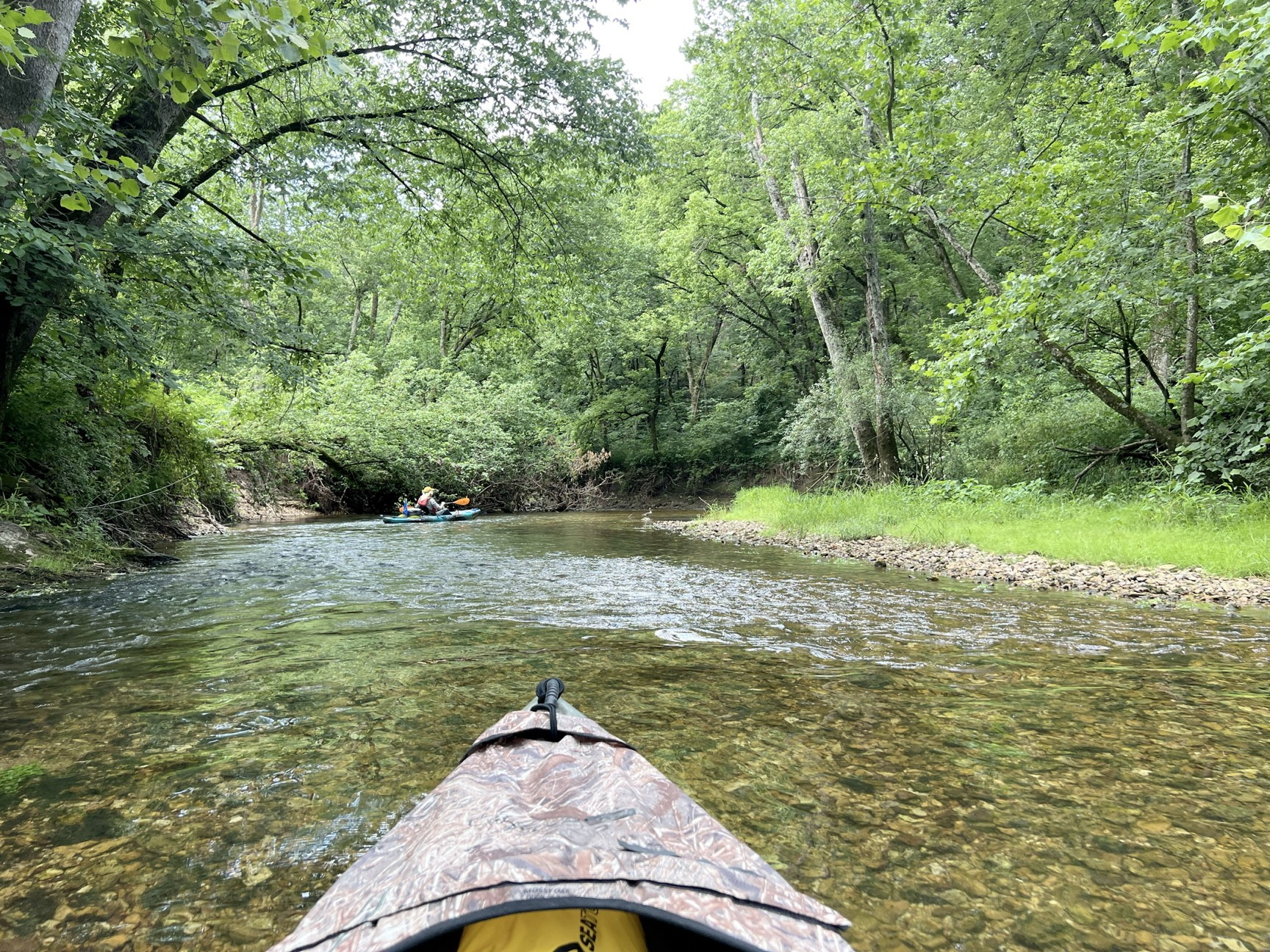
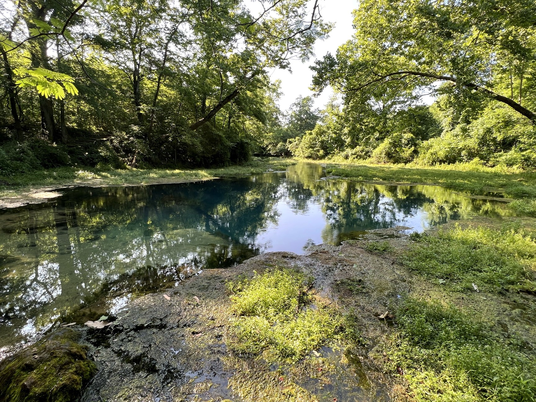
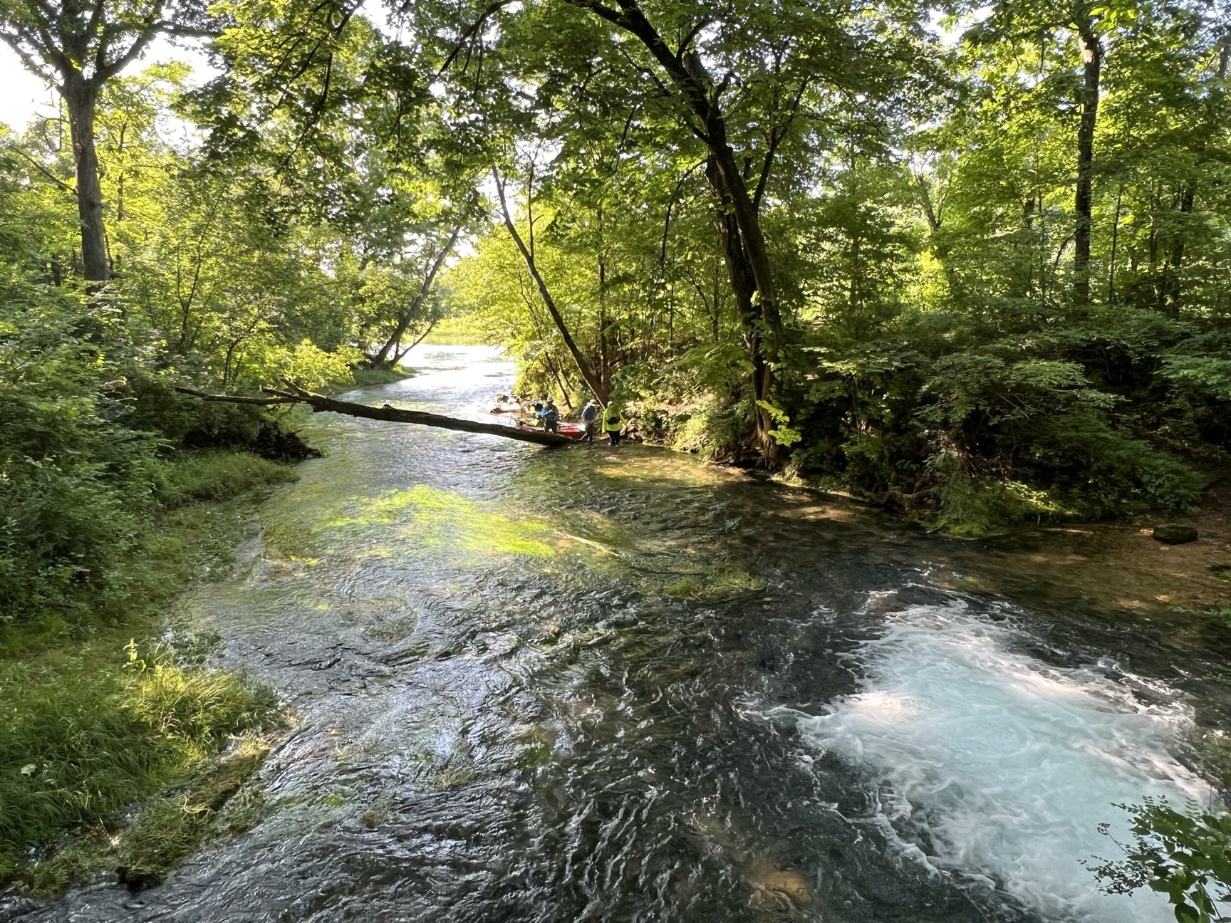
Several of us spent three days kayaking and camping on the Current River and Eleven Point River in south-central Missouri. These are clear, spring-fed Ozark rivers often bounded by dolomite cliffs that date to the Ordovician. Forty-four miles of the Eleven Point River were designated as a National Wild and Scenic River in 1968, which means it is free of impoundments and is largely undeveloped. We saw bald eagles, assorted ducks and geese, mink, otters, raccoons (they would raid our camp at night), deer, turtles, frogs, and a great variety of insects.
The beds of the rivers are mostly rock and gravel, occasionally sand, with water that is clear in the shallow areas and then turns a lovely aquamarine in the deeper sections. I assume that color comes from dissolved minerals.
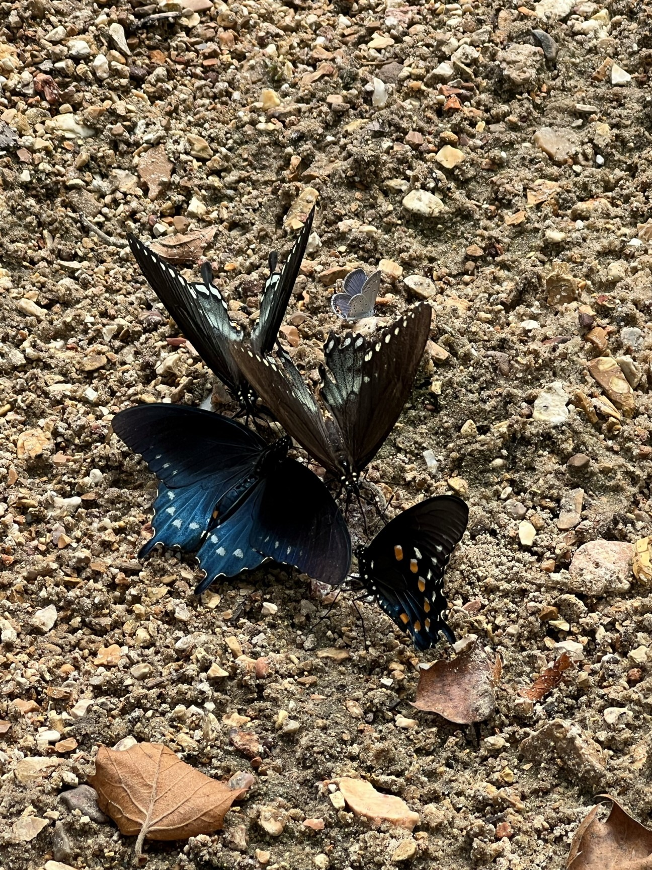
A lunch stop had butterflies puddling for entertainment. The top two are spicebush swallowtails (Papilio troilus) and the bottom two are pipevine swallowtails (Battus philenor). They were so engrossed in their activity I could get quite close. The small blue lycaenid butterfly was very skittish and would sometimes land on the swallowtails. Zebra swallowtails (Eurytides marcellus) were very common but too flighty to photograph.
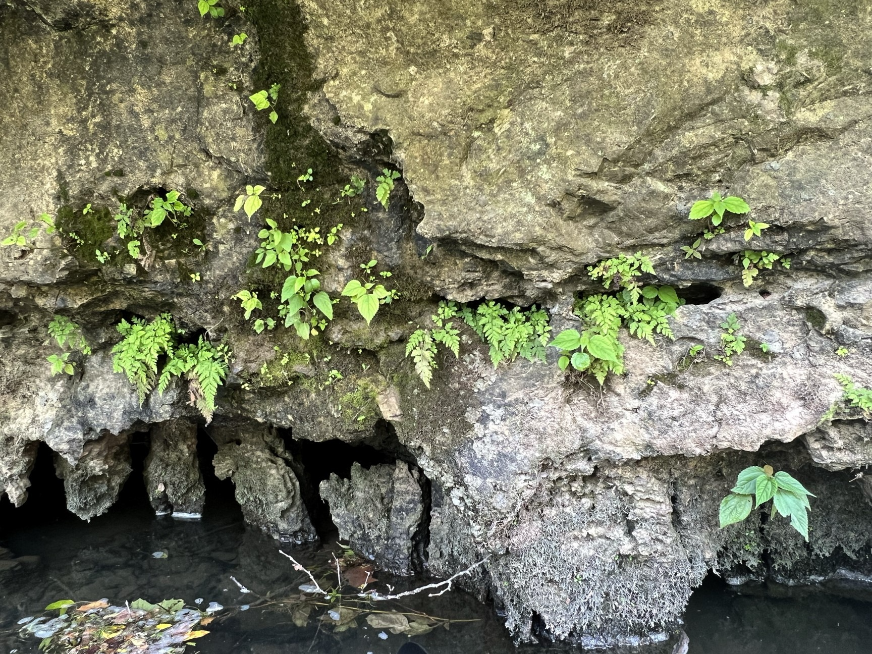
I loved the way the plants would cling to the surface of the rocky cliffs. Water often was seeping and dripping from the faces of the cliffs.
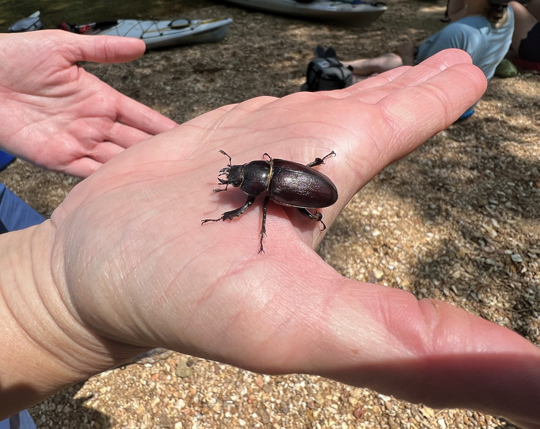
This stag beetle (Lucanidae) ambled by.
The rivers often had long shoals or rapids which made for a nice ride.
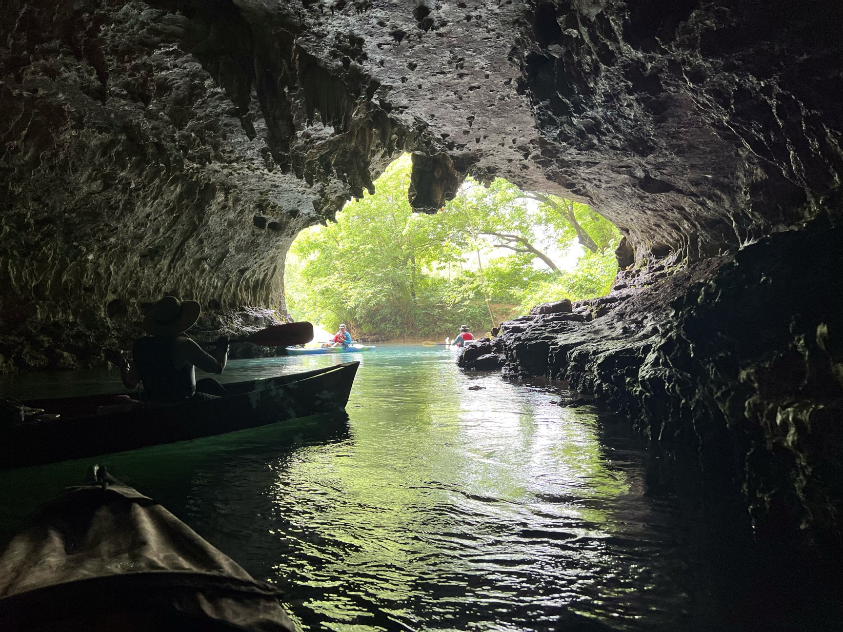
Cave Spring at the base of a cliff on the Current River is a popular stop for people.
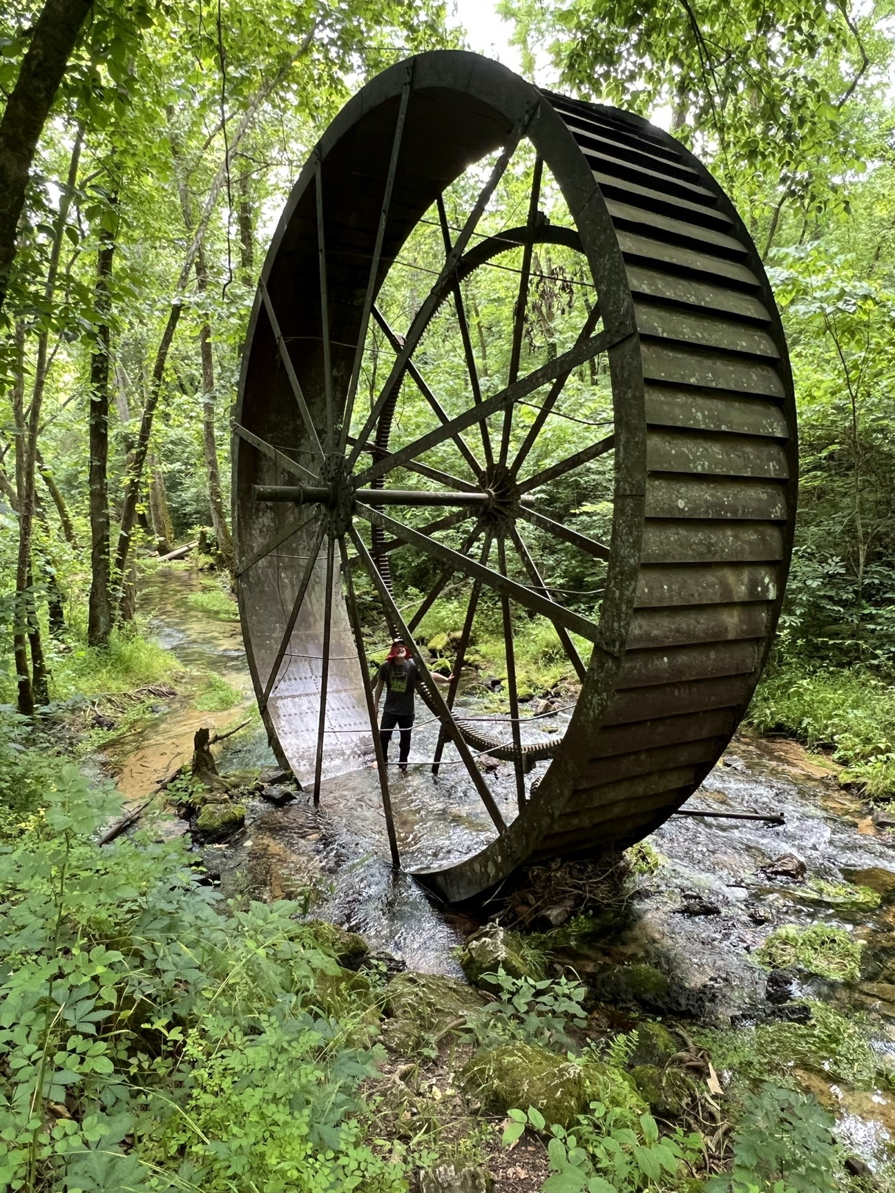
This large water wheel, 25 feet in diameter, is all that is left of Turner Mill, which is situated a short distance below Turner Spring along the Eleven Point River.
Turner Spring is one of the smaller springs that feeds the river and averages 1.5 million gallons of water per day.
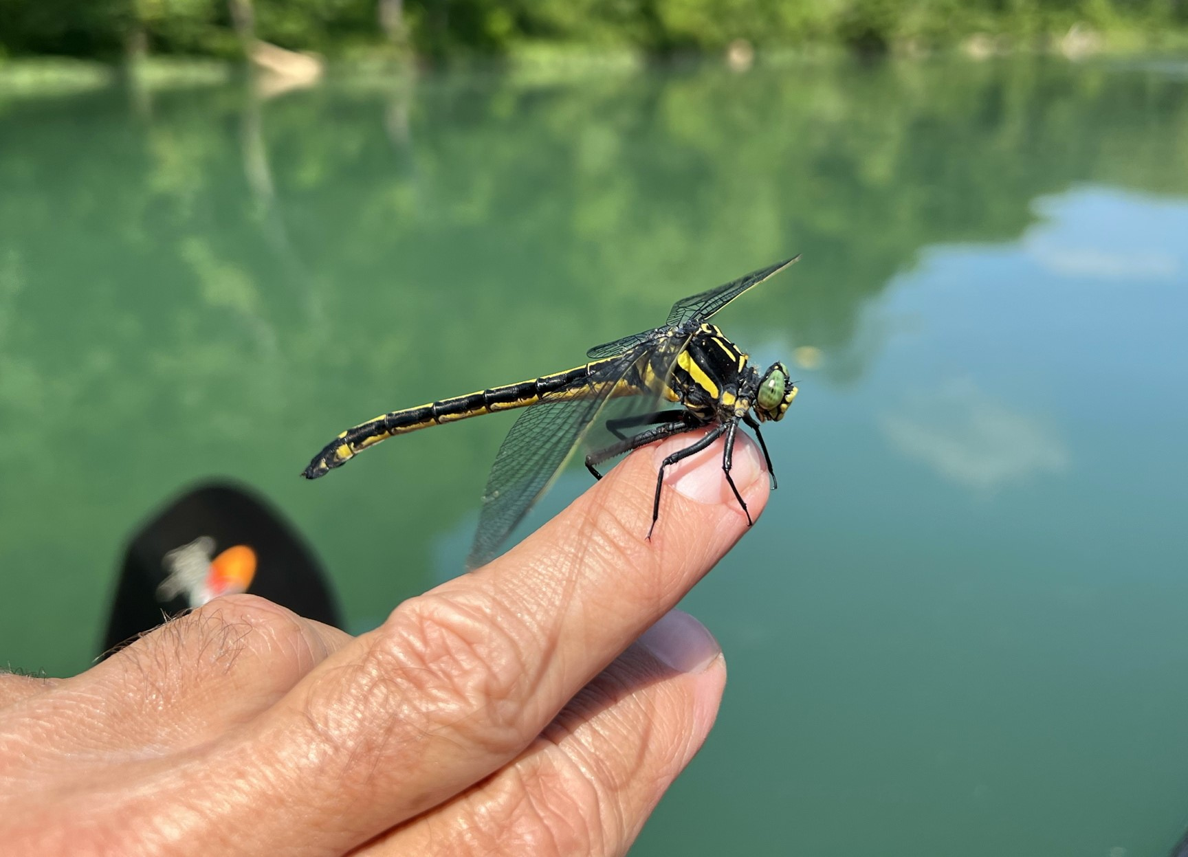
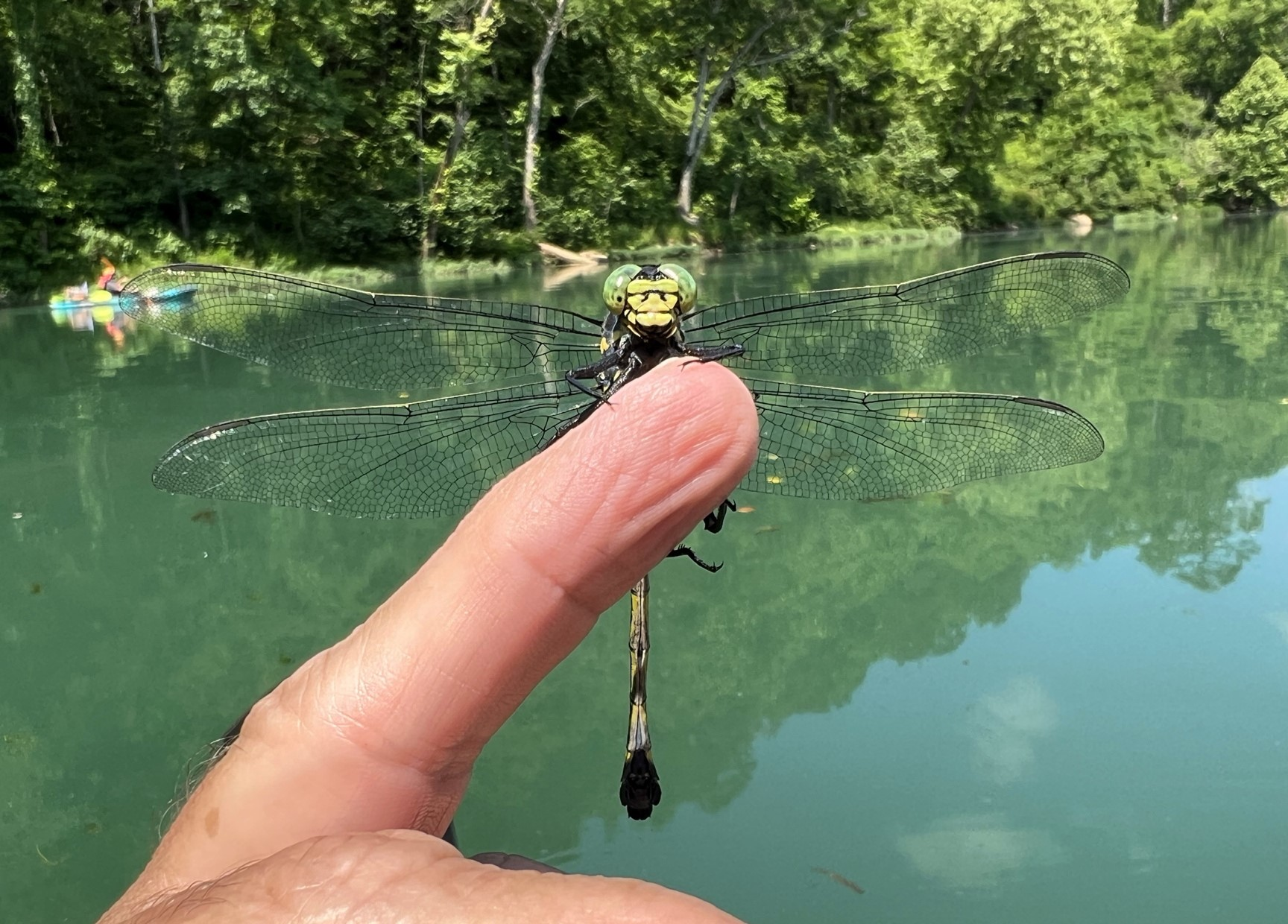
This should be a sanddragon in the genus Progomphus (Gomphidae), but I’m not sure of the species.
It was pretty docile and rode on my finger for a few minutes.
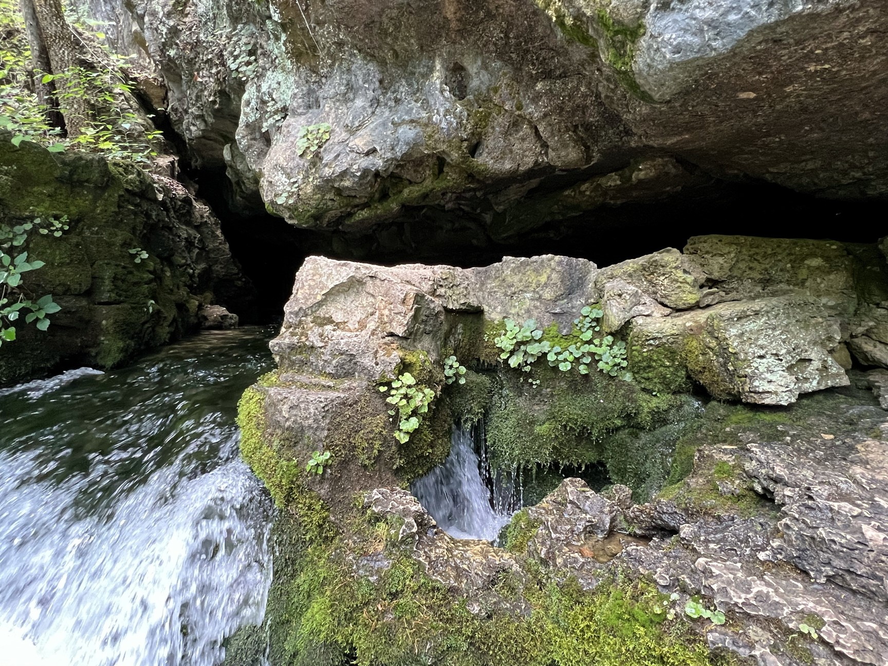
Boze Mill Spring is about 150 yards from the Eleven Point River, it is a large chasm that discharges 12-14 million gallons of water per day.
The outflow from Boze Mill Spring just before it meets the Eleven Point River. The water was quite cold.
Here is part 3 of a set of photos taken by reader Daniel Shoskes on his trip to Africa (see earlier photos here and here). The species IDs are not given, so I’ll provide links when I’m fairly sure of them. You can enlarge the photos by clicking on them. The narration is short and sweet:
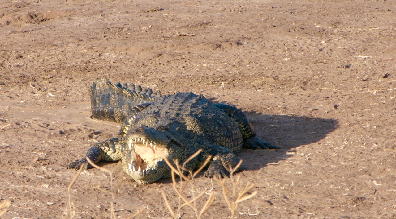
Here are photos from our trip to Africa. Started in Livingstone Zambia, traveled through Zimbabwe, and into Botswana.